Ramayampet
| Ramayampet | |
|---|---|
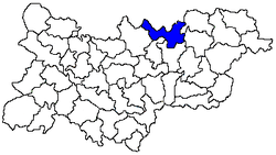 Location of the Ramayampet mandal in the Medak district | |
 Ramayampet Location in Telangana, India  Ramayampet Ramayampet (India) | |
| Coordinates: 18°07′00″N 78°25′47″E / 18.116609°N 78.429766°ECoordinates: 18°07′00″N 78°25′47″E / 18.116609°N 78.429766°E | |
| Country |
|
| State | Telangana |
| District | Medak |
| Population (2001) | |
| • Total | 63,849 |
| Languages | |
| • Official | Telugu |
| Time zone | UTC+5:30 (IST) |
| Vehicle registration | TS |
| Literacy | 63.00% |
| Website |
telangana |
Ramayampet is a town and mandal in Medak district in Indian state of Telangana.[1] It is the biggest town in Medak district and is 80 km (50 mi) from Hyderabad.[2]
Geography
Ramayampet is located at 18°07′00″N 78°25′47″E / 18.116609°N 78.429766°E.[3] It has an average elevation of 475 m (1,558 ft). Ramayampet is centrally located between Hyderabad and Nizamabad also between Siddipet and Sangareddy. It has got both National highway, state highway and rail transport system, and Ramayampet also has good education institutes.
Demographics
As of 2001 India census, Ramayampet had a population of 63,849. Males constitute 66% of the population and females 33%. Ramayampet has an average literacy rate of 63%, higher than the national average of 59.5%: male literacy is 64%, and female literacy is 52%. In Ramayampet, 16 Gram Panchayat wards are there.[2]
References
- ↑ "District Level Mandal wise list of villages in Medak district" (PDF). Chief Commissioner of Land Administration. National Informatics Centre. Archived from the original (PDF) on 2 April 2015. Retrieved 5 March 2016.
- 1 2 "List of towns: Census of India 2001" (PDF). www.censusindia.gov.in. Retrieved 2007-09-24.
- ↑ Falling Rain Genomics, Inc - Ramayampet