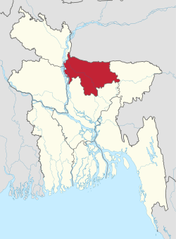
Rajshahi Division
| Rajshahi Division রাজশাহী বিভাগ | |
|---|---|
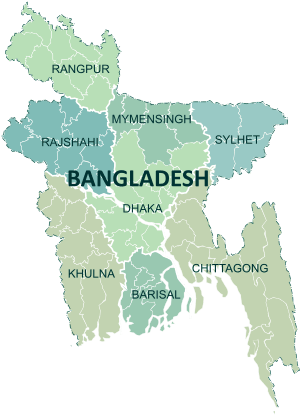
| Divisions of Bangladesh | |
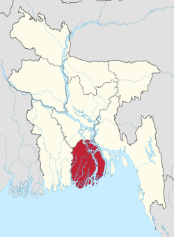
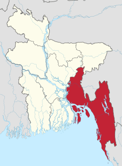
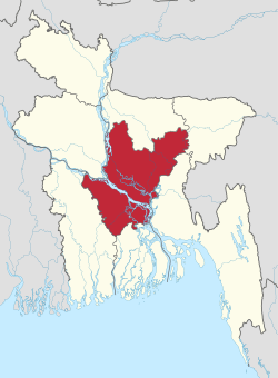
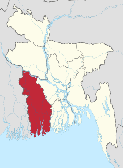
 Map of Rajshahi Division | |
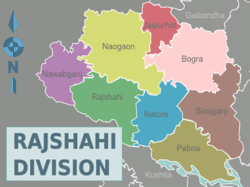 Districts of Rajshahi Division | |
| Coordinates: 25°00′N 89°00′E / 25.000°N 89.000°ECoordinates: 25°00′N 89°00′E / 25.000°N 89.000°E | |
| Country |
|
| Capital | Rajshahi |
| Government | |
| • Jatiya Sangsad constituencies | Joypurhat-1, Joypurhat-2, Bogra-1, Bogra-2, Bogra-3, Bogra-4, Bogra-5, Bogra-6, Bogra-7, Chapai Nawabganj-1, Chapai Nawabganj-2, Chapai Nawabganj-3, Naogaon-1, Naogaon-2, Naogaon-3, Naogaon-4, Naogaon-5, Naogaon-6, Rajshahi-1, Rajshahi-2, Rajshahi-3, Rajshahi-4, Rajshahi-5, Rajshahi-6, Natore-1, Natore-2, Natore-3, Natore-4, Sirajganj-1, Sirajganj-2, Sirajganj-3, Sirajganj-4, Sirajganj-5, Sirajganj-6, Pabna-1, Pabna-2, Pabna-3, Pabna-4, Pabna-5 |
| Area | |
| • Total | 18,174.4 km2 (7,017.2 sq mi) |
| Population (2011 census) | |
| • Total | 18,484,858 |
| • Density | 1,000/km2 (2,600/sq mi) |
| Demonym(s) | Rajshahiyo |
| Time zone | UTC+6 (BST) |
| ISO 3166 code | BD-E |
| Notable sport teams | Rajshahi Kings, Rajshahi Division |
| Website |
rajshahidiv |
Rajshahi Division (Bengali: রাজশাহী বিভাগ) is one of the eight first-level administrative divisions of Bangladesh. It has an area of 18,174.4 square kilometres (7,017.2 sq mi)[1] and a population at the 2011 Census of 18,484,858.[2] Rajshahi Division consists of 8 districts, 70 Upazilas (the next lower administrative tier) and 1,092 Unions (the lowest administrative tier). This division is characterized by its cheap labour force. It has an excellent rail and road communication infrastructure. The divisional capital of Rajshahi is only six-seven hours road journey away from Dhaka, the capital city.
Until 2010 this Division comprised 16 districts,[1] but early in that year it was divided into two, when a new Division (Rangpur Division) was formed out of the 8 northerly districts that until then had been part of Rajshahi Division. Rajshahi was dominated by various Rajas, Maharajas and Zamindars.[3]
Location
Rajshahi Division is in the mid western corner of Bangladesh. The famous Padma River borders Rajshahi Division on the south and another famous river, Jamuna River, lies across the eastern border. In the west, Rajshahi Division shares a border with India.
Crops
Rajshahi is well known for its fruit, particularly for mango and lichi. Rajshahi also produces a lot of crops and vegetables like potato, carrot, rice, onion, wheat, sugarcane, pulses, spices, banana etc. Joypurhat is known as the storehouse of food of Bangladesh.
Points of interest
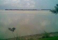
as seen from the highway
Rajshahi is a well known tourist destination within Bangladesh, with there being many interesting landmarks.
Notable places include:
- Sompur Bihar, a large Buddhist monastery.
- Varendra Research Museum in Rajshahi is one of the foremost museums specializing in history of ancient Bengal.
- Mahasthangarh, home to archaeological sites of Hindu, Buddhist and Muslim periods.
- Shishu Uddan, Joypurhat.
- Asranga & Nandail Dighi, Joypurhat.
- Puthia Temple Complex and Palaces, the palaces of old Jamidars, some Kilometers drive from Rajshahi city.
- Bagha Mosque, in Bagha thana of Rajshahi District.
- Lokma Rajbari, Joypurhat.
- Uttara Gonobhaban, palace of the famous Queen of Dighapatia, located in Natore district.
- Baro Shibaloy, Joypurhat.
- Kusumba Mosque, Naogaon.
- Sona Mosque, Chapai Nawabgonj
- Chalan Beel, the largest water body in Bangladesh, spreading in Natore and Pabna districts.
Districts
Major places
The major cities of Rajshahi division are Rajshahi, Pabna, ishwardi, Bogra, Joypurhat,. Rajshahi has an airport, with daily flights to Dhaka and Saidpur.
Education
The major educational institutes in Rajshahi are:
- University of Rajshahi (RU)
- Rajshahi University of Engineering and Technology (RUET)
- Rajshahi Medical College (RMC)
- Rajshahi Govt. City College[4]
- Shaheed Ziaur Rahman Medical College, Bogra
- Joypurhat Girls Cadet College, Joypurhat
- Rajshahi College
- New Govt. Degree College, Rajshahi
- Rajshahi Cadet College
- Azizul Haque College, Bogra
- Bogra Zilla school
- Pabna Zilla school
- Pabna Cadet College
- Pabna Textile Engineering College
- Govt. Edward College, Pabna
- Pabna University of Science and Technology
- Pabna Medical College, Pabna
- Joypurhat Government College
- Shaheed M. Monsur Ali Medical College, Sirajganj
- Government Laboratory High School Rajshahi
- Rajshahi Collegiate School (RCS), Rajshahi
The University of Rajshahi (established 1953) is the second largest university of Bangladesh with around 50 disciplines and 6 institutes.
Notable residents
- Abdul Hamid Khan Bhashani
- Air Vice Marshal (Rtd.) A. K. Khandker, first Chief of Staff of Bangladesh Air Force (1971–1975), Former Minister, Ministry Planning of People's Republic of Bangladesh
- Amulya Kumar Saha (1913–), orthopedic surgeon and past president of Indian Orthopedic Association was born in Pabna
- Amiya Bhushan Majumdar, Indian novelist
- Amjad Hossain, MNA (Member of National Assembly of Pakistan), organiser of Liberation War of Bangladesh in 1971.
- Bonde Ali Miah, poet
- Group Captain (Rtd.) Saiful Azam, former pilot, a war hero of 1965 Indo-Pakistani War and 1967 Arab–Israeli War (Six-Day War)
- General Joyanto Nath Chaudhuri OBE, former Chief of Army Staff of the Indian Army.
- Pramatha Chaudhuri, writer
- Mohammed Fazle Rabbee, cardiologist, intellectual, murdered in the intellectual killing during the 24 Dec 1971 genocide in Bangladesh
- Mohammad Ali Bogra
- Ziaur Rahman
- Khaleda Zia
- Tareq Rahman
- James
- Manzoor Alam Beg
- Montazur Rahman Akbar
- Mushfiqur Rahim
- Partha Pratim Majumder
- Samson H. Chowdhury
- Zahid Hasan
- Apu Biswas
- Mahiya Mahi
- Bidya Sinha Mim
- Taijul Islam
- Abdul jalil
References
- 1 2 Sajahan Miah (2006). "Rajshahi Division". In Sirajul Islam. Banglapedia: National Encyclopedia of Bangladesh. Asiatic Society of Bangladesh.
- ↑ "Population Census 2011: National Volume-1: Analytical Report" (PDF). Bangladesh Bureau of Statistics. p. 199. Retrieved February 9, 2016.
- ↑ Encyclopedia of Bangladesh pp 6
- ↑ http://rgcc.ac.bd
External links
| Wikivoyage has a travel guide for Rajshahi Division. |
- E-Rajshahi, An online portal for information and government services managed by Rajshahi City Corporation
Places adjacent to Rajshahi Division | ||||||||||
|---|---|---|---|---|---|---|---|---|---|---|
| ||||||||||