Rajampet
| Rajampet Kodanda Rajampeta | |
|---|---|
| Nagar panchayat | |
 | |
| Nickname(s): Devotional Capital of Andhra Pradesh | |
| Anthem: "Maa Telugu Thalliki" | |
 Rajampet Location in Andhra Pradesh, India  Rajampet Rajampet (India) | |
| Coordinates: 14°11′42″N 79°09′29″E / 14.195°N 79.158°ECoordinates: 14°11′42″N 79°09′29″E / 14.195°N 79.158°E | |
| Country |
|
| State | Andhra Pradesh |
| Region | Rayalaseema |
| District | Kadapa |
| Nagara Panchayethi | 1 June 1960 |
| Granted Municipality status | 2017 |
| Talukas | Utukuru, Boyanapally |
| Government | |
| • Type | Telugu Desam Party |
| • Body | Nagar panchayat |
| Area | |
| • Total | 35.87 km2 (13.85 sq mi) |
| Area rank | |
| Population (2011) | |
| • Total | 54,050[1] |
| Demonym(s) | Kadapollu |
| Languages | |
| • Official | Telugu |
| Time zone | UTC+5:30 (IST) |
| PIN | 516115 |
| Telephone code | 08565 |
| Vehicle registration | AP-04 |
| Sex ratio | 742 ♂/♀ |
| Literacy | 542% |
| Website | Rajampet Municipality |
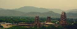
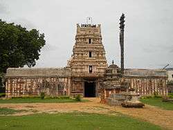
Rajampet is a small town in Kadapa district of the Indian state of Andhra Pradesh and is located in the Rayalaseema Region. It occupies 13.38 km2. It is located in Rajampet mandal of Rajampeta revenue division. It is bordered by Tirupati. Rajampet is nearest to Tirumala (90 km). Rajampeta is bordered by Chittor district to the south, Nellore to the west, Ananthapur to the east, and Kurnool to the north.[2]
Geography
Rajampet has an average elevation of 139 m (456 ft).
Governanace
Civic administration
Rajampet was a gram panchayat before 2005. It was upgraded as a nagar panchayat on 2 April 2005 and has an extent of 20.60 km2 (7.95 sq mi).[3][4] It consists of 20 election wards.[5]
Politics
Rajampet is a part of Rajampet (Assembly constituency) for Andhra Pradesh Legislative Assembly. Meda Venkata Mallikarjuna Reddy is the present MLA of the constituency from Telugu Desam Party.[6] It is also a part of Rajampet (Lok Sabha constituency) which was won by P. V. Midhun Reddy of YSR Congress Party.[7][8]
Education
There are numerous schools and colleges in Rajampet. In 1998, the first engineering college, Annamacharya Institute of Technology & Sciences, was established, which is of high quality education at rural level with relatively better faculty and industry interaction.[9] Other professional colleges include Narayanadri Engineering College,[10] Modugula Kalavathamma College of Engineering for women.[11]
Transport
Roads are well connected to all major national highways. Rajampet railway station is under South Central Railway of Guntakal railway division.
Airways
Kadapa Airport is located in Kadapa city nearest to Rajampet.
See also
References
- ↑ "Census of India Website : Office of the Registrar General & Census Commissioner, India". www.censusindia.gov.in.
- ↑ "Revenue Divisions and Mandals". Official website of YSR Kadapa District. National Informatics Centre- Kadapa, Andhra Pradesh. Retrieved 23 May 2015.
- ↑ "Municipalities, Municipal Corporations & UDAs" (PDF). Directorate of Town and Country Planning. Government of Andhra Pradesh. Archived from the original (PDF) on 28 January 2016. Retrieved 29 January 2016.
- ↑ "Basic Information of Municipality". Commissioner & Director of Municipal Administration. Municipal Administration & Urban Development Department, Govt. of Andhra Pradesh. Retrieved 19 November 2014.
- ↑ "Brief about Municipality". Municipal Administration & Urban Development Department, Government of Andhra Pradesh. Retrieved 7 September 2014.
- ↑ "MLA". AP State Portal. Retrieved 13 October 2014.
- ↑ "MP (Lok Sabha)". Government of AP. Retrieved 4 May 2015.
- ↑ "Delimitation of Parliamentary and Assembly Constituencies Order, 2008" (pdf). Election Commission of India. p. 22,31. Retrieved 11 October 2014.
- ↑ "Annamacharya Institute of Technology & Sciences - Rajampet". www.aitsrajampet.ac.in.
- ↑ http://www.nist.ac.in
- ↑ "香港马会资料大全开奖结果555566,报码室开奖结果报码,118kj开奖记录2016,118kj开奖现场开奖记录录". www.mkitwrjpt.com.
External links
| Wikimedia Commons has media related to Rajampet. |