Oatlands, Glasgow
| Oatlands | |
|---|---|
 New apartments on Haughview Terrace | |
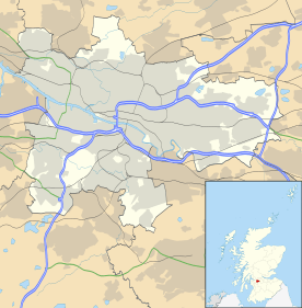 Oatlands Oatlands shown within Glasgow | |
| Council area | |
| Lieutenancy area |
|
| Country | Scotland |
| Sovereign state | United Kingdom |
| Post town | GLASGOW |
| Postcode district | G5 |
| Dialling code | 0141 |
| Police | Scottish |
| Fire | Scottish |
| Ambulance | Scottish |
| EU Parliament | Scotland |
| UK Parliament | |
| Scottish Parliament | |
Oatlands is an area in the city of Glasgow, Scotland. It is situated south of the River Clyde. It is part of the Gorbals historic area, and its boundaries are Hutchesontown and the Southern Necropolis cemetery to the west, Polmadie to the south (across the M74 motorway and West Coast Main Line railway), Shawfield in the town of Rutherglen to the east, and Glasgow Green public park to the north (across the River Clyde).
Oatlands is connected to the Green via Polmadie Bridge which was dismantled in 2015 due to structural safety concerns and replaced in 2018.
History
Until the 1990s, the area was characterised by four-storey red sandstone tenements built at the end of the 19th century and the start of the 20th,[1] and three-storey Rehousing (low build quality) grey reconstituted stone tenements from the 1930s.[2] A continuous line of tenements faced Richmond Park – a typical large urban park with boating pond, opened in 1899 and named after the Lord Provost of the time, Sir David Richmond whose tube works were located nearby[3] – across busy Rutherglen Road, one of Glasgow's main arterial routes.

After a long process of demolitions, work started in April 2005 on a comprehensive redevelopment scheme to create a new neighbourhood consisting of around 1,510 houses (1,217 or 81% new private and 293 or 19% for social rental, 213 of which are new).[4] The award-winning project was promoted by Glasgow City Council, The lead developer being Bett Homes (later Avant Homes)[5] with involvement from the Link and Glasgow Housing Associations, the local housing stock of the latter now being owned and managed by the New Gorbals Housing Association. By September 2007, part of the traffic by-pass (including a new Boulevard), 44 private houses and 172 social-rented dwellings had been constructed.
Progress was severely impacted by the Great Recession from 2007 onwards,[6] however the walkway by the River Clyde, linking to Hutchesontown, was reopened in 2011. Also at that time, the M74 extension motorway project was completed, with a junction serving Oatlands.[7] Part of the land clearance in the area (including the removal of the derelict Rosebery Park football ground) had been for the construction of the motorway and the reconfiguration of its major road to meet this new junction and connect to the Glasgow East End Regeneration Route,[8] but had also encountered safety problems and attracted protests due to the presence of Chromium VI in the ground which had been dumped by a large chemicals firm which had operated nearby.[9]
Over 500 houses had been completed by 2014, with detailed planning permission given that year for another 378 private houses.[4] The new tenements around Oatlands Square involved the installation of public artwork.[10] Two allotment sites have been laid out and the Oatlands Development Trust has created a new play area[4] as the first phase of the £2 million extension and upgrading of Richmond Park.[11][12][lower-alpha 1]

The diversion of Rutherglen Road to the southern edge of the site will allow integration of nearly all the housing with Richmond Park. A family pub/restaurant opened in 2018,[14] while future plans include a community centre, shop units, and school improvements. The project is almost entirely funded by Bett Homes in lieu of payment to Glasgow City Council for the land.[5]
The regeneration project has not been without controversy. For many years, redevelopment was prevented because of the risk of fire or explosion from propane stored nearby; 756 flats in red sandstone tenements were demolished after the failure of a £7 million refurbishment scheme. Attempts to regenerate the area were initially stymied by proposals for a business park and resistance from Housing Department officials. Even today, although the area's character reflects the outcome of an intensive process of community engagement, the area's design is occasionally the subject of criticism by modernist architects, but all the signs indicate that the new Oatlands will, if completed in accordance with current plans, become one of Glasgow's most popular residential neighbourhoods.[4]
Notes
- ↑ There is also another 'Richmond Park' a few miles to the east, bordering the Rutherglen neighbourhood of Eastfield; this name was familiar to Glasgow bus users as the terminus for the First Glasgow No 12 service and was the site of a large laundry throughout the 20th century (to add to the confusion, several other bus services pass Oatlands and its Richmond Park towards Rutherglen, including the 267 which also visited the other Richmond Park).[13]
Notable people
- Jimmy Boyle, artist, reformed criminal
- James Dornan, politician[6]
- David Holt, footballer with Queen's Park, Hearts
- Alex Wright, footballer with Partick Thistle, East Fife; manager of St Mirren, Dunfermline Athletic, Dumbarton
References
- ↑ "Neighbourhoods: The Gorbals". The Glasgow Story. Retrieved 29 September 2018.
- ↑ "Glasgow Corporation Housing Department (later Architectural & Planning Department, Glasgow Corporation)". Dictionary of Scottish Architects. Retrieved 28 September 2018.
- ↑ "Sir David Richmond". The Glasgow Story. Retrieved 28 September 2018.
- 1 2 3 4 Smith, Ronald P A, 'The Gorbals & Oatlands - A New History, Volume 4: Oatlands and General Conclusions', Stenlake Publishing, 2014
- 1 2 "Oatlands Regeneration". Glasgow City Council. Retrieved 29 September 2018.
- 1 2 "Oatlands £1 property deal has turned into 'nightmare'". Evening Times. 15 January 2013. Retrieved 29 September 2018.
- ↑ "M74 will benefit Scottish Economy". Transport Scotland. 28 June 2011. Archived from the original on 6 June 2013. Retrieved 29 September 2018.
- ↑ "New £25m Clyde Gateway road opens in Glasgow". BBC News. BBC. 26 April 2012. Retrieved 24 June 2012.
- ↑ "Euro ruling doubt over M74 plans". BBC News. 17 September 2004. Retrieved 29 September 2018.
- ↑ "New homes in Glasgow's Oatlands open the Gate to a thriving new community". Daily Record. 2 February 2018. Retrieved 29 September 2018.
- ↑ "Richmond Park Design Brief to Avant Homes". Glasgow City Council. 31 August 2016. Retrieved 29 September 2018.
- ↑ "Richmond Park". Clyde Waterfront. Retrieved 7 February 2018.
- ↑ "Richmond Park Laundry". Canmore. Retrieved 7 February 2018.
- ↑ "Our Pub". Jenny Burn (Marston's). Retrieved 29 September 2018.
External links
| Wikimedia Commons has media related to Oatlands, Glasgow. |
- Hampden School, ASN school in Oatlands
- Where did everybody go?: article and photography at Disappearing Glasgow
- Oatlands Memories, images and recollections of the community and landscape before regeneration