Garthamlock
| Garthamlock | |
|---|---|
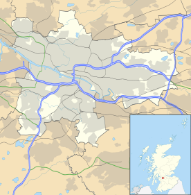 Garthamlock Garthamlock shown within Glasgow | |
| OS grid reference | NS659664 |
| Council area | |
| Lieutenancy area |
|
| Country | Scotland |
| Sovereign state | United Kingdom |
| Post town | GLASGOW |
| Postcode district | G33 |
| Dialling code | 0141 |
| Police | Scottish |
| Fire | Scottish |
| Ambulance | Scottish |
| EU Parliament | Scotland |
| UK Parliament | |
| Scottish Parliament | |
Garthamlock is a suburb in the north-east of the Scottish city of Glasgow. It is situated north of the River Clyde and south of the river Kelvin.
Garthamlock was developed from 1954 onwards after the city bought the estate of Garthamlock House.[1] The house itself was demolished in 1955 to make way for a new secondary school.
The area is now a mix of local authority housing and private stock. Easterhouse is to the east of Garthamlock and Hogganfield and Craigend to the west.
The Glasgow Fort shopping centre was built to the east of Garthamlock, partly on a disused quarry and partly on the grounds of Provan Hall House and Park (Easterhouse).
In 2016, Glasgow City Council outlined masterplans for the development of the Greater Easterhouse area (including Garthamlock) over the next 20 years.[2][3]
References
- ↑ Abacus, Scott Graham - (8 April 2014). "TheGlasgowStory: Garthamlock House". theglasgowstory.com. Archived from the original on 8 April 2014. Retrieved 8 April 2014.
- ↑ "Easterhouse the latest Glasgow district to be transformed". The Scotsman. 28 September 2016. Retrieved 23 July 2018.
- ↑ "Council report outlines exciting vision of the future transformation of Easterhouse". Glasgow City Council. 27 September 2016. Retrieved 23 July 2018.