Mansewood
Mansewood
| |
|---|---|
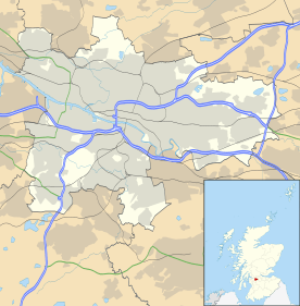 Mansewood Mansewood shown within Glasgow | |
| OS grid reference | NS559605 |
| Council area | |
| Lieutenancy area |
|
| Country | Scotland |
| Sovereign state | United Kingdom |
| Post town | GLASGOW |
| Postcode district | G43 |
| Dialling code | 0141 |
| Police | Scottish |
| Fire | Scottish |
| Ambulance | Scottish |
| EU Parliament | Scotland |
| UK Parliament | |
| Scottish Parliament | |
Mansewood (Scots: Mansewid) is a residential district in the Scottish city of Glasgow. It is situated south of the River Clyde and is surrounded by the districts of Eastwood, Hillpark, Pollokshaws in Glasgow, and Thornliebank and Giffnock in East Renfrewshire.
Geography
Mansewood is located on the summit and slopes of a boulder clay drumlin lying approximately NE to SW and rises approximately 63 metres (207 feet) above sea level.
History
Mansewood was originally Church or 'Glebe' land belonging to nearby Eastwood Parish Church. The name is derived from 'Manse' (the minister's home) and 'Wood' referring to the trees which grew in the area.

In 1871, the Reverend George Campbell, Minister of Eastwood Parish, submitted an application to feu the land to developers. This was the catalyst for the building of houses.
First houses
The first houses in Mansewood were constructed from 1880 onwards from blonde sandstone in plots located in the triangle formed by Statute Labour Road (Now Mansewood Road), Bemersyde Avenue and Turnpike Road (now called Thornliebank Road) leading from Glasgow by Pollokshaws to Stewarton. The original residents were employed in a wide variety of trades such as wine merchant, bleach works manager, ship owner, fancy box maker and Minister.
Local history
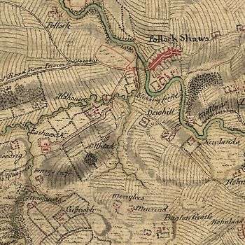
Hillhead House & The Kirkie
The fields on which Hillpark Secondary School now stands were known colloquially as the 'Kirkie'. Before the school was built, the land was part farmed and grazed as well as being the site of Hillhead house. Hillhead house appears on Roy's map of Scotland, 1747 and stood approximately where the grocers shop is located on Hillpark Drive. In the Renfrewshire OS Name Books, 1856-1857,[1] Hillhead House is described as "An excellent dwelling house surmounted by a square tower & having a very fine appearance as seen from almost any point of view & owing to its elevated position it can be seen from almost any part of the Parish. The house was built by Sir John Maxwell for his own use but is now occupied by Mr William Colledge Factor to the Pollok Estate."
Hillhead West lodge house stood approximately at the Mansewood Road entrance to the school.
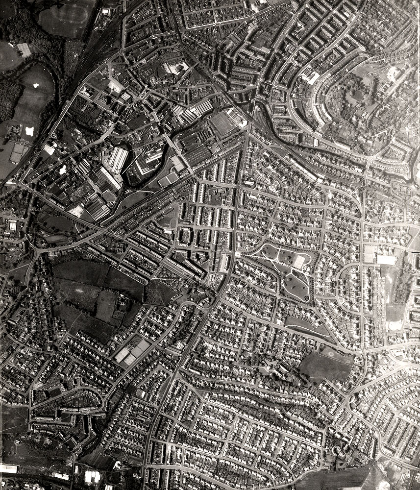
The 'Kirkie' and ruins of Hillhead House were photographed in May 1950 from an RAF aerial reconnaissance plane and can be viewed at http://www.theglasgowstory.com/images/TGSE00507.jpg. The 'Kirkie' is the area of fields in the South West of the photograph. Hillhead House and gardens is on the east of this area.
There was a farm located at what is now the corner of Mansewood Road and Burnfield Road known as Henryscroft Farm. Older residents remember the farmer driving his cows to and from the fields in the morning and evening and seeing the farmer plough his fields by horse.[2]
Local businesses
The main depot of the Postal Service for the postcodes G43-G46 is based on Burnfield Rd in Mansewood.
There is a Mini car dealership next door, a Morrisons supermarket and several local shops and other businesses along Burnfield Rd.
Past residents
Famous past residents in the area include Kai Johansen, of Rangers FC, and Scottish Screen Amateur Filmmaker Harry Birrell, as well as Michelle Mone, founder of international lingerie brand, Ultimo.