Cowglen
Cowglen
| |
|---|---|
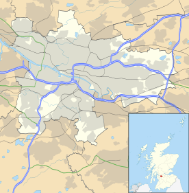 Cowglen Cowglen shown within Glasgow | |
| OS grid reference | NS539610 |
| Council area | |
| Lieutenancy area |
|
| Country | Scotland |
| Sovereign state | United Kingdom |
| Post town | GLASGOW |
| Postcode district | G53 |
| Dialling code | 0141 |
| Police | Scottish |
| Fire | Scottish |
| Ambulance | Scottish |
| EU Parliament | Scotland |
| UK Parliament | |
| Scottish Parliament | |
Cowglen is a district in the Scottish city of Glasgow, within the Newlands/Auldburn ward of the city but geographically closer to the large suburb of Pollok. It is situated south of the River Clyde. Much of its territory is open land occupied by a golf course, and it also adjoins Pollok Country Park.
Cowglen was the site of a military hospital during World War II.[1] In the 2010s, work began on a substantial housing development in the area, based around the site of the hospital and the buildings of a large National Savings and Investments regional headquarters to its north, with the project encouraged by the proximity of the Silverburn Shopping Centre, Kennishead railway station and Junction 2 of the M77 motorway.[2][3]
References
- ↑ "Cowglen Military Hospital (Land)". Parliamentary Debates (Hansard). House of Commons. 7 February 1962.
- ↑ "Plans for 500 home development near Silverburn Shopping Centre". Glasgow Live. 27 September 2016. Retrieved 10 July 2018.
- ↑ "Cowglen Planning Study, Spatial Masterplan". Glasgow City Council. 30 June 2011. Retrieved 10 July 2018.
External links
This article is issued from
Wikipedia.
The text is licensed under Creative Commons - Attribution - Sharealike.
Additional terms may apply for the media files.