Neighborhoods in Atlanta
Note: many unincorporated communities in DeKalb County and Cobb County, Georgia adjacent to Atlanta, including Druid Hills CDP and North Druid Hills, both in Dekalb County and Cumberland, Georgia and Vinings, Georgia, both in Cobb County use "Atlanta" in their postal address but are not part of the City of Atlanta. See DeKalb County and Cobb County, Georgia
Neighborhoods
The City of Atlanta is divided into 242 neighborhoods officially defined by the city. These "neighborhoods" are a mix of
- traditional neighborhoods
- subdivisions or groups of subdivisions
- core areas such as Downtown and Midtown
The neighborhoods are divisions of 25 neighborhood planning units or NPUs, which are "citizen advisory councils that make recommendations to the Mayor and City Council on zoning, land use, and other planning issues".[1]
Districts
The term "district" in Atlanta is generally used for small areas within the official neighborhoods. Downtown and Midtown Atlanta each contain a number of districts. Another example is Little Five Points, which sits on the border of 3 official neighborhoods.
In addition, Atlanta has various other divisions such as business improvement districts, police patrol zones, and in the unique case of Buckhead, a "community". Most of Atlanta north of the I-75 / I-85 downtown connector is part of the "Buckhead Community".
Areas
Although all of Atlanta is officially divided into Neighborhood Planning Units, it is more common in the news media[2] to refer to the larger areas of the city in one of three ways:
- Downtown, Midtown, and most of the central, east-central, west-central neighborhoods are referred to by their names, as these are well known throughout the Atlanta metro area, and most contain regional "destinations", such as the Zoo in Grant Park, or the shops and restaurants in Virginia Highland (other examples include East Lake, East Atlanta, Ormewood, Bankhead, Kirkwood, though they are not limited to these).
- Buckhead neighborhoods are referred to collectively as Buckhead – this covers the entire northern fifth of the city (north of the I-75 / I-85 downtown connector)
- Other areas are generally referred to as part of either "Northwest", "Southwest", or "Southeast Atlanta". However, "East Atlanta" refers to a small neighborhood which is part of the 'W' group NPU and does not have the same connotation as the other directional descriptors.
Neighborhoods (by area)
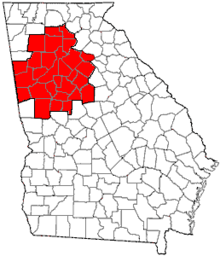
The city of Atlanta lies in three counties in Georgia: primarily in Fulton, and partly in DeKalb to the east, and part Clayton south of the county
- Numbers to the right of the neighborhood indicate its position on the map above
- "n" is a link to the corresponding neighborhood association
- "h" indicates a link to the homepage of the corresponding historic district (if the neighborhood is one)
Intown Atlanta
The term "intown" is more commonly used to refer to any neighborhoods within the central part of the city.

Downtown
|
Midtown
West Midtown / Westside
Sometimes Bolton and Hills Park are also included (see below: Northwestern Atlanta) |
East Side
|
|
The Little Five Points district is located where Inman Park and Candler Park meet.
Southeastern Atlanta
|
|
 Neighborhoods of Southeast Atlanta
|
Southwestern Atlanta

|
|
|
|
Northwestern Atlanta

|
|
|
|
Buckhead
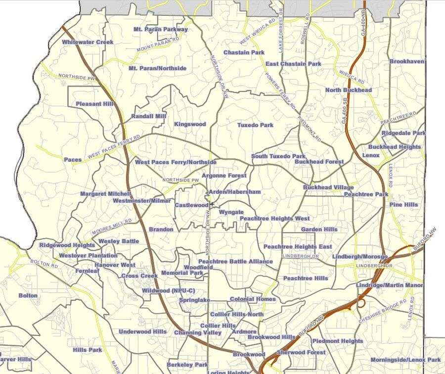
|
|
|
|
References
- ↑ "Neighborhood Planning Unit (NPU)". City of Atlanta. Retrieved 17 January 2017.
- ↑ "Atlanta News / Georgia News Section". ajc. Retrieved 28 August 2017.
- ↑ "Midtown Alliance". Midtownalliance.org. Retrieved 30 August 2017.
- ↑ "Atlanta, GA : NPU by Neighborhood". Atlantaga.gov. Retrieved 28 August 2017.
External links
| Wikimedia Commons has media related to Neighborhoods of Atlanta, Georgia. |
- City of Atlanta list of neighborhoods and Neighborhood planning unit|NPUs
- List of Atlanta Neighborhood Associations
| Topics |  | |
|---|---|---|
| Education | ||
| Government |
| |
| Sports | ||
| Related | ||
| ||
|  | |||||
|
| ||||||
| ||||||
