Peoa, Utah
| Peoa, Utah | |
|---|---|
| Census-designated place | |
 Public building in Peoa, Utah | |
 Location in Summit County and the state of Utah | |
| Coordinates: 40°43′34″N 111°20′07″W / 40.72611°N 111.33528°WCoordinates: 40°43′34″N 111°20′07″W / 40.72611°N 111.33528°W | |
| Country | United States |
| State | Utah |
| County | Summit |
| Settled | 1857 |
| Elevation[1] | 6,312 ft (1,924 m) |
| Population (2010)[2] | |
| • Total | 253 |
| Time zone | UTC-7 (Mountain (MST)) |
| • Summer (DST) | UTC-6 (MDT) |
| ZIP code | 84061 |
| Area code(s) | 435 |
| GNIS feature ID | 2584774[1] |
Peoa ( /piːˈoʊə/ pee-OH-ə) is an unincorporated census-designated place in southwestern Summit County, Utah, United States, between Jordanelle and Rockport State Parks. It lies along State Route 32 south of the city of Coalville, the county seat of Summit County.[3] Its elevation is 6,191 feet (1,887 m).[1] The population was 253 at the 2010 census. Peoa is unincorporated with the ZIP code of 84061.[4]
Peoa was first settled in 1857 by William W. Phelps and others.
Demographics
As of the census[2] of 2010, there were 253 people residing in the CDP. There were 109 housing units. The racial makeup of the town was 93.3% White, 0.8% Asian, 5.1% from some other race, and 0.8% from two or more races. Hispanic or Latino of any race were 9.9% of the population.
Climate
This climatic region is typified by large seasonal temperature differences, with warm to hot (and often humid) summers and cold (sometimes severely cold) winters. According to the Köppen Climate Classification system, Peoa has a humid continental climate, abbreviated "Dfb" on climate maps.[5]
Economy

There are currently four or five mink farms in Peoa. In the past there were significantly more as this was one of the town's major industries. The mink farms have also served as a source of tension between the Summit County sheriff's department and animal rights activist groups. Air pollution from mink farming continues to be an environmental problem.Other industries that contribute to the economy of Peoa are a large rock quarry, the birthing and first-year raising of beef/cattle and growing hay. Horses, goats, alpaca and buffalo are among the other animals raised and or boarded in this area.
Peoa has basically two roads, one of which is called "Wooden Shoe Road." The name was given to the road in part by the amount of Dutch and Scandinavian settlers that lived in the area who wore wooden clogs or wooden shoes. There may have been an old shop that at one point sold wooden shoes. The other road is SR-32.
See also
References
- 1 2 3 "Peoa, Utah". Geographic Names Information System. United States Geological Survey. Retrieved May 23, 2011.
- 1 2 "American FactFinder". United States Census Bureau. Retrieved May 23, 2011.
- ↑ Rand McNally. The Road Atlas '08. Chicago: Rand McNally, 2008, p. 102.
- ↑ Zip Code Lookup
- ↑ Climate Summary for Peoa, Utah
External links
![]()
Municipalities and communities of Summit County, Utah, United States | ||
|---|---|---|
| Cities | 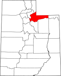 | |
| Towns | ||
| CDPs | ||
| Ghost towns | ||
| Footnotes | ‡This populated place also has portions in an adjacent county or counties | |