| [3] |
Name on the Register |
Image |
Date listed[4] |
Location |
Neighborhood |
Description |
|---|
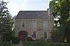
| 1 |
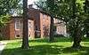
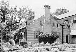
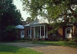
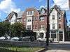
Abell House |
|
December 5, 1980
(#80001635) |
12210 Old Shelbyville Rd.
38°14′38″N 85°31′40″W / 38.243889°N 85.527778°W / 38.243889; -85.527778 (Abell House) |
Middletown |
|
| 2 |
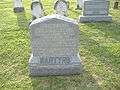
Adath Israel Cemetery |
|
June 22, 1982
(#82002702) |
2716 Preston Hwy.
38°12′40″N 85°44′28″W / 38.211111°N 85.741111°W / 38.211111; -85.741111 (Adath Israel Cemetery) |
Bradley |
|
| 3 |
Allison-Barrickman House |
|
July 12, 1983
(#83002628) |
6909 Wolf Pen Branch Rd.
38°19′14″N 85°37′08″W / 38.320556°N 85.618889°W / 38.320556; -85.618889 (Allison-Barrickman House) |
Harrods Creek |
|
| 4 |
Altawood Historic District |
|
May 2, 2001
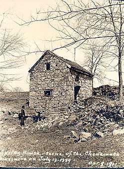
(#01000453) |
near Altawood Ct.
38°18′08″N 85°30′09″W / 38.302222°N 85.502500°W / 38.302222; -85.502500 (Altawood Historic District) |
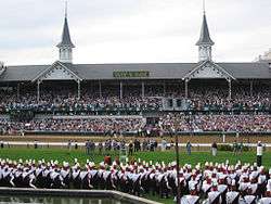
Louisville |
|
| 5 |
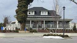
Arcadia Apartments |
|
November 15, 2010
(#10000906) |
Main office at 1423 Arcade Ave.
38°12′25″N 85°47′02″W / 38.206944°N 85.783889°W / 38.206944; -85.783889 (Arcadia Apartments) |
Taylor-Berry |
|
| 6 |
Ashbourne |
|
July 12, 1983
(#83002629) |
5300 Avish Ln.
38°19′33″N 85°38′02″W / 38.325833°N 85.633889°W / 38.325833; -85.633889 (Ashbourne) |
Harrods Creek |
|
| 7 |
Atherton Carriage House |
|
August 16, 1983
(#83002630) |
3204 Falls Park Pl.
38°17′40″N 85°38′48″W / 38.294583°N 85.646667°W / 38.294583; -85.646667 (Atherton Carriage House) |
Glenview |
|
| 8 |
Audubon Park Historic District |
|
April 18, 1996
(#96000430) |
Roughly bounded by Hess Ln. and Cardinal Dr. between Eagle Pass and Preston St.
38°12′16″N 85°43′48″W / 38.204444°N 85.730000°W / 38.204444; -85.730000 (Audubon Park Historic District) |
Audubon Park |
|
| 9 |
Aydelott House |
|
December 5, 1980
(#80001644) |
6814 Bethany Ln.
38°06′12″N 85°53′48″W / 38.103472°N 85.896667°W / 38.103472; -85.896667 (Aydelott House) |
Valley Station |
|
| 10 |
Rogers Clark Ballard Memorial School |
|
December 8, 1983
(#83003697) |
4200 Lime Kiln Ln.
38°18′47″N 85°38′44″W / 38.313056°N 85.645556°W / 38.313056; -85.645556 (Rogers Clark Ballard Memorial School) |
Glenview |
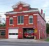
|
| 11 |
Bank of Middletown |
|
July 12, 1983
(#83002631) |
11615 Main St.
38°14′44″N 85°32′24″W / 38.245556°N 85.540000°W / 38.245556; -85.540000 (Bank of Middletown) |
Middletown |
|
| 12 |
Martin Jeff (M.J.) Bannon House |
|
December 29, 2006
(#06001196) |
5112 Bannon Crossings Dr.
38°10′51″N 85°37′45″W / 38.180972°N 85.629167°W / 38.180972; -85.629167 (Martin Jeff (M.J.) Bannon House) |
Buechel |
|
| 13 |
Patrick Bannon House |
|
December 5, 1980
(#80001573) |
5111 Bannon Crossings Dr.
38°10′51″N 85°37′42″W / 38.180972°N 85.628333°W / 38.180972; -85.628333 (Patrick Bannon House) |
Buechel |
Originally located at 4518 Bardstown Rd. before construction. |
| 14 |
Barber-Barbour House |
|
December 5, 1980
(#80001582) |
6900 Transylvania Ave.
38°20′14″N 85°38′06″W / 38.337222°N 85.635000°W / 38.337222; -85.635000 (Barber-Barbour House) |
Harrods Creek |
|
| 15 |
Levin Bates House |
|
December 5, 1980
(#80001574) |
10005 Wingfield Rd.
38°08′23″N 85°34′35″W / 38.139722°N 85.576389°W / 38.139722; -85.576389 (Levin Bates House) |
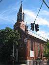
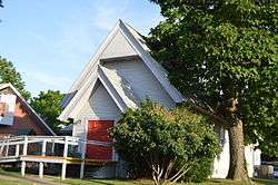
Buechel |
Originally located at 7300 Bardstown Rd., but relocated for the construction of Interstate 265[5] |
| 16 |
Beech Lawn |
|
December 5, 1980
(#80001585) |
8100 Six Mile Ln.
38°11′52″N 85°36′28″W / 38.197778°N 85.607778°W / 38.197778; -85.607778 (Beech Lawn) |
Jeffersontown |
|
| 17 |
Beechland |
|
July 12, 1983
(#83002633) |
8808 Stara Way
38°11′43″N 85°35′53″W / 38.195278°N 85.598056°W / 38.195278; -85.598056 (Beechland) |
Jeffersontown |
Previousli located at 8500 Six Mile Ln. before suburb construction. |
| 18 |
Belleview |
|
April 2, 1992
(#92000158) |
6600 River Rd.
38°19′53″N 85°37′55″W / 38.331389°N 85.631944°W / 38.331389; -85.631944 (Belleview) |
Harrods Creek |
|
| 19 |
Bellevoir-Ormsby Village |
|
December 5, 1980
(#80001632) |
1 Bellevoir Cir.
38°16′01″N 85°34′33″W / 38.266944°N 85.575833°W / 38.266944; -85.575833 (Bellevoir-Ormsby Village) |
Lyndon |
|
| 20 |
Berry Hill |
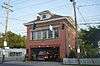
|
July 12, 1983
(#83002635) |
5900 Burlington Ave.
38°17′44″N 85°38′27″W / 38.295556°N 85.640833°W / 38.295556; -85.640833 (Berry Hill) |
Glenview |
|
| 21 |
Beynroth House |
|
May 31, 1984
(#84001552) |
11503 Main St.
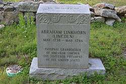
38°14′40″N 85°32′35″W / 38.244583°N 85.543194°W / 38.244583; -85.543194 (Beynroth House) |
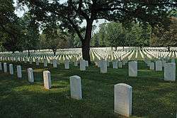
Middletown |
|
| 22 |
Bingham-Hilliard Doll House |
|
December 5, 1980
(#80001583) |
5001 Avish Ln.
38°19′14″N 85°38′12″W / 38.320556°N 85.636667°W / 38.320556; -85.636667 (Bingham-Hilliard Doll House) |
Harrods Creek |
|
| 23 |
Blankenbaker Station |
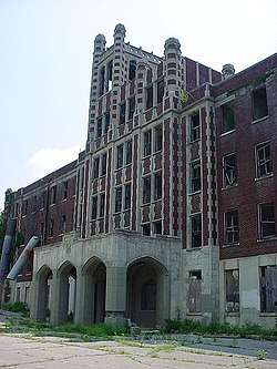
|
December 5, 1980
(#80001642) |
21 Poplar Hill Rd.
38°17′41″N 85°39′53″W / 38.294722°N 85.664722°W / 38.294722; -85.664722 (Blankenbaker Station) |
Indian Hills |
|
| 24 |
Temple Bodley Summer House |
|
March 29, 1985
(#85002449) |
1906 Riva Ridge Rd.
38°08′59″N 85°47′46″W / 38.149722°N 85.796111°W / 38.149722; -85.796111 (Temple Bodley Summer House) |
Parkwood |
|
| 25 |
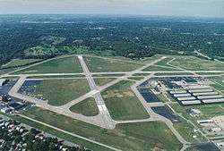
Bowman Field Historic District |
|
November 10, 1988
(#88002616) |
3345 Roger E Schupp St.
38°13′25″N 85°39′58″W / 38.223611°N 85.666111°W / 38.223611; -85.666111 (Bowman Field Historic District) |
|
|
| 26 |
Bradford Mills |
|
October 6, 1982
(#82001555) |
1124 Reutlinger Ave.
38°13′57″N 85°44′06″W / 38.232500°N 85.735000°W / 38.232500; -85.735000 (Bradford Mills) |
Germantown |
|
| 27 |
Bray Place |
|
August 11, 1980
(#80001595) |
2227 Bashford Manor Ln.
38°12′17″N 85°39′38″W / 38.204861°N 85.660556°W / 38.204861; -85.660556 (Bray Place) |
Bon Air |
|
| 28 |
James Brown House |
|
July 12, 1983
(#83002641) |
400 Mallard Creek Rd
38°14′22″N 85°37′54″W / 38.239444°N 85.631667°W / 38.239444; -85.631667 (James Brown House) |
St. Matthews |
Formerly on Browns Ln. before apartment complex construction. |
| 29 |
Theodore Brown House |
|
July 12, 1983
(#83002642) |
401 S. Hubbards Ln.
38°14′35″N 85°38′06″W / 38.243056°N 85.635000°W / 38.243056; -85.635000 (Theodore Brown House) |
St. Matthews |
Formerly on Browns Ln. |
| 30 |
Buildings at 900-906 East Main Street |
|
August 3, 2005
(#05000789) |
900 E. Main St. and 906 E. Main St.
38°15′15″N 85°44′08″W / 38.254167°N 85.735556°W / 38.254167; -85.735556 (Buildings at 900-906 East Main Street) |
Butchertown |
|
| 31 |
William Bull House |
|
December 5, 1980
(#80001636) |
11918 Old Shelbyville Rd.
38°14′38″N 85°31′59″W / 38.243889°N 85.533194°W / 38.243889; -85.533194 (William Bull House) |
Middletown |
|
| 32 |
Cornelia Bush House |
|
May 6, 1982
(#82002708) |
316 Kenwood Dr.
38°09′30″N 85°46′09″W / 38.158472°N 85.769167°W / 38.158472; -85.769167 (Cornelia Bush House) |
Kenwood Hill |
|
| 33 |
S.S. Bush House |
|
April 30, 1979
(#79000998) |
230 Kenwood Hill Rd.
38°09′34″N 85°46′21″W / 38.159444°N 85.772500°W / 38.159444; -85.772500 (S.S. Bush House) |
Kenwood Hill |
|
| 34 |
Butchertown Historic District |
|
August 11, 1976
(#76000900) |
Roughly bounded by Main, Hancock, Geiger, Quincy Sts., U.S. Route 42, S. Fort Beargrass Creek, and Baxter Ave.
38°15′20″N 85°43′47″W / 38.255556°N 85.729722°W / 38.255556; -85.729722 (Butchertown Historic District) |
Butchertown |
|
| 35 |
Cardinal Hill Reservoir |
|
December 5, 1980
(#80001597) |
8000 Cardinal Hill Rd.
38°08′47″N 85°48′15″W / 38.146458°N 85.8041293°W / 38.146458; -85.8041293 (Cardinal Hill Reservoir) |
Parkwood |
|
| 36 |
Carmichael House |
|
July 12, 1983
(#83002645) |
Off Kentucky Route 155
38°10′12″N 85°25′23″W / 38.17°N 85.423056°W / 38.17; -85.423056 (Carmichael House) |
Fisherville |
|
| 37 |
Cedarbrook Farm |
|
December 21, 1990
(#90001835) |
4800 Springdale Rd.
38°18′50″N 85°35′35″W / 38.313889°N 85.593056°W / 38.313889; -85.593056 (Cedarbrook Farm) |
Louisville |
|
| 38 |
Central Colored School |
|
September 13, 1976
(#76000901) |
550 W. Kentucky St.
38°14′22″N 85°45′46″W / 38.239500°N 85.762778°W / 38.239500; -85.762778 (Central Colored School) |
Limerick |
|
| 39 |
Chenoweth Fort-Springhouse |
|
July 1, 1975
(#75000779) |
property of 12910 Old Henry Rd.
38°15′41″N 85°30′21″W / 38.261389°N 85.505833°W / 38.261389; -85.505833 (Chenoweth Fort-Springhouse) |
Middletown |
|
| 40 |
Chenoweth House |
|
December 5, 1980
(#80001643) |
255 Chenoweth Ln.
38°15′42″N 85°39′38″W / 38.261667°N 85.660556°W / 38.261667; -85.660556 (Chenoweth House) |
St. Matthews |
|
| 41 |
Chrisler House |
|
December 5, 1980
(#80001584) |
4508 River Rd.
38°18′02″N 85°39′51″W / 38.300556°N 85.664167°W / 38.300556; -85.664167 (Chrisler House) |
Harrods Creek |
|
| 42 |
Churchill Downs |
|
November 15, 1978
(#78001348) |
700 Central Ave.
38°12′16″N 85°46′16″W / 38.204444°N 85.771111°W / 38.204444; -85.771111 (Churchill Downs) |
South Louisville |
|
| 43 |
Clifton Historic District |
|
August 29, 1983
(#83002649) |
Roughly bounded by Brownsboro Rd., William and E. Main Sts., Frankfort and N. Ewing Aves.; also roughly bounded by the CSX tracks, a Ewing Ave. alley, Interstate 64, and Mellwood Ave.
38°15′24″N 85°42′56″W / 38.256667°N 85.715556°W / 38.256667; -85.715556 (Clifton Historic District) |
Clifton |
Second set of boundaries represents a boundary increase of March 15, 1994 |
| 44 |
James Clore House |
|
November 15, 1984
(#84000387) |
7223 Old Clore Ln.
38°21′29″N 85°36′20″W / 38.358056°N 85.605556°W / 38.358056; -85.605556 (James Clore House) |
Prospect |
North of Prospect off Kentucky Route 329 |
| 45 |
Clover Hill |
|
July 17, 1978
(#78001349) |
1801 Youngland Ave.
38°12′43″N 85°47′52″W / 38.212083°N 85.797778°W / 38.212083; -85.797778 (Clover Hill) |
Shively |
Originally at 2618 Dixie Hwy. before construction in Shively. |
| 46 |
Confederate Martyrs Monument in Jeffersontown |
|
July 17, 1997
(#97000691) |
3702 Billtown Rd.
38°11′27″N 85°34′08″W / 38.190944°N 85.568750°W / 38.190944; -85.568750 (Confederate Martyrs Monument in Jeffersontown) |
Jeffersontown |
Jeffersontown Cemetery, located at Billtown Rd. & Watterson Trl. |
| 47 |
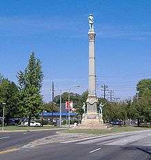
Confederate Monument in Louisville |
|
July 17, 1997
(#97000689) |
Junction of S. 2nd St and S. 3rd St.
38°13′08″N 85°45′42″W / 38.218889°N 85.761528°W / 38.218889; -85.761528 (Confederate Monument in Louisville) |
University of Louisville |
Across The Ville Grill restaurant. |
| 48 |
Conrad-Seaton House and Archeological Site |
|
August 18, 2011
(#11000537) |
10320 Watterson Trl.[6]
38°11′33″N 85°34′03″W / 38.192500°N 85.567500°W / 38.192500; -85.567500 (Conrad-Seaton House and Archeological Site) |
Louisville |
|
| 49 |
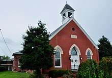
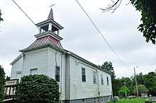
Cooper Memorial Church |
|
December 5, 1980
(#80001639) |
9901 Cooper Church Dr.
38°06′23″N 85°40′28″W / 38.106250°N 85.674444°W / 38.106250; -85.674444 (Cooper Memorial Church) |
Okolona |
Originally located at 9900 Preston Hwy. |
| 50 |
Country Estates of River Road |
|
April 29, 1999
(#99000495) |
4701 River Rd.
38°18′20″N 85°39′35″W / 38.305556°N 85.659722°W / 38.305556; -85.659722 (Country Estates of River Road) |
Glenview |
Roughly along River Rd. and Wolf Pen Branch Rd. from Longview Ln. to 500 feet (150 m) west of U.S. Route 42 |
| 51 |
Carrie Gaulbert Cox and Attilla Cox, Jr. House |
|
August 3, 2005
(#05000786) |
389 Mockingbird Valley Rd.
38°16′13″N 85°40′50″W / 38.270278°N 85.680556°W / 38.270278; -85.680556 (Carrie Gaulbert Cox and Attilla Cox, Jr. House) |
Mockingbird Valley |
|
| 52 |
Crescent Hill Branch Library |
|
March 10, 1981
(#81000282) |
2762 Frankfort Ave.
38°15′16″N 85°41′28″W / 38.254444°N 85.691111°W / 38.254444; -85.691111 (Crescent Hill Branch Library) |
Crescent Hill |
|
| 53 |
Crescent Hill Historic District |
|
November 12, 1982
(#82001556) |
Roughly bounded by Brownsboro and Lexington Rds., Peterson, Zorn, and Frankfort Aves., and Crabbs Lane
38°15′11″N 85°41′48″W / 38.253056°N 85.696667°W / 38.253056; -85.696667 (Crescent Hill Historic District) |
Crescent Hill |
|
| 54 |
Crescent Hill Reservoir |
|
September 10, 1979
(#79001001) |
121 Reservoir Ave.
38°15′25″N 85°40′45″W / 38.2569187°N 85.6791135°W / 38.2569187; -85.6791135 (Crescent Hill Reservoir) |
Crescent Hill |
|
| 55 |
Davis Tavern |
|
July 12, 1983
(#83002651) |
11803 Old Shelbyville Rd.
38°14′43″N 85°32′14″W / 38.245278°N 85.537222°W / 38.245278; -85.537222 (Davis Tavern) |
Middletown |
|
| 56 |
Diamond Fruit Farm |
|
July 12, 1983
(#83002652) |
3301 Hurstbourne Springs Dr.
38°12′04″N 85°36′17″W / 38.201111°N 85.604722°W / 38.201111; -85.604722 (Diamond Fruit Farm) |
Jeffersontown |
Formerly 8101 Six Mile Lane, current location of an apartment complex near DICK'S Sporting Goods. |
| 57 |
Dogwood Hill |
|
February 26, 1993
(#93000043) |
7001 U.S. Highway 42
38°18′48″N 85°37′41″W / 38.313333°N 85.628056°W / 38.313333; -85.628056 (Dogwood Hill) |
Lyndon |
|
| 58 |
Drumanard |
|
July 12, 1983
(#83002665) |
6401 Wolf Pen Branch Rd.; also the Mrs. A. M. Watson House and the Strater House
38°19′29″N 85°37′30″W / 38.324722°N 85.625000°W / 38.324722; -85.625000 (Drumanard) |
Harrods Creek |
Second and third houses represent a boundary increase of January 29, 1992. Originally listed under the name "Fitzhugh House"; name changed in connection with the boundary increase |
| 59 |
Stuart E. and Annie L. Duncan Estate |
|
March 12, 2003
(#02001468) |
404 Mockingbird Valley Rd.
38°16′28″N 85°41′26″W / 38.274444°N 85.690556°W / 38.274444; -85.690556 (Stuart E. and Annie L. Duncan Estate) |
Mockingbird Valley |
|
| 60 |
Eastwood School |
|
July 29, 2014
(#14000458) |
610 Gilliland Rd.
38°13′35″N 85°27′28″W / 38.2263°N 85.4579°W / 38.2263; -85.4579 (Eastwood School) |
|
|
| 61 |
Eclipse Woolen Mill |
|
December 22, 1978
(#78001352) |
1044 E. Chestnut St.
38°14′56″N 85°43′57″W / 38.248889°N 85.732500°W / 38.248889; -85.732500 (Eclipse Woolen Mill) |
Phoenix Hill |
|
| 62 |
Edgewood |
|
August 16, 1983
(#83002660) |
3605 Glenview Ave.
38°18′02″N 85°38′39″W / 38.300556°N 85.644167°W / 38.300556; -85.644167 (Edgewood) |
Brownsboro Farm |
|
| 63 |
Eight-Mile House |
|
March 26, 1976
(#76000904) |
8113 Shelbyville Rd.
38°14′56″N 85°36′12″W / 38.248889°N 85.603250°W / 38.248889; -85.603250 (Eight-Mile House) |
Lyndon |
|
| 64 |
Emerson School |
|
May 3, 1982
(#82002710) |
1100 Sylvia St.
38°13′18″N 85°44′23″W / 38.221667°N 85.739722°W / 38.221667; -85.739722 (Emerson School) |
Schnitzelburg |
|
| 65 |
Epworth Methodist Evangelical Church |
|
September 6, 1983
(#83002661) |
412 M. St.
38°12′32″N 85°45′56″W / 38.208889°N 85.765556°W / 38.208889; -85.765556 (Epworth Methodist Evangelical Church) |
South Louisville |
|
| 66 |
Falls City Jeans and Woolen Mills |
|
October 6, 1982
(#82001557) |
1010 S. Preston St.
38°14′14″N 85°44′57″W / 38.237222°N 85.749167°W / 38.237222; -85.749167 (Falls City Jeans and Woolen Mills) |
Shelby Park |
|
| 67 |
David Farnsley House |
|
July 12, 1983
(#83002663) |
4816 Cane Run Rd.
38°11′00″N 85°51′25″W / 38.183333°N 85.856944°W / 38.183333; -85.856944 (David Farnsley House) |
St. Dennis |
|
| 68 |
Farnsley-Moremen House |
|
April 20, 1979
(#79003117) |
7410 Moorman Rd.
38°05′52″N 85°53′52″W / 38.097639°N 85.897778°W / 38.097639; -85.897778 (Farnsley-Moremen House) |
Bethany |
|
| 69 |
Fincastle |
|
March 24, 2000
(#00000272) |
7501 Wolf Pen Branch Rd.
38°19′55″N 85°36′28″W / 38.331944°N 85.607778°W / 38.331944; -85.607778 (Fincastle) |
Prospect |
|
| 70 |
J. Finzer and Brothers Company Building |
|
April 18, 2003
(#03000264) |
419 Finzer St.
38°14′40″N 85°44′48″W / 38.244444°N 85.746667°W / 38.244444; -85.746667 (J. Finzer and Brothers Company Building) |
Smoketown |
|
| 71 |
Fisher House |
|
July 12, 1983
(#83002667) |
15103 Old Taylorsville Rd.
38°11′26″N 85°27′48″W / 38.190556°N 85.463333°W / 38.190556; -85.463333 (Fisher House) |
Fisherville |
|
| 72 |
Fishpool Plantation |
|
July 12, 1983
(#83002668) |
9701 Cooper Church Dr.
38°06′26″N 85°40′51″W / 38.107222°N 85.680833°W / 38.107222; -85.680833 (Fishpool Plantation) |
Louisville |
Formerly 9710 Preston Highway, before construction in Hillview. Current location can be found at Kurtz Ave. and McCrea Ln. |
| 73 |
Ford Motor Company, Louisville Plant |
|
November 25, 2005
(#05001318) |
2520 S. 3rd St.
38°12′48″N 85°45′46″W / 38.213333°N 85.762778°W / 38.213333; -85.762778 (Ford Motor Company, Louisville Plant) |
University of Louisville |
|
| 74 |
Henry Frank House |
|
December 5, 1980
(#80001637) |
218 S. Madison Ave.
38°14′31″N 85°32′22″W / 38.241944°N 85.539306°W / 38.241944; -85.539306 (Henry Frank House) |
Middletown |
|
| 75 |
Harriet Funk House |
|
December 5, 1980
(#80001587) |
1940 Hurstbourne Cir.
38°13′08″N 85°35′10″W / 38.218889°N 85.586111°W / 38.218889; -85.586111 (Harriet Funk House) |
Jeffersontown |
|
| 76 |
James H. Funk House |
|
December 5, 1980
(#80001588) |
9000 Taylorsville Rd
38°12′51″N 85°35′27″W / 38.214167°N 85.590833°W / 38.214167; -85.590833 (James H. Funk House) |
Jeffersontown |
|
| 77 |
Gaar-Fenton House |
|
July 12, 1983
(#83002670) |
4124 Nachand Ln.
38°11′06″N 85°37′00″W / 38.185000°N 85.616667°W / 38.185000; -85.616667 (Gaar-Fenton House) |
Buechel |
The house is not there anymore. |
| 78 |
Gaffney House |
|
December 8, 1983
(#83003710) |
4515 River Rd.
38°18′08″N 85°39′48″W / 38.302361°N 85.663333°W / 38.302361; -85.663333 (Gaffney House) |
Glenview |
|
| 79 |
Gardencourt Historic District |
|
December 1, 1988
(#88002653) |
1010 Alta Vista Rd.
38°14′18″N 85°41′11″W / 38.238333°N 85.686389°W / 38.238333; -85.686389 (Gardencourt Historic District) |
Cherokee-Seneca |
|
| 80 |
German Evangelical Church of Christ Complex |
|
May 21, 1987
(#87000795) |
1236 E. Breckinridge St.
38°14′24″N 85°43′52″W / 38.240000°N 85.731111°W / 38.240000; -85.731111 (German Evangelical Church of Christ Complex) |
Germantown |
|
| 81 |
Glenview Historic District |
|
August 16, 1983
(#83002673) |
Glenview Ave.
38°18′32″N 85°39′06″W / 38.308889°N 85.651667°W / 38.308889; -85.651667 (Glenview Historic District) |
Glenview |
|
| 82 |
Roscoe Goose House |
|
September 29, 2015
(#15000651) |
3012 S. 3rd St.
38°12′21″N 85°45′50″W / 38.2057°N 85.7638°W / 38.2057; -85.7638 (Roscoe Goose House) |
|
|
| 83 |
Cornelia Gordon House |
|
May 6, 1982
(#82002711) |
308 Kenwood Hill Rd.
38°09′31″N 85°46′19″W / 38.158611°N 85.771944°W / 38.158611; -85.771944 (Cornelia Gordon House) |
Kenwood Hill |
|
| 84 |
Green Tree Manor Residential Historic District |
|
November 21, 1991
(#91001664) |
107 Fenley Ave.
38°15′21″N 85°40′10″W / 38.255833°N 85.669444°W / 38.255833; -85.669444 (Green Tree Manor Residential Historic District) |
Crescent Hill |
|
| 85 |
Mary Alica Hadley House |
|
July 10, 2008
(#08000649) |
1638 Story Ave.
38°15′35″N 85°43′12″W / 38.259722°N 85.720000°W / 38.259722; -85.720000 (Mary Alica Hadley House) |
Butchertown |
|
| 86 |
Haldeman House |
|
December 8, 1983
(#83003712) |
3609 Glenview Ave.
38°18′06″N 85°38′46″W / 38.301667°N 85.646111°W / 38.301667; -85.646111 (Haldeman House) |
Northfield |
|
| 87 |
Harrods Creek Historic District |
|
November 22, 1991
(#91001679) |
Junction of Upper River and Wolf Pen Branch Rds.
38°19′22″N 85°38′08″W / 38.322778°N 85.635556°W / 38.322778; -85.635556 (Harrods Creek Historic District) |
Harrods Creek |
|
| 88 |
Head House |
|
June 28, 1974
(#74000885) |
11601 Main St.
38°14′43″N 85°32′30″W / 38.245139°N 85.541528°W / 38.245139; -85.541528 (Head House) |
Middletown |
|
| 89 |
Herr-Rudy Family Houses |
|
May 19, 1978
(#78001354) |
520 Old Stone Ln., 4319 Westport Rd., 4417 Westport Rd., 612 Rudy Ln., 726 Waterford Rd., 1823 Ballard Mill Ln., and 1705 Lynn Way
38°16′13″N 85°38′20″W / 38.270139°N 85.638750°W / 38.270139; -85.638750 (Herr-Rudy Family Houses) |
Graymoor-Devondale, Indian Hills, Windy Hills |
|
| 90 |
John H. Heywood Elementary School |
|
September 6, 1983
(#83002679) |
422 Heywood Ave.
38°12′22″N 85°46′00″W / 38.206111°N 85.766667°W / 38.206111; -85.766667 (John H. Heywood Elementary School) |
South Louisville |
|
| 91 |
Hikes Family Houses |
|
March 21, 1978
(#78001355) |
4118 Taylorsville Rd., 2806 Meadow Dr., 3026 Hikes Ln.
38°12′42″N 85°38′14″W / 38.211667°N 85.637222°W / 38.211667; -85.637222 (Hikes Family Houses) |
Bon Air, Hikes Point, Klondike |
|
| 92 |
Hikes-Hunsinger House |
|
October 10, 1975
(#75000769) |
2834 Hikes Ln.
38°12′27″N 85°38′48″W / 38.207500°N 85.646667°W / 38.207500; -85.646667 (Hikes-Hunsinger House) |
Klondike |
|
| 93 |
Abraham Hite House |
|
December 5, 1980
(#80001575) |
4215 Starlite Ln.
38°11′11″N 85°37′14″W / 38.186389°N 85.620556°W / 38.186389; -85.620556 (Abraham Hite House) |
Buechel |
|
| 94 |
Hite-Chenoweth House |
|
December 5, 1980
(#80001576) |
4219 Starlite Ln.
38°11′10″N 85°37′12″W / 38.186111°N 85.620000°W / 38.186111; -85.620000 (Hite-Chenoweth House) |
Buechel |
|
| 95 |
Andrew Hoke House |
|
July 14, 1983
(#83002681) |
2700 Llandovery Dr.
38°12′22″N 85°34′15″W / 38.206111°N 85.570833°W / 38.206111; -85.570833 (Andrew Hoke House) |
Jeffersontown |
|
| 96 |
Holy Name Church Rectory, Convent and School |
|
May 13, 1982
(#82002712) |
2920 S. 3rd St, 2914 S. 3rd St., 2911 S. 4th St and 2917 S. 4th St.
38°12′24″N 85°45′51″W / 38.206667°N 85.764167°W / 38.206667; -85.764167 (Holy Name Church Rectory, Convent and School) |
South Louisville |
|
| 97 |
Hook and Ladder Company No. 2 |
|
November 7, 1980
(#80001601) |
221 S. Hancock St.
38°15′10″N 85°44′31″W / 38.252778°N 85.741944°W / 38.252778; -85.741944 (Hook and Ladder Company No. 2) |
Phoenix Hill |
|
| 98 |
Hook and Ladder Company No. 3 |
|
November 7, 1980
(#80001602) |
1761 Frankfort Ave.
38°15′25″N 85°43′00″W / 38.257083°N 85.716667°W / 38.257083; -85.716667 (Hook and Ladder Company No. 3) |
Clifton |
|
| 99 |
Hope Worsted Mills |
|
January 19, 1996
(#95001543) |
942 E. Kentucky St.
38°14′09″N 85°44′14″W / 38.235833°N 85.737222°W / 38.235833; -85.737222 (Hope Worsted Mills) |
Germantown |
|
| 100 |
Robert Hord House |
|
July 12, 1983
(#83002682) |
15903 Shelbyville Rd.
38°14′08″N 85°27′31″W / 38.235556°N 85.458611°W / 38.235556; -85.458611 (Robert Hord House) |
Eastwood |
|
| 101 |
Horner House |
|
August 16, 1983
(#83002683) |
3509 Woodside Rd.
38°18′07″N 85°39′04″W / 38.301944°N 85.651111°W / 38.301944; -85.651111 (Horner House) |
Glenview |
|
| 102 |
Immanuel Chapel Protestant Episcopal Church |
|
September 6, 1983
(#83002687) |
410 W Fairmont Ave.
38°11′42″N 85°46′04″W / 38.195000°N 85.767778°W / 38.195000; -85.767778 (Immanuel Chapel Protestant Episcopal Church) |
Wyandotte |
|
| 103 |
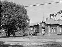
Charles D. Jacob Elementary School |
|
February 28, 2012
(#12000044) |
3670 Wheeler Ave.
38°11′31″N 85°47′20″W / 38.191944°N 85.788889°W / 38.191944; -85.788889 (Charles D. Jacob Elementary School) |
Jacobs |
|
| 104 |
Jefferson Jacob School |
|
August 6, 2012
(#12000449) |
6519 Jacob School Rd.
38°20′43″N 85°37′29″W / 38.345347°N 85.624861°W / 38.345347; -85.624861 (Jefferson Jacob School) |
Prospect |
|
| 105 |
Jeffersontown Colored School |
|
March 29, 1985
(#85002448) |
10400 Shelby St.
38°11′47″N 85°33′54″W / 38.196389°N 85.565000°W / 38.196389; -85.565000 (Jeffersontown Colored School) |
Jeffersontown |
|
| 106 |
J. Stoddard Johnston Elementary School |
|
December 3, 2008
(#82005031) |
2301 Bradley Ave.
38°12′53″N 85°44′53″W / 38.214722°N 85.748056°W / 38.214722; -85.748056 (J. Stoddard Johnston Elementary School) |
St. Joseph |
|
| 107 |
Jones House |
|
July 12, 1983
(#83002689) |
4998 Valley Station Rd.
38°06′14″N 85°51′14″W / 38.103889°N 85.853889°W / 38.103889; -85.853889 (Jones House) |
Valley Station |
|
| 108 |
Judge Kirby House |
|
July 12, 1983
(#83002690) |
4104 Stony Brook Dr.
38°11′15″N 85°35′49″W / 38.187500°N 85.596806°W / 38.187500; -85.596806 (Judge Kirby House) |
Jeffersontown |
|
| 109 |
Kennedy-Hunsinger Farm |
|
July 12, 1983
(#83002685) |
4334 Taylorsville Rd.
38°12′54″N 85°36′31″W / 38.215000°N 85.608611°W / 38.215000; -85.608611 (Kennedy-Hunsinger Farm) |
Jeffersontown |
|
| 110 |
Kentucky Wagon Works |
|
September 6, 1983
(#83002692) |
2601 S. 3rd St.
38°12′39″N 85°45′40″W / 38.210833°N 85.761111°W / 38.210833; -85.761111 (Kentucky Wagon Works) |
University of Louisville |
|
| 111 |
Kosmosdale Depot |
|
April 9, 1984
(#84001562) |
8214 Depot Ln.
38°01′57″N 85°54′36″W / 38.032500°N 85.910000°W / 38.032500; -85.910000 (Kosmosdale Depot) |
Valley Station |
Off of Dixie Hwy. (U.S. 31W) |
| 112 |
KYANG Site (15JF267) |
|
September 12, 1972
(#72000539) |
Address Restricted
|
Louisville |
Also known as the Kentucky Air National Guard Site. Located on the grounds of Louisville International Airport. |
| 113 |
Ladless Hill |
|
August 16, 1983
(#83002693) |
6501 Longview Ln.
38°17′59″N 85°39′38″W / 38.299722°N 85.660556°W / 38.299722; -85.660556 (Ladless Hill) |
Glenview |
|
| 114 |
Leatherman House |
|
December 5, 1980
(#80001589) |
3606 College Dr.
38°11′32″N 85°34′01″W / 38.192222°N 85.566944°W / 38.192222; -85.566944 (Leatherman House) |
Jeffersontown |
|
| 115 |
Addison W. Lee House |
|
August 2, 2000
(#00000868) |
4218 River Rd.
38°17′37″N 85°40′29″W / 38.293611°N 85.674722°W / 38.293611; -85.674722 (Addison W. Lee House) |
Longview |
|
| 116 |
Dr. John Lewis House |
|
April 9, 1984
(#84001564) |
220 Ridgeway Ave.
38°15′22″N 85°38′56″W / 38.256111°N 85.648889°W / 38.256111; -85.648889 (Dr. John Lewis House) |
St. Matthews |
|
| 117 |
Simeon Lewis Rural Historic District |
|
November 25, 2005
(#05001319) |
5215 Bardstown Rd.
38°10′24″N 85°36′31″W / 38.173333°N 85.608611°W / 38.173333; -85.608611 (Simeon Lewis Rural Historic District) |
Buechel |
|
| 118 |
Lewiston House |
|
December 5, 1980
(#80001645) |
4902 Ranchland Dr.
38°10′21″N 85°49′48″W / 38.172500°N 85.830000°W / 38.172500; -85.830000 (Lewiston House) |
Valley Station |
|
| 119 |
Limerick Historic District |
|
September 13, 1978
(#78001360) |
Roughly bounded by Breckinridge, Oak, 5th, and 8th Sts.; also between Breckinridge, Oak, 5th, and 8th Sts.
38°14′15″N 85°45′48″W / 38.237500°N 85.763333°W / 38.237500; -85.763333 (Limerick Historic District) |
Limerick |
Second set of boundaries represents a boundary increase of December 23, 1983 |
| 120 |
Lincliff |
|
August 16, 1983
(#83002694) |
6100 Longview Ln.
38°17′45″N 85°39′45″W / 38.295833°N 85.662500°W / 38.295833; -85.662500 (Lincliff) |
Glenview |
|
| 121 |
Lindenberger-Grant House |
|
July 25, 1996
(#96000793) |
8200 Railroad Ave.
38°15′45″N 85°36′09″W / 38.262500°N 85.602389°W / 38.262500; -85.602389 (Lindenberger-Grant House) |
Lyndon |
|
| 122 |
Little Loomhouses |
|
June 30, 1975
(#75000770) |
328 Kenwood Hill Rd.
38°09′28″N 85°46′13″W / 38.157778°N 85.770278°W / 38.157778; -85.770278 (Little Loomhouses) |
Kenwood Hill |
|
| 123 |
Locust Avenue |
|
July 12, 1983
(#83002695) |
1814 Fern Valley Rd.
38°09′20″N 85°39′59″W / 38.155556°N 85.666389°W / 38.155556; -85.666389 (Locust Avenue) |
Knopp |
|
| 124 |
Locust Grove |
|
March 11, 1971
(#71000347) |
561 Blankenbaker Ln.
38°17′13″N 85°39′43″W / 38.287083°N 85.661944°W / 38.287083; -85.661944 (Locust Grove) |
Riverwood |
|
| 125 |
Long Run Baptist Church and Cemetery |
|
August 6, 1975
(#75000768) |
16106 Old Stage Coach Rd.
38°15′18″N 85°24′48″W / 38.255000°N 85.413333°W / 38.255000; -85.413333 (Long Run Baptist Church and Cemetery) |
Eastwood |
|
| 126 |
Louisville Cotton Mills |
|
October 6, 1982
(#82001560) |
1008 Goss Ave. and 1318 McHenry St.
38°13′46″N 85°44′22″W / 38.229444°N 85.739444°W / 38.229444; -85.739444 (Louisville Cotton Mills) |
Schnitzelburg |
Boundary increase February 11, 2016 |
| 127 |
Louisville Veterans Administration Hospital |
|
May 22, 2018
(#100002460) |
800 Zorn Ave.
38°16′14″N 85°41′52″W / 38.2705°N 85.6978°W / 38.2705; -85.6978 (Louisville Veterans Administration Hospital) |
|
|
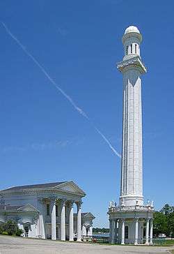
| 128 |
Louisville Water Company Pumping Station |
|
November 11, 1971
(#71000348) |
3005 River Rd.
38°16′50″N 85°42′04″W / 38.280556°N 85.701111°W / 38.280556; -85.701111 (Louisville Water Company Pumping Station) |
Butchertown |
|
| 129 |
James Russell Lowell Elementary School |
|
September 6, 1983
(#83002697) |
4501 Crittenden Dr.
38°11′17″N 85°44′59″W / 38.188056°N 85.749722°W / 38.188056; -85.749722 (James Russell Lowell Elementary School) |
Beechmont |
|
| 130 |
Lyndon Cottage |
|
May 30, 1990
(#90000781) |
9002 Hurstbourne Club Ln.
38°14′21″N 85°35′22″W / 38.239167°N 85.589444°W / 38.239167; -85.589444 (Lyndon Cottage) |
Hurstbourne |
The Terminus Building. |
| 131 |
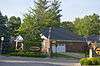
Lynn Acres Garden Apartments |
|
March 17, 2015
(#15000083) |
100 E. Southland Blvd.
38°10′18″N 85°45′47″W / 38.1718°N 85.7631°W / 38.1718; -85.7631 (Lynn Acres Garden Apartments) |
Southside |
|
| 132 |
Lynnford-Lyndon Hall |
|
April 18, 1985
(#85002447) |
8222 Shelbyville Rd.
38°14′23″N 85°35′26″W / 38.239722°N 85.590556°W / 38.239722; -85.590556 (Lynnford-Lyndon Hall) |
Lyndon |
|
| 133 |
Maghera Glass-Ormsby Hall |
|
December 5, 1980
(#80001633) |
8521 La Grange Rd.
38°16′20″N 85°35′46″W / 38.272222°N 85.596111°W / 38.272222; -85.596111 (Maghera Glass-Ormsby Hall) |
Lyndon |
|
| 134 |
Jefferson Marders House |
|
July 12, 1983
(#83002698) |
211 S. Madison Ave.
38°14′53″N 85°32′26″W / 38.248194°N 85.540556°W / 38.248194; -85.540556 (Jefferson Marders House) |
Middletown |
Destroyed in September 2005 and replaced with condominia[7] |
| 135 |
Masonic Hall |
|
July 12, 1983
(#83002701) |
15116 Old Taylorsville Rd.
38°11′22″N 85°27′44″W / 38.189444°N 85.462222°W / 38.189444; -85.462222 (Masonic Hall) |
Fisherville |
|
| 136 |
Masonic Widows and Orphans Home |
|
September 6, 2002
(#02000916) |
3701 Frankfort Ave.
38°15′20″N 85°39′54″W / 38.255556°N 85.665000°W / 38.255556; -85.665000 (Masonic Widows and Orphans Home) |
St. Matthews |
|
| 137 |
McBride's Harrods Creek Landing |
|
February 11, 2011
(#11000006) |
5913 River Rd.
38°19′30″N 85°38′33″W / 38.325000°N 85.642500°W / 38.325000; -85.642500 (McBride's Harrods Creek Landing) |
Harrods Creek |
|
| 138 |
McClure House |
|
July 28, 1984
(#84001581) |
8209 Old Westport Rd.
38°16′48″N 85°36′00″W / 38.280000°N 85.600000°W / 38.280000; -85.600000 (McClure House) |
Lyndon |
|
| 139 |
Merriwether House |
|
March 22, 1989
(#87000361) |
6421 River Rd.
38°19′41″N 85°37′50″W / 38.328056°N 85.630556°W / 38.328056; -85.630556 (Merriwether House) |
Prospect |
|
| 140 |
Middletown Inn |
|
April 9, 1984
(#84001580) |
11705 Main St.
38°14′44″N 85°32′22″W / 38.245556°N 85.539444°W / 38.245556; -85.539444 (Middletown Inn) |
Middletown |
|
| 141 |
Middletown United Methodist Church |
|
December 5, 1980
(#80001638) |
11902 Old Shelbyville Rd.
38°14′42″N 85°32′22″W / 38.245128°N 85.539444°W / 38.245128; -85.539444 (Middletown United Methodist Church) |
Middletown |
|
| 142 |
Midlands |
|
August 16, 1983
(#83002706) |
25 Poplar Hill Rd.
38°17′33″N 85°39′44″W / 38.292500°N 85.662222°W / 38.292500; -85.662222 (Midlands) |
Indian Hills |
|
| 143 |
Mockingbird Valley Historic District |
|
April 13, 2007
(#06000815) |
Roughly bounded by River Rd., Indian Hills Trail, Fairway, Swing, Brownsboro, Jarvis, and Green Ridge Ln.
38°16′21″N 85°40′57″W / 38.272500°N 85.682500°W / 38.272500; -85.682500 (Mockingbird Valley Historic District) |
Mockingbird Valley |
|
| 144 |
Simeon Moore House |
|
December 5, 1980
(#80001581) |
17317 Taylorsville Rd.
38°09′29″N 85°26′05″W / 38.157917°N 85.434722°W / 38.157917; -85.434722 (Simeon Moore House) |
Fisherville |
|
| 145 |
Most Blessed Sacrament School |
|
February 11, 2011
(#11000008) |
1128 Berry Blvd.
38°11′45″N 85°46′55″W / 38.195833°N 85.781944°W / 38.195833; -85.781944 (Most Blessed Sacrament School) |
Wyandotte |
|
| 146 |
Municipal College Campus, Simmons University |
|
November 21, 1976
(#76000906) |
1018 S. 7th St.
38°14′22″N 85°45′53″W / 38.239444°N 85.764722°W / 38.239444; -85.764722 (Municipal College Campus, Simmons University) |
Limerick |
|
| 147 |
Dr. John Murray Farm |
|
July 12, 1983
(#83002708) |
3000 Murray Hill Pike.
38°17′25″N 85°35′13″W / 38.290278°N 85.586944°W / 38.290278; -85.586944 (Dr. John Murray Farm) |
Lyndon |
|
| 148 |
Nitta Yuma Historic District |
|
February 10, 1983
(#83002714) |
5028 Nitta Yuma Dr., 5040 Nitta Yuma Dr., 5044 Nitta Yuma Dr., and 5051 Nitta Yuma Dr.
38°19′20″N 85°37′41″W / 38.322222°N 85.628056°W / 38.322222; -85.628056 (Nitta Yuma Historic District) |
Harrods Creek |
|
| 149 |
Oakdale District |
|
September 6, 1983
(#83002715) |
Roughly bounded by Terrace Park, Southern Parkway, 4th and Kenton Sts.
38°11′59″N 85°46′00″W / 38.199722°N 85.766667°W / 38.199722; -85.766667 (Oakdale District) |
South Louisville |
|
| 150 |
Olmsted Park System |
|
May 17, 1982
(#82002715) |
Algonquin, Cherokee, Eastern, Southern, North, and South Western Parkways
38°13′06″N 85°46′34″W / 38.218333°N 85.776111°W / 38.218333; -85.776111 (Olmsted Park System) |
Louisville |
|
| 151 |
Omer/Pound House |
|
July 12, 1983
(#83002716) |
6609 Billtown Rd.
38°08′55″N 85°32′34″W / 38.148611°N 85.542778°W / 38.148611; -85.542778 (Omer/Pound House) |
Fern Creek |
|
| 152 |
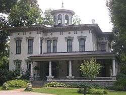
Oxmoor |
|
July 13, 1976
(#76000907) |
720 Oxmoor Ave.
38°14′15″N 85°36′28″W / 38.237500°N 85.607778°W / 38.237500; -85.607778 (Oxmoor) |
Norwood |
|
| 153 |
Paget House and Heigold House Facade |
|
November 17, 1978
(#78001363) |
1562 Fulton St. and 1501 River Rd.
38°15′54″N 85°43′40″W / 38.265000°N 85.727778°W / 38.265000; -85.727778 (Paget House and Heigold House Facade) |
Butchertown |
Heigold House facade was relocated to Frankfort Avenue in 2007.[8] |
| 154 |
Pennsylvania Run Presbyterian Church |
|
July 12, 1983
(#83002720) |
8405 Pennsylvania Run Rd.
38°07′36″N 85°37′46″W / 38.126667°N 85.629444°W / 38.126667; -85.629444 (Pennsylvania Run Presbyterian Church) |
Okolona |
|
| 155 |
Peterson Avenue Hill |
|
March 24, 1980
(#80001614) |
309 S. Peterson Ave.
38°15′00″N 85°41′50″W / 38.250000°N 85.697222°W / 38.250000; -85.697222 (Peterson Avenue Hill) |
Crescent Hill |
|
| 156 |
Peterson–Dumesnil House |
|
October 31, 1975
(#75000773) |
310 S. Peterson Ave.
38°15′04″N 85°41′46″W / 38.251111°N 85.696111°W / 38.251111; -85.696111 (Peterson–Dumesnil House) |
Crescent Hill |
|
| 157 |
Phoenix Hill Historic District |
|
January 10, 1983
(#83002721) |
Roughly bounded by Main, Campbell, Jefferson, Chestnut, Broadway, Hancock, Walnut, Shelby, Market, and Floyd Sts.
38°14′52″N 85°44′12″W / 38.247778°N 85.736667°W / 38.247778; -85.736667 (Phoenix Hill Historic District) |
Phoenix Hill |
|
| 158 |
Pirtle House |
|
August 16, 1983
(#83002722) |
5803 Orion Rd.
38°18′14″N 85°38′47″W / 38.303889°N 85.646389°W / 38.303889; -85.646389 (Pirtle House) |
Glenview |
|
| 159 |
Preston-St. Catherine Street Historic District |
|
May 2, 1985
(#85000953) |
Roughly bounded by Roland, Preston, Jackson, St. Catherine, and Floyd Sts.
38°14′12″N 85°45′00″W / 38.236667°N 85.750000°W / 38.236667; -85.750000 (Preston-St. Catherine Street Historic District) |
Shelby Park |
|
| 160 |
Repton |
|
May 13, 1982
(#82002717) |
314 Ridgedale Rd.
38°15′37″N 85°41′48″W / 38.260278°N 85.696667°W / 38.260278; -85.696667 (Repton) |
Clifton Heights |
|
| 161 |
Ridgeway |
|
April 11, 1973
(#73000810) |
4095 Massie Ave.
38°15′50″N 85°38′53″W / 38.263889°N 85.648056°W / 38.263889; -85.648056 (Ridgeway) |
St. Matthews |
|
| 162 |
Rockdale |
|
July 12, 1983
(#83002727) |
12109 Taylorsville Rd.
38°11′14″N 85°31′56″W / 38.187222°N 85.532222°W / 38.187222; -85.532222 (Rockdale) |
Jeffersontown |
|
| 163 |
Rockledge |
|
August 16, 1983
(#83002728) |
4810 River Rd.
38°18′21″N 85°39′13″W / 38.305833°N 85.653611°W / 38.305833; -85.653611 (Rockledge) |
Glenview |
|
| 164 |
St. Bartholomew Parish School |
|
August 5, 2010
(#10000531) |
2036 Buechel Bank Rd.
38°11′05″N 85°38′51″W / 38.184861°N 85.647500°W / 38.184861; -85.647500 (St. Bartholomew Parish School) |
Newburg |
|
| 165 |
St. Bonifacius Kirche Complex |
|
October 29, 1982
(#82001562) |
501 E. Liberty St., 531 E. Liberty St.
38°15′05″N 85°44′38″W / 38.251389°N 85.743889°W / 38.251389; -85.743889 (St. Bonifacius Kirche Complex) |
Phoenix Hill |
|
| 166 |
St. Elizabeth of Hungary Roman Catholic Church |
|
May 6, 1982
(#82002721) |
1024 E. Burnett Ave., 1028 E. Burnett Ave.
38°13′22″N 85°44′23″W / 38.222778°N 85.739722°W / 38.222778; -85.739722 (St. Elizabeth of Hungary Roman Catholic Church) |
Schnitzelburg |
|
| 167 |
Saint Frances of Rome School |
|
March 26, 1987
(#87000515) |
2105 Payne St., 2117 Payne St.
38°15′10″N 85°42′25″W / 38.252778°N 85.706944°W / 38.252778; -85.706944 (Saint Frances of Rome School) |
Clifton |
|
| 168 |
St. Therese Roman Catholic Church, School, and Rectory |
|
July 28, 1975
(#75000776) |
1010 Schiller Ave.
38°14′07″N 85°43′55″W / 38.235278°N 85.731944°W / 38.235278; -85.731944 (St. Therese Roman Catholic Church, School, and Rectory) |
Germantown |
|
| 169 |
St. Vincent DePaul Church, Rectory, School, St. Ursula Home and Convent |
|
November 15, 1984
(#84000380) |
1201 S. Shelby St., and 1214 Logan St.
38°13′59″N 85°44′28″W / 38.233056°N 85.741111°W / 38.233056; -85.741111 (St. Vincent DePaul Church, Rectory, School, St. Ursula Home and Convent) |
Shelby Park |
|
| 170 |
Selema Hall |
|
September 6, 1978
(#78001366) |
2837 Riedling Dr.
38°15′42″N 85°41′32″W / 38.261667°N 85.692222°W / 38.261667; -85.692222 (Selema Hall) |
Butchertown and Clifton |
|
| 171 |
Seventh Street School |
|
August 4, 2016
(#16000499) |
1512 S. 7th St.
38°13′33″N 85°46′11″W / 38.225825°N 85.769639°W / 38.225825; -85.769639 (Seventh Street School) |
Louisville |
|
| 172 |
Shady Brook Farm |
|
August 16, 1983
(#83002731) |
5802 River Rd
38°19′07″N 85°38′21″W / 38.318611°N 85.639167°W / 38.318611; -85.639167 (Shady Brook Farm) |
Harrods Creek |
|
| 173 |
Shelby Park Branch Library |
|
December 3, 1980
(#80001619) |
600 E. Oak St.
38°14′01″N 85°44′44″W / 38.233611°N 85.745556°W / 38.233611; -85.745556 (Shelby Park Branch Library) |
Shelby Park |
|
| 174 |
Shwab House |
|
August 16, 1983
(#83002733) |
4812 River Rd.
38°18′28″N 85°39′18″W / 38.307778°N 85.655000°W / 38.307778; -85.655000 (Shwab House) |
Glenview |
|
| 175 |
Smoketown Historic District |
|
July 3, 1997
(#97000661) |
Roughly bounded by Preston, Caldwell, and Jacob Sts., and the alley east of Shelby St.
38°14′27″N 85°44′38″W / 38.240833°N 85.743889°W / 38.240833; -85.743889 (Smoketown Historic District) |
Smoketown |
|
| 176 |
Snapp House |
|
December 5, 1980
(#80001577) |
current location of 8621 Summertree Ln.
38°07′41″N 85°34′37″W / 38.128056°N 85.576944°W / 38.128056; -85.576944 (Snapp House) |
Buechel |
Formerly at 8300 Bardstown Rd. |
| 177 |
Soldiers Retreat |
|
July 12, 1983
(#83002734) |
9300 Seaton Springs Pkwy.
38°14′08″N 85°34′43″W / 38.235556°N 85.578611°W / 38.235556; -85.578611 (Soldiers Retreat) |
Lyndon |
|
| 178 |
South Louisville Reformed Church |
|
September 6, 1983
(#83002735) |
1060 Lynnhurst Ave.
38°10′41″N 85°46′55″W / 38.178056°N 85.781944°W / 38.178056; -85.781944 (South Louisville Reformed Church) |
Beechmont |
|
| 179 |
Southern Heights-Beechmont District |
|
September 6, 1983
(#83002736) |
Roughly bounded by Southern Parkway, 6th St., Ashland, and Southern Heights Aves.
38°11′12″N 85°46′08″W / 38.186667°N 85.768889°W / 38.186667; -85.768889 (Southern Heights-Beechmont District) |
Beechmont |
|
| 180 |
Spring Station |
|
December 12, 1977
(#77000627) |
3241 Trinity Rd.
38°14′47″N 85°40′12″W / 38.246389°N 85.670000°W / 38.246389; -85.670000 (Spring Station) |
Rockcreek-Lexington Road |
|
| 181 |
Steam Engine Company No. 3 |
|
November 7, 1980
(#80001629) |
802 E. Main St., 804 E. Main St.
38°15′16″N 85°44′15″W / 38.254444°N 85.737500°W / 38.254444; -85.737500 (Steam Engine Company No. 3) |
Butchertown |
|
| 182 |
Steam Engine Company No. 4 |
|
November 7, 1980
(#80001630) |
1024 Logan St.
38°14′09″N 85°44′23″W / 38.235917°N 85.739722°W / 38.235917; -85.739722 (Steam Engine Company No. 4) |
Shelby Park |
|
| 183 |
Steam Engine Company No. 10 |
|
November 7, 1980
(#80001622) |
1419 E. Washington St.
38°15′29″N 85°43′36″W / 38.258056°N 85.726528°W / 38.258056; -85.726528 (Steam Engine Company No. 10) |
Butchertown |
|
| 184 |
Steam Engine Company No. 18 |
|
November 7, 1980
(#80001624) |
2600 S. 4th St.
38°12′41″N 85°45′53″W / 38.211500°N 85.764722°W / 38.211500; -85.764722 (Steam Engine Company No. 18) |
South Louisville |
|
| 185 |
Steam Engine Company No. 21 |
|
November 7, 1980
(#80001627) |
2620 Frankfort Ave.[9]
38°15′15″N 85°41′44″W / 38.254167°N 85.695417°W / 38.254167; -85.695417 (Steam Engine Company No. 21) |
Parkland |
|
| 186 |
Steam Engine Company No. 22 |
|
November 7, 1980
(#80001628) |
3627 W. Broadway
38°15′01″N 85°48′48″W / 38.250278°N 85.813333°W / 38.250278; -85.813333 (Steam Engine Company No. 22) |
Shawnee |
|
| 187 |
Arthur P. Stitzel House |
|
March 22, 1989
(#87000366) |
9707 Shelbyville Rd.
38°14′51″N 85°34′26″W / 38.247500°N 85.573889°W / 38.247500; -85.573889 (Arthur P. Stitzel House) |
Wildwood |
|
| 188 |
Zodia Stivers House |
|
December 5, 1980
(#80001578) |
3701 Montclair Ave.[10]
38°11′43″N 85°37′08″W / 38.195361°N 85.618889°W / 38.195361; -85.618889 (Zodia Stivers House) |
Buechel |
|
| 189 |
Ben Stout House |
|
July 12, 1983
(#83002738) |
8630 Stout Rd.
38°07′16″N 85°32′12″W / 38.121111°N 85.536667°W / 38.121111; -85.536667 (Ben Stout House) |
Jeffersontown |
|
| 190 |
Stuart Building |
|
March 14, 1985
(#85000560) |
601 W. Oak St.
38°14′08″N 85°45′50″W / 38.235556°N 85.763889°W / 38.235556; -85.763889 (Stuart Building) |
Limerick |
|
| 191 |
Stucky House |
|
December 5, 1980
(#80001590) |
3504 Marlin Dr.
38°11′41″N 85°34′27″W / 38.194722°N 85.574167°W / 38.194722; -85.574167 (Stucky House) |
Jeffersontown |
|
| 192 |
Sunnyside |
|
March 14, 1985
(#85000561) |
3020 Poppy Way
38°14′51″N 85°40′43″W / 38.247500°N 85.678742°W / 38.247500; -85.678742 (Sunnyside) |
Cherokee Gardens |
|
| 193 |
Taggart House |
|
December 5, 1980
(#80001579) |
5000 Bardstown Rd.
38°10′29″N 85°37′03″W / 38.174722°N 85.617500°W / 38.174722; -85.617500 (Taggart House) |
Buechel |
Burned down in the early 1980s[11] |
| 194 |
Zachary Taylor House |
|
October 15, 1966
(#66000359) |
5608 Apache Rd.
38°16′45″N 85°38′50″W / 38.279167°N 85.647222°W / 38.279167; -85.647222 (Zachary Taylor House) |
Indian Hills |
Boyhood home of the twelfth President of the United States; also known as Springfield |
| 195 |
Zachary Taylor National Cemetery |
|
November 3, 1983
(#83003733) |
4701 Brownsboro Rd.
38°16′40″N 85°38′36″W / 38.277778°N 85.643333°W / 38.277778; -85.643333 (Zachary Taylor National Cemetery) |
St. Matthews |
|
| 196 |
Three Mile Tollhouse |
|
October 1, 1990
(#90001489) |
2311 Frankfort Ave.
38°15′13″N 85°42′10″W / 38.253611°N 85.702778°W / 38.253611; -85.702778 (Three Mile Tollhouse) |
Clifton |
|
| 197 |
George H. Tingley Elementary School |
|
July 12, 1984
(#84001586) |
1311 S. Preston St., 1317 S. Preston St.
38°13′50″N 85°44′59″W / 38.230556°N 85.749722°W / 38.230556; -85.749722 (George H. Tingley Elementary School) |
Shelby Park |
|
| 198 |
James Trigg House |
|
December 5, 1980
(#80001640) |
7112 Covered Bridge Rd.
38°21′13″N 85°36′40″W / 38.353611°N 85.611000°W / 38.353611; -85.611000 (James Trigg House) |
Prospect |
|
| 199 |
Hazael Tucker House |
|
December 5, 1980
(#80001591) |
2406 Tucker Station Rd.
38°12′20″N 85°31′39″W / 38.205575°N 85.527500°W / 38.205575; -85.527500 (Hazael Tucker House) |
Jeffersontown |
|
| 200 |
Tway House |
|
December 5, 1980
(#80001592) |
10235 Timberwood Cir.
38°13′53″N 85°33′58″W / 38.231389°N 85.566111°W / 38.231389; -85.566111 (Tway House) |
Jeffersontown |
|
| 201 |
Tyler Settlement Rural Historic District |
|
May 1, 1986
(#86001045) |
Roughly bounded by the Southern railroad line, Taylorsville Rd., and Jeffersontown City
38°11′13″N 85°31′54″W / 38.186944°N 85.531667°W / 38.186944; -85.531667 (Tyler Settlement Rural Historic District) |
Jeffersontown |
|
| 202 |
Moses Tyler House |
|
July 12, 1983
(#83002744) |
3200 Tucker Station Rd.
38°11′46″N 85°32′02″W / 38.196111°N 85.533889°W / 38.196111; -85.533889 (Moses Tyler House) |
Jeffersontown |
|
| 203 |
Robert Tyler Place |
|
July 12, 1983
(#83002739) |
12603 Taylorsville Rd.
38°11′28″N 85°31′13″W / 38.191111°N 85.520278°W / 38.191111; -85.520278 (Robert Tyler Place) |
Jeffersontown |
|
| 204 |
University of Louisville Belknap Campus |
|
June 25, 1976
(#76000908) |
2301 S. 3rd St.
38°12′54″N 85°45′36″W / 38.215000°N 85.760000°W / 38.215000; -85.760000 (University of Louisville Belknap Campus) |
University of Louisville |
Includes Grawemeyer Hall and the University of Louisville School of Law. |
| 205 |
University of Louisville Library |
|
July 30, 2013
(#13000561) |
2200 S. First St.
38°12′55″N 85°45′33″W / 38.215278°N 85.759167°W / 38.215278; -85.759167 (University of Louisville Library) |
University of Louisville |
|
| 206 |
Ursuline Academy and Convent |
|
June 13, 1978
(#78001369) |
800 E. Chestnut St.
38°14′48″N 85°44′20″W / 38.246667°N 85.738889°W / 38.246667; -85.738889 (Ursuline Academy and Convent) |
Phoenix Hill |
|
| 207 |
Von Allmen Dairy Farm House |
|
December 11, 2007
(#07001251) |
5050 Norton Healthcare Blvd.
38°18′56″N 85°34′21″W / 38.315556°N 85.572500°W / 38.315556; -85.572500 (Von Allmen Dairy Farm House) |
Worthington |
|
| 208 |
Waverly Hills Tuberculosis Sanitarium Historic Buildings |
|
July 12, 1983
(#83002746) |
4400 Paralee Dr.
38°07′48″N 85°50′31″W / 38.130000°N 85.841944°W / 38.130000; -85.841944 (Waverly Hills Tuberculosis Sanitarium Historic Buildings) |
Waverly Hills |
|
| 209 |
Westwood Farm |
|
July 2, 1983
(#83002749) |
3503 Westwood Farms Dr.
38°11′48″N 85°36′45″W / 38.196667°N 85.612500°W / 38.196667; -85.612500 (Westwood Farm) |
Jeffersontown |
Formerly 7800 Six Mile Ln. |
| 210 |
Widman's Saloon and Grocery |
|
June 13, 1990
(#89002016) |
2317 Frankfort Ave., 2319 Frankfort Ave.
38°15′13″N 85°42′09″W / 38.253611°N 85.702500°W / 38.253611; -85.702500 (Widman's Saloon and Grocery) |
Clifton |
|
| 211 |
Wilhoyte House |
|
December 5, 1980
(#80001641) |
8610 Westover Dr.[12]
38°21′21″N 85°35′47″W / 38.355972°N 85.596389°W / 38.355972; -85.596389 (Wilhoyte House) |
Prospect |
|
| 212 |
Abraham L. Williams L & N Guest House |
|
December 5, 1980
(#80001634) |
4201 Murphy Ln.
38°18′21″N 85°32′00″W / 38.305833°N 85.533333°W / 38.305833; -85.533333 (Abraham L. Williams L & N Guest House) |
Lyndon |
|
| 213 |
Winchester House |
|
July 12, 1983
(#83002751) |
613 Breckenridge Ln.
38°14′37″N 85°38′44″W / 38.243611°N 85.645556°W / 38.243611; -85.645556 (Winchester House) |
St. Matthews |
|
| 214 |
Winkworth |
|
August 16, 1983
(#83002752) |
3200 Boxhill Ln.
38°18′05″N 85°39′28″W / 38.301389°N 85.657778°W / 38.301389; -85.657778 (Winkworth) |
Glenview |
|
| 215 |
Wirth, Lang and Company-The Louisville Leather Company Tannery Building |
|
August 2, 2000
(#00000869) |
711 Brent St., 715 Brent St.
38°14′37″N 85°44′05″W / 38.243611°N 85.734722°W / 38.243611; -85.734722 (Wirth, Lang and Company-The Louisville Leather Company Tannery Building) |
Smoketown |
|
| 216 |
Wolf Pen Branch Mill |
|
January 5, 1978
(#78001344) |
7839 Wolf Pen Branch Rd.
38°19′49″N 85°35′47″W / 38.330139°N 85.596389°W / 38.330139; -85.596389 (Wolf Pen Branch Mill) |
Harrods Creek |
|
| 217 |
Woodside/John T. Bate House |
|
August 16, 1983
(#83002753) |
3100 Woodside Rd.
38°17′39″N 85°38′53″W / 38.294167°N 85.648056°W / 38.294167; -85.648056 (Woodside/John T. Bate House) |
Glenview |
|
| 218 |
Yager House |
|
July 12, 1983
(#83002755) |
15905 Aiken Rd.
38°16′10″N 85°28′19″W / 38.269444°N 85.471944°W / 38.269444; -85.471944 (Yager House) |
Louisville |
|
| 219 |
George B. Yenowine House |
|
December 28, 1980
(#80004599) |
1021 Watterson Trl.
38°13′39″N 85°32′56″W / 38.227500°N 85.548889°W / 38.227500; -85.548889 (George B. Yenowine House) |
Middletown |
Currently the Sports & Fitness Center |
| 220 |
Yenowine-Kennedy House |
|
July 12, 1983
(#83002756) |
4420 Taylorsville Rd.
38°13′05″N 85°36′12″W / 38.218056°N 85.603333°W / 38.218056; -85.603333 (Yenowine-Kennedy House) |
Jeffersontown |
|


.jpg)