| [3] |
Name on the Register |
Image |
Date listed[4] |
Location |
City or town |
Description |
|---|
| 1 |
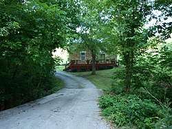
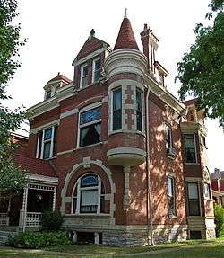
Peter Barth Farm |
|
March 9, 1983
(#83002594) |
Lower Tug Fork Rd.
39°00′13″N 84°22′44″W / 39.003611°N 84.378889°W / 39.003611; -84.378889 (Peter Barth Farm) |
Alexandria |
|
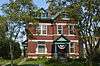
| 2 |
Baumann House |
|
March 9, 1983
(#83002595) |
Four Mile Pike
38°59′20″N 84°21′49″W / 38.988889°N 84.363611°W / 38.988889; -84.363611 (Baumann House) |
Camp Springs |
|
| 3 |
Bellevue |
|
April 22, 1976
(#76000857) |
335 E. 3rd St.
39°05′47″N 84°29′32″W / 39.096389°N 84.492222°W / 39.096389; -84.492222 (Bellevue) |
Newport |
Homestead of James Taylor, Jr. |
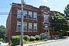
| 4 |
Bellevue High School |
|
January 9, 1986
(#86000026) |
Washington and Center Sts.
39°06′12″N 84°26′53″W / 39.103333°N 84.447944°W / 39.103333; -84.447944 (Bellevue High School) |
Bellevue |
|
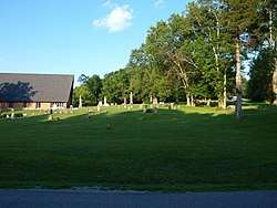
| 5 |
Bishoff House |
|
March 9, 1983
(#83002622) |
Upper Eight Mile Rd.
39°00′54″N 84°20′51″W / 39.015°N 84.3475°W / 39.015; -84.3475 (Bishoff House) |
Camp Springs |
|
| 6 |
Blau's Four Mile House |
|
March 9, 1983
(#83002596) |
Four Mile Pike
38°59′49″N 84°21′46″W / 38.996944°N 84.362778°W / 38.996944; -84.362778 (Blau's Four Mile House) |
Camp Springs |
|
| 7 |
Blenk House |
|
March 9, 1983
(#83002597) |
Four and Eight Mile Rd.
38°59′24″N 84°21′25″W / 38.99°N 84.356944°W / 38.99; -84.356944 (Blenk House) |
Alexandria |
|
| 8 |
Bonnie Leslie Historic District |
|
March 5, 2018
(#100002153) |
Bounded by Memorial Pkwy., Taylor, Wilson, Berry & Anspaugh Aves.
39°05′45″N 84°28′30″W / 39.095793°N 84.474878°W / 39.095793; -84.474878 (Bonnie Leslie Historic District) |
Bellevue |
|
| 9 |
John Braun House |
|
March 9, 1983
(#83002598) |
Eight Mile Rd.
39°00′17″N 84°21′13″W / 39.004722°N 84.353611°W / 39.004722; -84.353611 (John Braun House) |
Camp Springs |
|
| 10 |
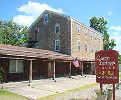
Camp Springs House |
|
March 9, 1983
(#83002599) |
Four Mile Pike
39°00′24″N 84°21′59″W / 39.006667°N 84.366389°W / 39.006667; -84.366389 (Camp Springs House) |
Camp Springs |
|
| 11 |
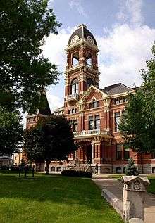
Campbell County Courthouse at Newport |
|
March 8, 1988
(#88000181) |
4th and York Sts.
39°05′32″N 84°29′53″W / 39.092222°N 84.498056°W / 39.092222; -84.498056 (Campbell County Courthouse at Newport) |
Newport |
|
| 12 |
Cote Brillante Historic District |
|
August 3, 2005
(#05000791) |
Portions of E. 10th, E. 11th Sts., Park Ave., Camryn Court, Vine, Center, Prospect, and Miller Sts., and Wiedemann Place
39°05′22″N 84°28′52″W / 39.089444°N 84.481111°W / 39.089444; -84.481111 (Cote Brillante Historic District) |
Newport |
|
| 13 |
Dayton High School |
|
July 18, 1985
(#85001579) |
8th and Walnut Sts.
39°06′34″N 84°28′37″W / 39.109444°N 84.476944°W / 39.109444; -84.476944 (Dayton High School) |
Dayton |
|
| 14 |
Doyle Country Club |
|
March 13, 2017
(#100000735) |
37 Mary Ingalls Hwy.
39°06′46″N 84°27′20″W / 39.112785°N 84.455460°W / 39.112785; -84.455460 (Doyle Country Club) |
Dayton |
|
| 15 |
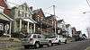
East Row Historic District |
|
August 25, 1983
(#83002600) |
Roughly bounded by the C&O railroad line, 6th, Saratoga, and Oak Sts.
39°05′28″N 84°29′13″W / 39.091111°N 84.486944°W / 39.091111; -84.486944 (East Row Historic District) |
Newport |
|
| 16 |
John Faha House |
|
March 9, 1983
(#83002601) |
Lower Tug Fork Rd.
39°00′17″N 84°21′13″W / 39.004722°N 84.353611°W / 39.004722; -84.353611 (John Faha House) |
Alexandria |
|
| 17 |
Fairfield Avenue Historic District |
|
February 22, 1988
(#88000100) |
Fairfield Ave. between LaFayette Ave. and O'Fallon
39°06′29″N 84°28′51″W / 39.108056°N 84.480833°W / 39.108056; -84.480833 (Fairfield Avenue Historic District) |
Bellevue |
|
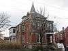
| 18 |
Foote-Fister Mansion |
|
February 24, 1988
(#88000099) |
801 Lincoln Rd.
39°06′12″N 84°28′23″W / 39.103333°N 84.473056°W / 39.103333; -84.473056 (Foote-Fister Mansion) |
Bellevue |
|
| 19 |
Fort Thomas Commercial District |
|
July 10, 2008
(#08000003) |
1011-1312 S. Ft. Thomas Ave, 9-11 River Rd., and 12-28 Midway Ct.
39°03′51″N 84°26′49″W / 39.06428°N 84.44698°W / 39.06428; -84.44698 (Fort Thomas Commercial District) |
Fort Thomas |
|
| 20 |
Fort Thomas Military Reservation District |
|
May 15, 1986
(#86001103) |
Roughly bounded by Pearson, Alexander and Cochran Aves., River Rd., and S. Fort Thomas Ave.
39°03′55″N 84°26′39″W / 39.065278°N 84.444167°W / 39.065278; -84.444167 (Fort Thomas Military Reservation District) |
Fort Thomas |
|
| 21 |
Gubser-Schuchter Farm |
|
March 9, 1983
(#83002602) |
Four Mile Pike Area
38°59′01″N 84°21′47″W / 38.983611°N 84.363056°W / 38.983611; -84.363056 (Gubser-Schuchter Farm) |
Camp Springs |
|
| 22 |
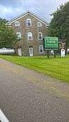
Heiert Farm |
|
March 9, 1983
(#83002603) |
Upper Eight Mile Pike
39°00′18″N 84°20′37″W / 39.005°N 84.343611°W / 39.005; -84.343611 (Heiert Farm) |
Camp Springs |
|
| 23 |
Elijah Herndon House |
|
October 29, 1983
(#83002604) |
Northwest of California on Washington Trace Rd.
38°55′37″N 84°17′40″W / 38.926944°N 84.294444°W / 38.926944; -84.294444 (Elijah Herndon House) |
California |
|
| 24 |
Hilbert Farm |
|
March 9, 1983
(#83002605) |
Gunkel Rd.
39°00′39″N 84°20′18″W / 39.010833°N 84.338333°W / 39.010833; -84.338333 (Hilbert Farm) |
Camp Springs |
|
| 25 |
Harlan Hubbard Studio |
|
August 4, 2016
(#16000493) |
129 Highland Ave.
39°04′37″N 84°27′08″W / 39.077004°N 84.452098°W / 39.077004; -84.452098 (Harlan Hubbard Studio) |
Fort Thomas |
|
| 26 |
Kort Grocery |
|
March 9, 1983
(#83002606) |
Four Mile Pike
39°00′01″N 84°21′49″W / 39.000278°N 84.363611°W / 39.000278; -84.363611 (Kort Grocery) |
Camp Springs |
|
| 27 |
Frederich Kremer House |
|
March 9, 1983
(#83002607) |
317 Poplar Ridge Rd.
38°58′59″N 84°22′25″W / 38.983056°N 84.373611°W / 38.983056; -84.373611 (Frederich Kremer House) |
Alexandria |
|
| 28 |
Matthias Kremer House |
|
March 9, 1983
(#83002608) |
Four and Twelve Mile Rd.
38°59′35″N 84°21′45″W / 38.993056°N 84.3625°W / 38.993056; -84.3625 (Matthias Kremer House) |
Camp Springs |
|
| 29 |
Nicholas Kremer House |
|
March 9, 1983
(#83002609) |
Four and Twelve Mile Pike
38°59′21″N 84°21′17″W / 38.989167°N 84.354722°W / 38.989167; -84.354722 (Nicholas Kremer House) |
Alexandria |
|
| 30 |
Leick House |
|
March 9, 1983
(#83002610) |
Four Mile Pike
38°59′42″N 84°21′39″W / 38.995°N 84.360833°W / 38.995; -84.360833 (Leick House) |
Camp Springs |
|
| 31 |
Mansion Hill Historic District |
|
July 17, 1980
(#80001493) |
Roughly bounded by Interstate 471, Washington Ave., 2nd and 6th Sts.; also roughly bounded by Washington Ave., 6th, Saratoga, and 3rd Sts.
39°05′44″N 84°29′30″W / 39.095556°N 84.491667°W / 39.095556; -84.491667 (Mansion Hill Historic District) |
Newport |
Second set of addresses represents a boundary increase |
| 32 |
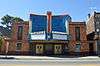
Marianne Theater |
|
March 17, 2015
(#15000081) |
609 Fairfield Ave.
39°06′30″N 84°28′52″W / 39.108333°N 84.481111°W / 39.108333; -84.481111 (Marianne Theater) |
Bellevue |
|
| 33 |
Monmouth Street Historic District |
|
July 25, 1996
(#96000794) |
Monmouth St. between 3rd and 11th Sts.
39°05′22″N 84°29′39″W / 39.089444°N 84.494167°W / 39.089444; -84.494167 (Monmouth Street Historic District) |
Newport |
|
| 34 |
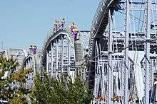
Newport and Cincinnati Bridge |
|
April 17, 2001
(#01000363) |
Over the Ohio River
39°05′41″N 84°29′40″W / 39.094722°N 84.494444°W / 39.094722; -84.494444 (Newport and Cincinnati Bridge) |
Newport |
Also known as the Newport Southbank Bridge; extends into Cincinnati, Ohio |
| 35 |
Newport Courthouse Square Historic District |
|
February 5, 2010
(#09001306) |
York St., Court Pl., and 4th St.
39°05′32″N 84°29′49″W / 39.092267°N 84.497047°W / 39.092267; -84.497047 (Newport Courthouse Square Historic District) |
Newport |
|
| 36 |
Ort-Heeb Farm |
|
March 9, 1983
(#83002611) |
Four Mile Pike
38°58′48″N 84°22′01″W / 38.98°N 84.366944°W / 38.98; -84.366944 (Ort-Heeb Farm) |
Alexandria |
|
| 37 |
Posey Flats |
|
January 29, 1987
(#86003730) |
101-103 E. 3rd St.
39°05′40″N 84°29′45″W / 39.094444°N 84.495833°W / 39.094444; -84.495833 (Posey Flats) |
Newport |
Destroyed; now the site of Newport on the Levee |
| 38 |
Reitman House |
|
March 9, 1983
(#83002612) |
Reitman Rd.
38°59′43″N 84°22′30″W / 38.995278°N 84.375°W / 38.995278; -84.375 (Reitman House) |
Alexandria |
|
| 39 |
Reitman's St. Joseph House |
|
March 9, 1983
(#83002613) |
Four Mile Pike
38°59′43″N 84°21′48″W / 38.995278°N 84.363333°W / 38.995278; -84.363333 (Reitman's St. Joseph House) |
Camp Springs |
|
| 40 |
Andrew Ritter Farm |
|
March 9, 1983
(#83002614) |
Four Mile Pike
38°59′00″N 84°21′29″W / 38.983333°N 84.358056°W / 38.983333; -84.358056 (Andrew Ritter Farm) |
Alexandria |
|
| 41 |
E.O. Robinson House |
|
August 2, 2017
(#100001420) |
105 Regency Ct.
39°02′06″N 84°26′50″W / 39.035105°N 84.447102°W / 39.035105; -84.447102 (E.O. Robinson House) |
Highland Heights |
|
| 42 |
Roth Farm |
|
March 9, 1983
(#83002615) |
Off Lower Eight Mile Rd.
39°00′45″N 84°21′22″W / 39.0125°N 84.356111°W / 39.0125; -84.356111 (Roth Farm) |
Camp Springs |
|
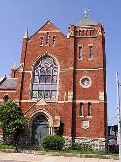
| 43 |
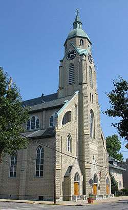
Sacred Heart Church |
|
August 13, 1974
(#74000856) |
337 Taylor Ave.
39°06′10″N 84°28′48″W / 39.102778°N 84.48°W / 39.102778; -84.48 (Sacred Heart Church) |
Bellevue |
|
| 44 |
St. John's Lutheran Cemetery |
|
March 9, 1983
(#83002617) |
Upper Tug Fork Rd.
39°00′51″N 84°22′58″W / 39.014167°N 84.382778°W / 39.014167; -84.382778 (St. John's Lutheran Cemetery) |
Alexandria |
|
| 45 |
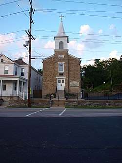
St. John the Baptist Roman Catholic Church |
|
August 11, 1980
(#80001495) |
641 Licking Pike / 1309 Johns Hill Rd.
39°02′48″N 84°29′07″W / 39.046700°N 84.485190°W / 39.046700; -84.485190 (St. John the Baptist Roman Catholic Church) |
Wilder |
|
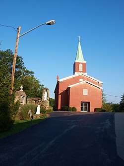
| 46 |
St. Joseph's Catholic Church and Cemetery |
|
May 16, 1983
(#83002618) |
Four Mile Pike
38°59′38″N 84°21′42″W / 38.993889°N 84.361667°W / 38.993889; -84.361667 (St. Joseph's Catholic Church and Cemetery) |
Alexandria |
|
| 47 |
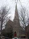
St. Paul's Episcopal Church |
|
November 25, 1980
(#80001494) |
15 Court Pl.
39°05′34″N 84°29′49″W / 39.092778°N 84.496944°W / 39.092778; -84.496944 (St. Paul's Episcopal Church) |
Newport |
|
| 48 |
St. Vincent de Paul School |
|
October 11, 1989
(#89001598) |
117 Main St.
39°04′50″N 84°29′13″W / 39.080556°N 84.486944°W / 39.080556; -84.486944 (St. Vincent de Paul School) |
Newport |
|
| 49 |
Salem Methodist Episcopal Church and Parsonage |
|
March 27, 1986
(#86000608) |
810 York St.
39°05′18″N 84°29′35″W / 39.088333°N 84.493056°W / 39.088333; -84.493056 (Salem Methodist Episcopal Church and Parsonage) |
Newport |
|
| 50 |
August Sauer House |
|
August 18, 1997
(#97000873) |
832 Central Ave.
39°05′11″N 84°29′42″W / 39.086250°N 84.495000°W / 39.086250; -84.495000 (August Sauer House) |
Newport |
|
| 51 |
Sauser Farm |
|
March 9, 1983
(#83002616) |
Upper Tug Fork Rd.
39°00′56″N 84°23′01″W / 39.015556°N 84.383611°W / 39.015556; -84.383611 (Sauser Farm) |
Alexandria |
|
| 52 |
Joseph Seiter House |
|
April 3, 1986
(#86000617) |
307-309 Berry Ave.
39°06′11″N 84°29′02″W / 39.103056°N 84.483889°W / 39.103056; -84.483889 (Joseph Seiter House) |
Bellevue |
|
| 53 |
Southgate-Parker-Maddux House |
|
August 29, 1977
(#77000605) |
24 E. 3rd St.
39°05′36″N 84°29′47″W / 39.093333°N 84.496389°W / 39.093333; -84.496389 (Southgate-Parker-Maddux House) |
Newport |
|
| 54 |
Taylor's Daughters Historic District |
|
February 24, 1988
(#88000101) |
Roughly bounded by O'Fallon Ave., Locust St., Retreat St., Clark St., Chen Ave., and Fairfield Ave.
39°06′11″N 84°28′47″W / 39.103056°N 84.479722°W / 39.103056; -84.479722 (Taylor's Daughters Historic District) |
Bellevue |
|
| 55 |
Third Street Motor Car Company Building |
|
December 5, 2002
(#02001465) |
216 E. 3rd St.
39°05′42″N 84°29′38″W / 39.095000°N 84.493889°W / 39.095000; -84.493889 (Third Street Motor Car Company Building) |
Newport |
|
| 56 |
Tiemeyer House |
|
March 9, 1983
(#83002619) |
KY 8
39°01′40″N 84°21′16″W / 39.027778°N 84.354444°W / 39.027778; -84.354444 (Tiemeyer House) |
Melbourne |
|
| 57 |
Trutschell House |
|
March 9, 1983
(#83002620) |
KY 8
39°01′32″N 84°21′00″W / 39.025556°N 84.35°W / 39.025556; -84.35 (Trutschell House) |
Melbourne |
|
| 58 |
U.S. Army Fort Thomas Mess Hall |
|
March 13, 1980
(#80001492) |
Cochran Ave.
39°04′05″N 84°26′40″W / 39.068056°N 84.444444°W / 39.068056; -84.444444 (U.S. Army Fort Thomas Mess Hall) |
Fort Thomas |
|
| 59 |
Uebel House |
|
March 9, 1983
(#83002621) |
Upper Tug Fork Rd.
38°59′34″N 84°23′08″W / 38.992778°N 84.385556°W / 38.992778; -84.385556 (Uebel House) |
Alexandria |
|
| 60 |
Walter House |
|
December 11, 2007
(#83004584) |
6570 Vineyard Ln.
38°59′51″N 84°19′35″W / 38.9975°N 84.326389°W / 38.9975; -84.326389 (Walter House) |
Melbourne |
|
| 61 |
John Weber Farm |
|
July 11, 2007
(#07000672) |
6231 Four Mile Rd.
39°00′37″N 84°22′11″W / 39.010328°N 84.369842°W / 39.010328; -84.369842 (John Weber Farm) |
Camp Springs |
|
| 62 |
Charles Wiedemann House |
|
August 18, 1984
(#84001401) |
1102 Park Ave.
39°05′20″N 84°28′57″W / 39.088889°N 84.482500°W / 39.088889; -84.482500 (Charles Wiedemann House) |
Newport |
|
| 63 |
York Street Historic District |
|
May 26, 1995
(#95000640) |
York St. from 7th St. to 10th St.
39°05′15″N 84°29′34″W / 39.0875°N 84.492778°W / 39.0875; -84.492778 (York Street Historic District) |
Newport |
|
%2C_Camp_Springs%2C_Kentucky.jpg)