| [3] |
Name on the Register |
Image |
Date listed[4] |
Location |
Neighborhood |
Description |
|---|
| 1 |
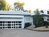
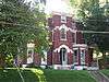
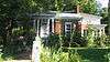
Leslie V. Abbott House |
|
July 30, 2013
(#13000558) |
2401 Newburg Rd.
38°12′49″N 85°42′01″W / 38.213611°N 85.700278°W / 38.213611; -85.700278 (Leslie V. Abbott House) |
Belknap |
|
| 2 |
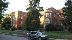
Willam R. Belknap School |
|
August 12, 1982
(#82002706) |
1800 Sils Ave.
38°13′19″N 85°41′23″W / 38.221944°N 85.689722°W / 38.221944; -85.689722 (Willam R. Belknap School) |
Belknap |
|
| 3 |
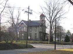
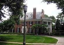
Bullock-Clifton House |
|
May 6, 1982
(#82002707) |
1824 Rosedale Ave.
38°13′27″N 85°42′15″W / 38.224167°N 85.704167°W / 38.224167; -85.704167 (Bullock-Clifton House) |
Deer Park |
|
| 4 |
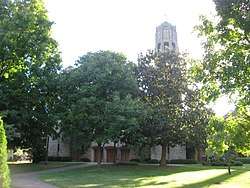
Calvary Evangelical Lutheran Church |
|
March 13, 2017
(#100000740) |
1838 Bardstown Rd.
38°13′39″N 85°41′59″W / 38.227517°N 85.699731°W / 38.227517; -85.699731 (Calvary Evangelical Lutheran Church) |
|
|
| 5 |
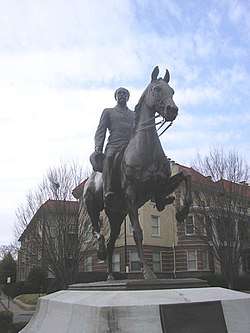
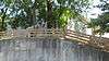
John B. Castleman Monument |
|
July 17, 1997
(#97000690) |
Junction of Cherokee Rd. and Cherokee Parkway
38°14′07″N 85°42′45″W / 38.235278°N 85.712500°W / 38.235278; -85.712500 (John B. Castleman Monument) |
Cherokee Triangle |
|
| 6 |
Cave Hill Cemetery |
|
December 11, 1979
(#79000999) |
701 Baxter Ave.
38°14′44″N 85°42′56″W / 38.245556°N 85.715556°W / 38.245556; -85.715556 (Cave Hill Cemetery) |
Cherokee Triangle |
|
| 7 |
Cave Hill National Cemetery |
|
September 3, 1998
(#98001133) |
701 Baxter Ave.
38°14′56″N 85°43′20″W / 38.248889°N 85.722222°W / 38.248889; -85.722222 (Cave Hill National Cemetery) |
Cherokee Triangle |
|
| 8 |
Cherokee Triangle Area Residential District |
|
June 30, 1976
(#76000902) |
Roughly bounded by Bardstown Rd., Sherwood Ave., and Broadway, east to the junction of Grinstead Dr. and Cherokee Parkway
38°14′22″N 85°42′56″W / 38.239444°N 85.715556°W / 38.239444; -85.715556 (Cherokee Triangle Area Residential District) |
Cherokee Triangle |
|
| 9 |
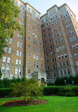
Commodore Apartment Building |
|
April 29, 1982
(#82002709) |
2140 Bonnycastle Ave.
38°13′58″N 85°42′03″W / 38.232778°N 85.700833°W / 38.232778; -85.700833 (Commodore Apartment Building) |
Bonnycastle |
|
| 10 |
Engelhard House |
|
December 5, 1980
(#80001599) |
1080 Baxter Ave.
38°14′15″N 85°43′21″W / 38.237500°N 85.722500°W / 38.237500; -85.722500 (Engelhard House) |
Tyler Park |
|
| 11 |
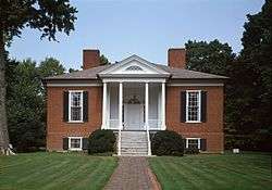
Farmington |
|
October 18, 1972
(#72000536) |
3033 Bardstown Rd.
38°12′53″N 85°40′05″W / 38.214722°N 85.668056°W / 38.214722; -85.668056 (Farmington) |
Hawthorne |
|
| 12 |
Nicholas Finzer House |
|
May 9, 1979
(#79001004) |
1212 Hull St.
38°14′53″N 85°43′39″W / 38.248194°N 85.727500°W / 38.248194; -85.727500 (Nicholas Finzer House) |
Irish Hill |
|
| 13 |
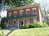
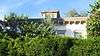
Hayfield |
|
August 19, 1980
(#80001600) |
1809 Tyler Lane
38°12′28″N 85°41′10″W / 38.207778°N 85.686111°W / 38.207778; -85.686111 (Hayfield) |
Hayfield Dundee |
|
| 14 |
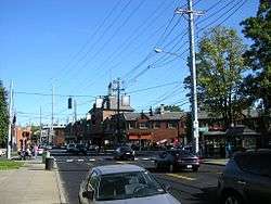
Highlands Historic District |
|
February 11, 1983
(#83002680) |
Roughly bounded by Barrett Ave., Eastern Parkway, Bardstown Road, and Fernwood, Woodbourne, Ellerbee, and Sherwood Aves.
38°14′22″N 85°43′36″W / 38.239444°N 85.726667°W / 38.239444; -85.726667 (Highlands Historic District) |
Original Highlands |
|
| 15 |
Howard-Gettys House |
|
February 8, 1978
(#78001356) |
1226 Bates Ct.
38°13′45″N 85°43′24″W / 38.229167°N 85.723333°W / 38.229167; -85.723333 (Howard-Gettys House) |
Tyler Park |
|
| 16 |
Humphrey-McMeekin House |
|
March 20, 1986
(#86000475) |
2240 Douglass Boulevard
38°13′42″N 85°41′09″W / 38.228333°N 85.685833°W / 38.228333; -85.685833 (Humphrey-McMeekin House) |
Highlands-Douglass |
|
| 17 |
Kentucky Home School for Girls |
|
August 2, 2017
(#100001422) |
2305 Douglass Blvd.
38°13′48″N 85°41′09″W / 38.230105°N 85.685916°W / 38.230105; -85.685916 (Kentucky Home School for Girls) |
|
|
| 18 |
Klotz Confectionary Company |
|
February 11, 2016
(#16000007) |
731 Brent St.
38°14′35″N 85°44′05″W / 38.242953°N 85.734666°W / 38.242953; -85.734666 (Klotz Confectionary Company) |
|
|
| 19 |
Nelson Distillery Warehouse |
|
June 27, 2014
(#14000423) |
100 Distillery Commons Dr.
38°15′00″N 85°43′23″W / 38.2500°N 85.723°W / 38.2500; -85.723 (Nelson Distillery Warehouse) |
Irish Hill |
Now the Distillery Commons. |
| 20 |
Rose Hill |
|
December 3, 1980
(#80001616) |
1835 Hampden Ct.
38°13′43″N 85°41′54″W / 38.228611°N 85.698333°W / 38.228611; -85.698333 (Rose Hill) |
Highlands-Douglass |
|
| 21 |
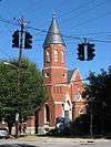
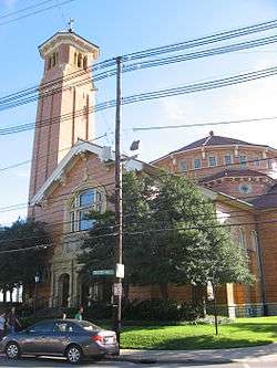
Saint Francis of Assisi Complex |
|
May 29, 1987
(#87000850) |
1960 Bardstown Rd.
38°13′33″N 85°41′52″W / 38.225833°N 85.697778°W / 38.225833; -85.697778 (Saint Francis of Assisi Complex) |
Deer Park |
|
| 22 |
St. James Roman Catholic Church, Rectory, and School |
|
March 1, 1982
(#82002722) |
1430 Bardstown Rd., 1826 Edenside Ave, and 1818 Edenside Ave.
38°13′57″N 85°42′39″W / 38.232500°N 85.710833°W / 38.232500; -85.710833 (St. James Roman Catholic Church, Rectory, and School) |
Tyler Park |
|
| 23 |
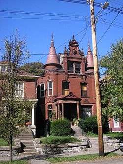
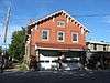
Valentine Schneikert House |
|
April 17, 1986
(#86000848) |
1234 Lexington Rd.
38°14′58″N 85°43′38″W / 38.249444°N 85.727361°W / 38.249444; -85.727361 (Valentine Schneikert House) |
Irish Hill |
|
| 24 |
Schuster Building |
|
March 19, 1980
(#80001618) |
1500-1512 Bardstown Rd.
38°13′54″N 85°42′32″W / 38.231667°N 85.708889°W / 38.231667; -85.708889 (Schuster Building) |
Deer Park |
|
| 25 |
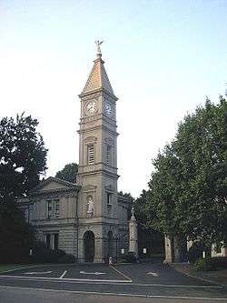
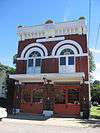
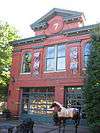
Steam Engine Company No. 11 |
|
November 7, 1980
(#80001623) |
1122 Rogers St.
38°14′45″N 85°43′38″W / 38.245833°N 85.727222°W / 38.245833; -85.727222 (Steam Engine Company No. 11) |
Irish Hill |
|
| 26 |
Steam Engine Company No. 20 |
|
November 7, 1980
(#80001626) |
1330 Bardstown Rd.
38°14′04″N 85°42′51″W / 38.234444°N 85.714167°W / 38.234444; -85.714167 (Steam Engine Company No. 20) |
Tyler Park |
|
| 27 |
Steam Engine Company No. 20 |
|
November 7, 1980
(#80004498) |
1735 Bardstown Rd.
38°13′45″N 85°42′06″W / 38.229167°N 85.701667°W / 38.229167; -85.701667 (Steam Engine Company No. 20) |
Bonnycastle |
|
| 28 |
Struss House |
|
November 7, 2003
(#03001112) |
1920 Winston Ave.
38°12′55″N 85°41′09″W / 38.215139°N 85.685833°W / 38.215139; -85.685833 (Struss House) |
Hayfield Dundee |
|
| 29 |
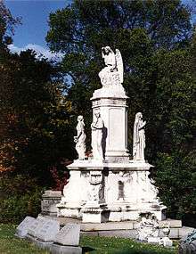
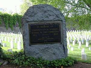
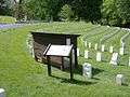
Union Monument in Louisville |
|
July 17, 1997
(#97000687) |
701 Baxter Ave.
38°14′54″N 85°43′20″W / 38.248333°N 85.722222°W / 38.248333; -85.722222 (Union Monument in Louisville) |
Irish Hill |
Cave Hill Cemetery, junction of Payne St. and Lexington Rd. |
| 30 |
David Wilson House |
|
March 26, 1987
(#87000511) |
2215 Carolina Ave.
38°13′46″N 85°41′02″W / 38.229306°N 85.683889°W / 38.229306; -85.683889 (David Wilson House) |
Highlands-Douglass |
|
| 31 |
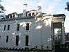
Woodbourne House |
|
February 7, 2008
(#08000008) |
2024 Woodford Pl.
38°13′33″N 85°41′38″W / 38.225833°N 85.693889°W / 38.225833; -85.693889 (Woodbourne House) |
Highlands-Douglass |
|