| [3] |
Name on the Register |
Image |
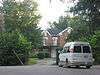
Date listed[4] |
Location |
City or town |
Description |
|---|
| 1 |
Archeological Site 15 Ma 24 |
|
August 18, 1980
(#80001651) |
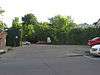
At Round Hill[5]
37°40′46″N 84°25′00″W / 37.679444°N 84.416667°W / 37.679444; -84.416667 (Archeological Site 15 Ma 24) |
Round Hill |
|
| 2 |
Archeological Site No. 15MA25 |
|
April 28, 1983
(#83002816) |
Address Restricted
|
Bighill |
|
| 3 |
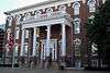
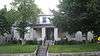
Arlington |
|
October 13, 1983
(#83003778) |
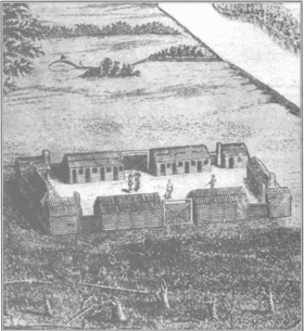
Lexington Rd.
37°45′40″N 84°19′19″W / 37.761111°N 84.321944°W / 37.761111; -84.321944 (Arlington) |
Richmond |
|
| 4 |
Battle of Richmond Historic Areas |
|
August 22, 1996
(#94000844) |
Two discontiguous areas: one northeast of the junction of U.S. Routes 25 and 421, and one southeast of the junction of U.S. Route 25 and Rose Ln.
37°40′10″N 84°15′07″W / 37.669444°N 84.251944°W / 37.669444; -84.251944 (Battle of Richmond Historic Areas) |
Richmond |
|
| 5 |
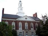
Berea College Forest |
|
November 4, 2003
(#02000343) |
Kentucky Route 21, 2 miles (3.2 km) east of the Berea College campus
37°32′00″N 84°13′41″W / 37.533333°N 84.228056°W / 37.533333; -84.228056 (Berea College Forest) |
Berea |
|
| 6 |
Blair Park |
|
October 13, 1983
(#83003779) |
108 Rosedale St.
37°45′16″N 84°18′27″W / 37.754444°N 84.307500°W / 37.754444; -84.307500 (Blair Park) |
Richmond |
|
| 7 |
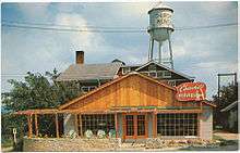
Blythewood |
|
February 8, 1989
(#88003330) |
Junction of Peytontown and Duncanon Rds.
37°40′16″N 84°19′21″W / 37.671111°N 84.3225°W / 37.671111; -84.3225 (Blythewood) |
Richmond |
|
| 8 |
Bogie Circle |
|
March 28, 1983
(#83002814) |
Address Restricted
|
Ruthton |
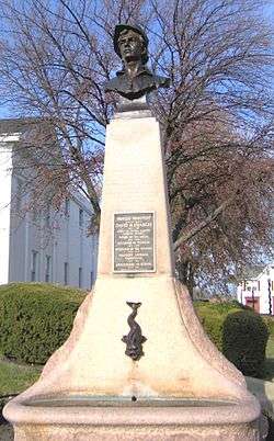
|
| 9 |
Bogie Houses and Mill Site |
|
August 13, 1976
(#76000920) |
8 miles (13 km) west of Richmond on Silver Creek
37°43′42″N 84°25′28″W / 37.728333°N 84.424444°W / 37.728333; -84.424444 (Bogie Houses and Mill Site) |
Richmond |
|
| 10 |
Boone Tavern Hotel |
|
January 11, 1996
(#95001527) |
100 Main St.
37°34′19″N 84°17′19″W / 37.571944°N 84.288611°W / 37.571944; -84.288611 (Boone Tavern Hotel) |
Berea |
|
| 11 |
Judge Daniel Breck House |
|
November 7, 1976
(#76000921) |
312 Lancaster Ave.
37°44′48″N 84°18′00″W / 37.746528°N 84.300000°W / 37.746528; -84.300000 (Judge Daniel Breck House) |
Richmond |
|
| 12 |
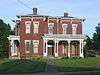
Bronston Place |
|
October 13, 1983
(#83003781) |
Woodland Ave.
37°45′06″N 84°17′41″W / 37.751667°N 84.294722°W / 37.751667; -84.294722 (Bronston Place) |
Richmond |
|
| 13 |
Burnamwood |
|
January 3, 1984
(#84001801) |
Burnam Ct.
37°45′07″N 84°18′21″W / 37.751944°N 84.305833°W / 37.751944; -84.305833 (Burnamwood) |
Richmond |
|
| 14 |
Campbell House |
|
February 8, 1989
(#88003334) |
Kentucky Route 52 near Paint Lick
37°37′47″N 84°24′10″W / 37.629722°N 84.402778°W / 37.629722; -84.402778 (Campbell House) |
Paint Lick |
|
| 15 |
Cane Springs Primitive Baptist Church |
|
December 22, 1978
(#78001381) |
North of College Hill
37°49′37″N 84°07′51″W / 37.826944°N 84.130833°W / 37.826944; -84.130833 (Cane Springs Primitive Baptist Church) |
College Hill |
|
| 16 |
Chenault House |
|
February 8, 1989
(#88003339) |
North of Richmond off Interstate 75
37°46′28″N 84°18′11″W / 37.774444°N 84.303056°W / 37.774444; -84.303056 (Chenault House) |
Richmond |
|
| 17 |
Churchill Weavers |
|
January 8, 2014
(#13001054) |
100 Churchill Dr.
37°34′42″N 84°16′52″W / 37.578333°N 84.281111°W / 37.578333; -84.281111 (Churchill Weavers) |
Berea |
|
| 18 |
Brutus and Pattie Field Clay House |
|
June 13, 1990
(#88003341) |
Lexington Rd. west of Richmond
37°45′55″N 84°18′31″W / 37.765278°N 84.308611°W / 37.765278; -84.308611 (Brutus and Pattie Field Clay House) |
Richmond |
|
| 19 |
Whitney Cobb House |
|
February 8, 1989
(#88003312) |
Kentucky Route 388
37°50′26″N 84°15′48″W / 37.840556°N 84.263333°W / 37.840556; -84.263333 (Whitney Cobb House) |
Richmond |
|
| 20 |
Cornelison Mound |
|
February 12, 1998
(#98000090) |
Address Restricted
|
Ruthton |
|
| 21 |
Cornelison Pottery |
|
July 24, 1978
(#78001380) |
Kentucky Route 52
37°43′58″N 84°07′29″W / 37.732778°N 84.124722°W / 37.732778; -84.124722 (Cornelison Pottery) |
Bybee |
|
| 22 |
Covington House |
|
February 8, 1989
(#88003329) |
Southwest of Richmond on Kentucky Route 595
37°41′17″N 84°20′12″W / 37.688056°N 84.336667°W / 37.688056; -84.336667 (Covington House) |
Richmond |
|
| 23 |
Coy Site Complex |
|
February 12, 1998
(#98000091) |
Address Restricted
|
Richmond |
|
| 24 |
Downtown Richmond Historic District |
|
September 30, 1976
(#76000922) |
Main St. and Courthouse Sq.
37°44′52″N 84°17′43″W / 37.747778°N 84.295278°W / 37.747778; -84.295278 (Downtown Richmond Historic District) |
Richmond |
|
| 25 |
Dozier-Guess House |
|
May 1, 1989
(#88003343) |
Kentucky Route 388, Red House Rd.
37°47′02″N 84°16′28″W / 37.783889°N 84.274444°W / 37.783889; -84.274444 (Dozier-Guess House) |
Richmond |
|
| 26 |
Duncannon |
|
September 17, 1980
(#80001650) |
South of Richmond on John Parrish Lane
37°40′38″N 84°17′46″W / 37.677222°N 84.296111°W / 37.677222; -84.296111 (Duncannon) |
Richmond |
|
| 27 |
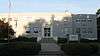
Eastern Kentucky University Historic District |
|
January 3, 1984
(#84001804) |
Lancaster, Crabbe Sts. and University Dr.
37°44′30″N 84°18′00″W / 37.741667°N 84.3°W / 37.741667; -84.3 (Eastern Kentucky University Historic District) |
Richmond |
|
| 28 |
Elk Garden |
|
February 8, 1989
(#88003326) |
South of Kirksville off Kentucky Route 595
37°38′34″N 84°23′48″W / 37.642778°N 84.396667°W / 37.642778; -84.396667 (Elk Garden) |
Kirksville |
|
| 29 |
Elmwood |
|
August 6, 2012
(#84003927) |
Lancaster Ave.
37°44′38″N 84°18′11″W / 37.743889°N 84.303056°W / 37.743889; -84.303056 (Elmwood) |
Richmond |
|
| 30 |
Farmers Bank of Kirksville |
|
June 13, 1990
(#88003324) |
Near the junction of Kentucky Route 595 and County Road 1295
37°39′55″N 84°24′31″W / 37.665278°N 84.408611°W / 37.665278; -84.408611 (Farmers Bank of Kirksville) |
Kirksville |
|
| 31 |
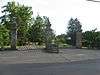
Fort Boonesborough Townsite Historic District |
|
April 14, 1994
(#94000303) |
4375 Old Boonesborough Rd.
37°53′18″N 84°16′03″W / 37.888333°N 84.2675°W / 37.888333; -84.2675 (Fort Boonesborough Townsite Historic District) |
Richmond |
|
| 32 |
Griggs House |
|
February 8, 1989
(#88003316) |
North of Waco
37°44′43″N 84°08′34″W / 37.745278°N 84.142778°W / 37.745278; -84.142778 (Griggs House) |
Waco |
|
| 33 |
Hagan House |
|
February 8, 1989
(#88003337) |
Hagans Mill Rd.
37°41′29″N 84°21′46″W / 37.691389°N 84.362778°W / 37.691389; -84.362778 (Hagan House) |
Richmond |
|
| 34 |
Hakins-Stone-Hagan-Curtis House |
|
February 8, 1989
(#88003327) |
1875 Curtis Pike
37°41′50″N 84°22′57″W / 37.697222°N 84.3825°W / 37.697222; -84.3825 (Hakins-Stone-Hagan-Curtis House) |
Kirksville |
|
| 35 |
Nathan Hawkins House |
|
June 23, 1983
(#83002815) |
Curtis Rd.
37°41′46″N 84°23′08″W / 37.696111°N 84.385556°W / 37.696111; -84.385556 (Nathan Hawkins House) |
Kirksville |
|
| 36 |
William Holloway House |
|
October 13, 1983
(#83003783) |
Hillsdale St.
37°44′45″N 84°17′18″W / 37.745833°N 84.288333°W / 37.745833; -84.288333 (William Holloway House) |
Richmond |
|
| 37 |
Homelands |
|
February 8, 1989
(#88003332) |
Northwest of Richmond on U.S. Route 25
37°49′43″N 84°19′39″W / 37.828611°N 84.3275°W / 37.828611; -84.3275 (Homelands) |
Richmond |
|
| 38 |
Irvinton |
|
May 6, 1975
(#75000798) |
319 Lancaster Ave.
37°44′40″N 84°17′58″W / 37.744444°N 84.299444°W / 37.744444; -84.299444 (Irvinton) |
Richmond |
|
| 39 |
Merritt Jones Tavern |
|
April 2, 1973
(#73000817) |
1 mile (1.6 km) south of Bighill on U.S. Route 421
37°39′05″N 84°45′32″W / 37.651389°N 84.758889°W / 37.651389; -84.758889 (Merritt Jones Tavern) |
Bighill |
|
| 40 |
Karr House |
|
February 8, 1989
(#88003313) |
Lost Fork Rd.
37°50′37″N 84°17′17″W / 37.843611°N 84.288056°W / 37.843611; -84.288056 (Karr House) |
Richmond |
|
| 41 |
Kellogg and Company Warehouse |
|
August 2, 2017
(#100001424) |
131 Orchard St.
37°44′43″N 84°17′11″W / 37.7453°N 84.286458°W / 37.7453; -84.286458 (Kellogg and Company Warehouse) |
Richmond |
|
| 42 |
Kirksville Christian Church |
|
February 8, 1989
(#88003325) |
Kentucky Route 595
37°39′47″N 84°24′27″W / 37.663056°N 84.4075°W / 37.663056; -84.4075 (Kirksville Christian Church) |
Kirksville |
|
| 43 |
Lincoln Hall |
|
December 2, 1974
(#74000892) |
Berea College campus
37°34′19″N 84°17′26″W / 37.571944°N 84.290556°W / 37.571944; -84.290556 (Lincoln Hall) |
Berea |
|
| 44 |
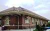
Louisville and Nashville Railroad Passenger Depot |
|
August 22, 1975
(#75000797) |
Broadway at Adams St.
37°34′17″N 84°17′58″W / 37.571389°N 84.299444°W / 37.571389; -84.299444 (Louisville and Nashville Railroad Passenger Depot) |
Berea |
|
| 45 |
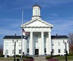
Madison County Courthouse |
|
May 12, 1975
(#75000800) |
Main St. between N. 1st and N. 2nd Sts.
37°44′51″N 84°16′59″W / 37.7475°N 84.283056°W / 37.7475; -84.283056 (Madison County Courthouse) |
Richmond |
|
| 46 |
Mason House |
|
February 8, 1989
(#88003320) |
South of Richmond off Meneleus Pike
37°39′25″N 84°18′27″W / 37.656944°N 84.3075°W / 37.656944; -84.3075 (Mason House) |
Richmond |
|
| 47 |
William M. Miller Farm |
|
January 4, 2001
(#00001599) |
1099 Parrish Rd.
37°40′18″N 84°17′35″W / 37.671667°N 84.293056°W / 37.671667; -84.293056 (William M. Miller Farm) |
Richmond |
|
| 48 |
William M. Miller House |
|
July 16, 1979
(#79003602) |
South of Richmond
37°40′08″N 84°17′45″W / 37.668889°N 84.295833°W / 37.668889; -84.295833 (William M. Miller House) |
Richmond |
|
| 49 |
Moberly House |
|
February 8, 1989
(#88003315) |
0.3 miles (0.48 km) north of Old Kentucky Route 52
37°44′43″N 84°09′58″W / 37.745278°N 84.166111°W / 37.745278; -84.166111 (Moberly House) |
Moberly |
|
| 50 |
John Moberly House |
|
June 23, 1983
(#83002817) |
Gum Bottom Rd.
37°39′41″N 84°10′40″W / 37.661389°N 84.177778°W / 37.661389; -84.177778 (John Moberly House) |
Moberly |
|
| 51 |
Morrison House |
|
February 8, 1989
(#88003340) |
East of Kirksville off Kentucky Route 595
37°39′38″N 84°23′16″W / 37.660556°N 84.387778°W / 37.660556; -84.387778 (Morrison House) |
Kirksville |
|
| 52 |
Mt. Pleasant |
|
October 13, 1983
(#83003784) |
2nd and Water Sts.
37°44′46″N 84°17′44″W / 37.746111°N 84.295556°W / 37.746111; -84.295556 (Mt. Pleasant) |
Richmond |
|
| 53 |
Mt. Pleasant Christian Church |
|
February 8, 1989
(#88003331) |
North of Richmond on U.S. Route 25
37°50′16″N 84°19′35″W / 37.837778°N 84.326389°W / 37.837778; -84.326389 (Mt. Pleasant Christian Church) |
Richmond |
|
| 54 |
Mt. Zion Christian Church |
|
February 8, 1989
(#88003318) |
U.S. Route 421 south of its junction with U.S. Route 25
37°40′25″N 84°15′14″W / 37.673611°N 84.253889°W / 37.673611; -84.253889 (Mt. Zion Christian Church) |
Richmond |
|
| 55 |
Stephen Murphy House |
|
June 23, 1983
(#83002818) |
Off Kentucky Route 39
37°45′30″N 84°30′40″W / 37.758333°N 84.511111°W / 37.758333; -84.511111 (Stephen Murphy House) |
Little Hickman |
|
| 56 |
Isaac Newland House |
|
June 23, 1983
(#83002819) |
Off U.S. Route 25
37°47′55″N 84°19′56″W / 37.798611°N 84.332222°W / 37.798611; -84.332222 (Isaac Newland House) |
Richmond |
|
| 57 |
Noland Mound (15-Ma-14) |
|
January 27, 1983
(#83002820) |
Address Restricted
|
Richmond |
|
| 58 |
Old Central University |
|
June 19, 1973
(#73000818) |
University Dr. on Eastern Kentucky University campus
37°44′27″N 84°18′04″W / 37.740833°N 84.301111°W / 37.740833; -84.301111 (Old Central University) |
Richmond |
|
| 59 |
Richmond Armory |
|
March 24, 2000
(#00000282) |
Junction of 2nd St. and Moberly Ave.
37°45′04″N 84°17′32″W / 37.751111°N 84.292222°W / 37.751111; -84.292222 (Richmond Armory) |
Richmond |
|
| 60 |
Richmond Cemetery |
|
October 13, 1983
(#83003785) |
E. Main St.
37°44′32″N 84°17′23″W / 37.742222°N 84.289722°W / 37.742222; -84.289722 (Richmond Cemetery) |
Richmond |
|
| 61 |
Robbins Mound |
|
February 12, 1998
(#98000092) |
Address Restricted
|
Ruthton |
|
| 62 |
Rolling Meadows |
|
February 8, 1989
(#88003321) |
Kentucky Route 595 north of Round Hill
37°41′27″N 84°25′29″W / 37.690833°N 84.424722°W / 37.690833; -84.424722 (Rolling Meadows) |
Round Hill |
|
| 63 |
Shearer Store |
|
June 13, 1990
(#88003314) |
Kentucky Route 1936 at Union City
37°47′52″N 84°11′51″W / 37.797778°N 84.1975°W / 37.797778; -84.1975 (Shearer Store) |
Richmond |
|
| 64 |
Simmons House |
|
February 8, 1989
(#88003323) |
Arbuckle Lane off County Road 1295
37°41′14″N 84°23′13″W / 37.687222°N 84.386944°W / 37.687222; -84.386944 (Simmons House) |
Richmond |
|
| 65 |
Stephenson House |
|
February 8, 1989
(#88003322) |
North of Round Hill on Kentucky Route 595
37°40′57″N 84°25′05″W / 37.6825°N 84.418056°W / 37.6825; -84.418056 (Stephenson House) |
Round Hill |
|
| 66 |
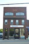
Tate Building |
|
September 13, 2006
(#06000814) |
444 Chestnut St.
37°34′05″N 84°17′55″W / 37.568056°N 84.298611°W / 37.568056; -84.298611 (Tate Building) |
Berea |
|
| 67 |
Tates Creek Baptist Church |
|
February 8, 1989
(#88003333) |
Kentucky Route 627/Boonesborough Rd.
37°50′49″N 84°19′06″W / 37.846944°N 84.318333°W / 37.846944; -84.318333 (Tates Creek Baptist Church) |
Richmond |
|
| 68 |
Taylor House |
|
February 8, 1989
(#88003336) |
North of Baldwin
37°48′24″N 84°25′49″W / 37.806667°N 84.430278°W / 37.806667; -84.430278 (Taylor House) |
Baldwin |
|
| 69 |
Taylor House |
|
October 13, 1983
(#83003787) |
216 Water St.
37°44′49″N 84°17′47″W / 37.746944°N 84.296389°W / 37.746944; -84.296389 (Taylor House) |
Richmond |
|
| 70 |
Tevis House |
|
February 8, 1989
(#88003335) |
Kentucky Route 627/Boonesborough Rd.
37°51′24″N 84°17′32″W / 37.856667°N 84.292222°W / 37.856667; -84.292222 (Tevis House) |
Richmond |
|
| 71 |
Turner House |
|
February 8, 1989
(#88003338) |
Southeast of Richmond on Curtis Pike
37°42′01″N 84°22′24″W / 37.700278°N 84.373333°W / 37.700278; -84.373333 (Turner House) |
Richmond |
|
| 72 |
Turner-Fitzpatrick House |
|
February 8, 1989
(#88003328) |
Off Mule Shed Rd.
37°44′26″N 84°21′46″W / 37.740556°N 84.362778°W / 37.740556; -84.362778 (Turner-Fitzpatrick House) |
Richmond |
|
| 73 |
Squire Turner House |
|
October 13, 1983
(#83003786) |
302 N. 2nd St.
37°44′46″N 84°17′44″W / 37.746111°N 84.295556°W / 37.746111; -84.295556 (Squire Turner House) |
Richmond |
|
| 74 |
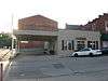
Union Bus Station |
|
April 10, 2007
(#07000285) |
127 S. 3rd St.
37°44′58″N 84°17′49″W / 37.749444°N 84.296944°W / 37.749444; -84.296944 (Union Bus Station) |
Richmond |
|
| 75 |
Viney Fork Baptist Church |
|
February 8, 1989
(#88003317) |
Junction of County Roads 374 and 499
37°40′26″N 84°10′38″W / 37.673889°N 84.177222°W / 37.673889; -84.177222 (Viney Fork Baptist Church) |
Speedwell |
|
| 76 |
Walker House |
|
October 13, 1983
(#83003789) |
315 Lancaster Ave.
37°44′45″N 84°17′57″W / 37.745833°N 84.299167°W / 37.745833; -84.299167 (Walker House) |
Richmond |
|
| 77 |
William Walker House |
|
February 8, 1989
(#88003319) |
Duncannon Rd.
37°40′44″N 84°18′27″W / 37.678889°N 84.3075°W / 37.678889; -84.3075 (William Walker House) |
Richmond |
|
| 78 |
West Richmond Historic District |
|
January 12, 1984
(#84001815) |
Roughly W. Main St. between Church and Norwood Sts.
37°44′59″N 84°18′00″W / 37.749722°N 84.300000°W / 37.749722; -84.300000 (West Richmond Historic District) |
Richmond |
|
| 79 |
Whitehall |
|
March 11, 1971
(#71000352) |
7 miles (11 km) north of Richmond on Clay Lane off U.S. Route 25
37°49′58″N 84°21′08″W / 37.832778°N 84.352222°W / 37.832778; -84.352222 (Whitehall) |
Richmond |
|

.jpg)