| [3] |
Name on the Register |
Image |
Date listed[4] |
Location |
City or town |
Description |
|---|
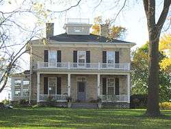
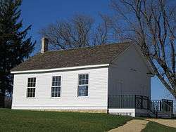
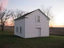
| 1 |
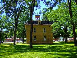
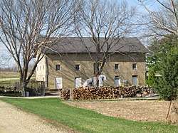
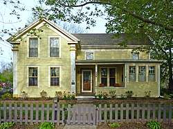
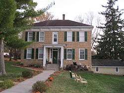
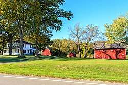
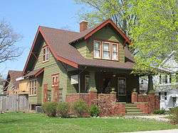
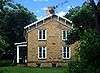
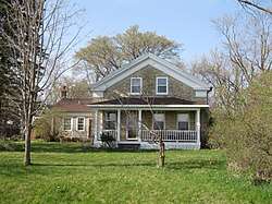
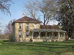
Francis Marian Ames Farmstead |
|
November 5, 1992
(#92001555) |
221 US 14
42°51′26″N 89°20′40″W / 42.857222°N 89.344444°W / 42.857222; -89.344444 (Francis Marian Ames Farmstead) |
Rutland |
|
| 2 |
Bedrud-Olson Farmstead |
|
April 1, 1999
(#99000429) |
996 E. Church Rd.
42°57′12″N 89°05′14″W / 42.953333°N 89.087222°W / 42.953333; -89.087222 (Bedrud-Olson Farmstead) |
Christiana |
|
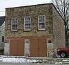
| 3 |
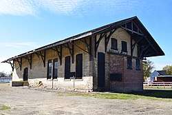
Belleville Illinois Central Railroad Depot |
|
December 6, 2016
(#16000831) |
109 S. Park St.
42°51′31″N 89°31′58″W / 42.858719°N 89.532774°W / 42.858719; -89.532774 (Belleville Illinois Central Railroad Depot) |
Belleville |
|
| 4 |
Bram Mound Group |
|
March 25, 1993
(#93000216) |
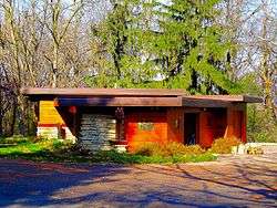
Address Restricted
|
Dunn |
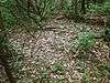
3 linear mounds and 1 low conical mound |
| 5 |
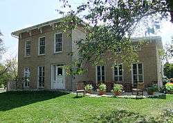
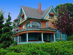
Brown-Sewell House |
|
April 22, 2003
(#03000307) |
101 S. Fifth St.
42°55′05″N 89°12′59″W / 42.918056°N 89.216389°W / 42.918056; -89.216389 (Brown-Sewell House) |
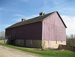
Stoughton |
1859, Greek Revival style |
| 6 |
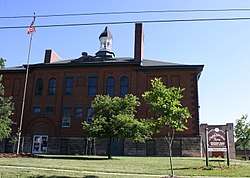
Cambridge Public School and High School |
|
June 23, 1998
(#98000708) |
103 South St.
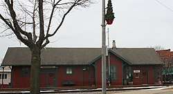
43°00′06″N 89°00′54″W / 43.001667°N 89.015°W / 43.001667; -89.015 (Cambridge Public School and High School) |
Cambridge |
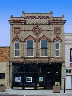
|
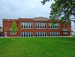
| 7 |
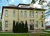
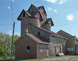
Chase Grain Elevator |
|
August 12, 2010
(#10000540) |
123 Railroad St.
43°10′43″N 89°12′53″W / 43.178611°N 89.214722°W / 43.178611; -89.214722 (Chase Grain Elevator) |
Sun Prairie |
1922, elevator silos made of tile |
| 8 |
Jens and Ingeborg Cold House |
|
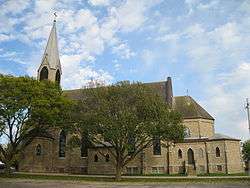
March 26, 2003
(#03000169) |
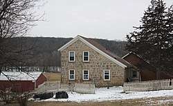
111 S Fifth St.
42°55′05″N 89°12′58″W / 42.918056°N 89.216111°W / 42.918056; -89.216111 (Jens and Ingeborg Cold House) |
Stoughton |
1892, Queen Anne style |
| 9 |
College Hills Historic District |
|
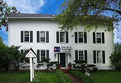
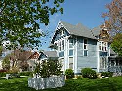
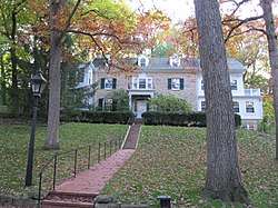
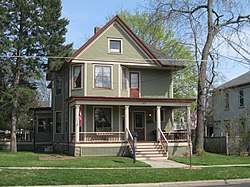
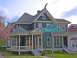
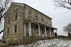
December 9, 2002
(#02001518) |
Roughly bounded by Colombia Rd., Amherst Dr., Bowdoin Rd., Corporate Limit, University Bay, and Harvard Dr.
43°04′45″N 89°26′20″W / 43.079167°N 89.438889°W / 43.079167; -89.438889 (College Hills Historic District) |
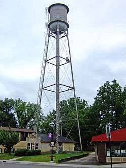
Shorewood Hills |
|
| 10 |
Dr. Charles G. Crosse House |
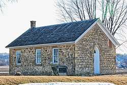
|
February 24, 1993
(#93000029) |
133 W. Main St.
43°10′59″N 89°12′54″W / 43.183056°N 89.215°W / 43.183056; -89.215 (Dr. Charles G. Crosse House) |
Sun Prairie |
1864, Carpenter Gothic style |
| 11 |
Henry L. and Sarah Dahle House |
|
November 26, 2003
(#03001218) |
312 S. Fourth St.
43°00′16″N 89°44′07″W / 43.004444°N 89.735278°W / 43.004444; -89.735278 (Henry L. and Sarah Dahle House) |
Mount Horeb |
|
| 12 |
Herman B. and Anne Marie Dahle House |
|
November 26, 2003
(#03001217) |
200 N. Second St.
43°00′39″N 89°44′19″W / 43.010833°N 89.738611°W / 43.010833; -89.738611 (Herman B. and Anne Marie Dahle House) |
Mount Horeb |
|
| 13 |
Onon B. and Betsy Dahle House |
|
April 16, 2008
(#08000322) |
10779 Evergreen Ave.
42°54′57″N 89°48′56″W / 42.915696°N 89.815551°W / 42.915696; -89.815551 (Onon B. and Betsy Dahle House) |
Perry |
|
| 14 |
John Sweet Donald Farmstead |
|
June 7, 1984
(#84003633) |
1972 WI 92
42°57′52″N 89°41′08″W / 42.964444°N 89.685556°W / 42.964444; -89.685556 (John Sweet Donald Farmstead) |
Springdale |
|
| 15 |
Adam Dunlap Farmstead |
|
November 15, 2001
(#01001242) |
9646 Dunlap Hollow Rd.
43°12′28″N 89°43′53″W / 43.207778°N 89.731389°W / 43.207778; -89.731389 (Adam Dunlap Farmstead) |
Mazomanie |
|
| 16 |
Dunroven House |
|
November 28, 1980
(#80000120) |
7801 Dunroven Rd.
43°17′04″N 89°28′23″W / 43.284444°N 89.473056°W / 43.284444; -89.473056 (Dunroven House) |
Dane |
|
| 17 |
East End Historic District |
|
July 25, 2003
(#03000699) |
7002-7016 Hubbard Ave., 1812-1916 Park St. (even only) 7002-7227,7233,7235,7237 Elmwood Ave.
43°05′45″N 89°30′12″W / 43.095833°N 89.503333°W / 43.095833; -89.503333 (East End Historic District) |
Middleton |
|
| 18 |
East Park Historic District |
|
May 1, 2003
(#03000335) |
108-324 S. Lynn St., 700-816 Park St., and East Park
42°55′02″N 89°12′41″W / 42.917222°N 89.211389°W / 42.917222; -89.211389 (East Park Historic District) |
Stoughton |
|
| 19 |
East Side Historic District |
|
January 9, 1997
(#96001577) |
Roughly bounded by Ridge, Henry, Vernon, and Academy Sts.
42°55′06″N 89°12′31″W / 42.918333°N 89.208611°W / 42.918333; -89.208611 (East Side Historic District) |
Stoughton |
|
| 20 |
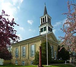
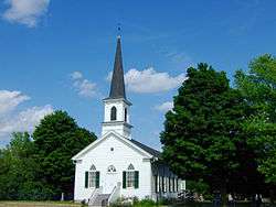
First Lutheran Church |
|
June 16, 1988
(#88000728) |
Pleasant View Rd. at Old Sauk Rd.
43°04′31″N 89°32′11″W / 43.075278°N 89.536389°W / 43.075278; -89.536389 (First Lutheran Church) |
Middleton |
1866, steeple added 1884, Gothic Revival style |
| 21 |
First National Bank |
|
October 16, 2007
(#07001096) |
113 N. Main St.
42°55′36″N 89°23′04″W / 42.926667°N 89.384444°W / 42.926667; -89.384444 (First National Bank) |
Oregon |
|
| 22 |
First Unitarian Society Meeting House |
|
April 11, 1973
(#73000076) |
900 University Bay Dr.
43°04′34″N 89°26′04″W / 43.076111°N 89.434444°W / 43.076111; -89.434444 (First Unitarian Society Meeting House) |
Shorewood Hills |
1947, Frank Lloyd Wright |
| 23 |
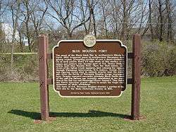
Fort Blue Mounds |
|
September 24, 2001
(#01001044) |
Address Restricted
|
Blue Mounds |
|
| 24 |
Fox Hall |
|
December 1, 1983
(#83004273) |
5183 County Hwy. M
42°56′57″N 89°24′01″W / 42.949167°N 89.400278°W / 42.949167; -89.400278 (Fox Hall) |
Fitchburg |
|
| 25 |
Frey School |
|
July 14, 2011
(#11000461) |
8847 County Road Y
43°14′58″N 89°40′19″W / 43.249444°N 89.671944°W / 43.249444; -89.671944 (Frey School) |
Roxbury |
|
| 26 |
John Fritz Farmstead |
|
July 15, 1998
(#98000879) |
642 Fritz Rd.
42°53′24″N 89°35′46″W / 42.89°N 89.596111°W / 42.89; -89.596111 (John Fritz Farmstead) |
Montrose |
|
| 27 |
Fuhremann Canning Company Factory |
|
September 15, 2004
(#04001003) |
151 Market St.
43°10′51″N 89°12′40″W / 43.180833°N 89.211111°W / 43.180833; -89.211111 (Fuhremann Canning Company Factory) |
Sun Prairie |
1900 |
| 28 |
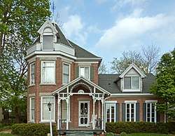
John and Flora Gilbert House |
|
September 6, 2007
(#07000933) |
357 N. Main St.
42°55′54″N 89°23′02″W / 42.931667°N 89.383889°W / 42.931667; -89.383889 (John and Flora Gilbert House) |
Oregon |
1906, Queen Anne style |
| 29 |
Sereno W. Graves House |
|
September 29, 1982
(#82000651) |
4006 Old Stage Rd.
42°51′49″N 89°18′50″W / 42.863611°N 89.313889°W / 42.863611; -89.313889 (Sereno W. Graves House) |
Rutland |
|
| 30 |
Nicholas Haight Farmstead |
|
October 29, 1993
(#93001162) |
4926 Haight Farm Rd.
43°00′08″N 89°22′42″W / 43.002222°N 89.378333°W / 43.002222; -89.378333 (Nicholas Haight Farmstead) |
Fitchburg |
|
| 31 |
Samuel Hall House |
|
December 23, 1993
(#93001445) |
974 Hillside Rd.
42°54′03″N 89°02′31″W / 42.900833°N 89.041944°W / 42.900833; -89.041944 (Samuel Hall House) |
Albion |
|
| 32 |
Hauge Log Church |
|
December 31, 1974
(#74000071) |
1 mi (1.6 km). north of Daleyville on CR Z
42°55′48″N 89°49′13″W / 42.93°N 89.820278°W / 42.93; -89.820278 (Hauge Log Church) |
Daleyville |
|
| 33 |
Heim Mound |
|
March 31, 2004
(#04000254) |
Address Restricted
43°05′38″N 89°29′21″W / 43.093889°N 89.489167°W / 43.093889; -89.489167 (Heim Mound) |
Middleton |
effigy of a fox or wolf |
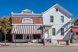
| 34 |
Heiney's Meat Market |
|
September 27, 1984
(#84003642) |
1221 Mills St.
43°08′16″N 89°44′52″W / 43.137778°N 89.747778°W / 43.137778; -89.747778 (Heiney's Meat Market) |
Black Earth |
|
| 35 |
Hoff Department Store |
|
February 14, 1989
(#89000005) |
101-103 Main St.
43°00′30″N 89°44′16″W / 43.008333°N 89.737778°W / 43.008333; -89.737778 (Hoff Department Store) |
Mount Horeb |
|
| 36 |
Hornung Mound Group |
|
April 26, 1996
(#96000497) |
Address Restricted
|
Roxbury |
|
| 37 |
Samuel Hunt House |
|
September 30, 1982
(#82000652) |
632 Center Rd.
42°52′51″N 89°18′35″W / 42.880833°N 89.309722°W / 42.880833; -89.309722 (Samuel Hunt House) |
Rutland |
|
| 38 |
Gaute Ingebretson Loft House |
|
March 13, 1987
(#87000437) |
1212 Pleasant Hill Rd.
42°54′47″N 89°10′12″W / 42.913056°N 89.17°W / 42.913056; -89.17 (Gaute Ingebretson Loft House) |
Stoughton |
|
| 39 |
Iverson-Johnson House |
|
January 21, 1988
(#87002501) |
327 E. Washington St.
42°55′02″N 89°13′00″W / 42.917222°N 89.216667°W / 42.917222; -89.216667 (Iverson-Johnson House) |
Stoughton |
1898, Queen Anne style with Nordic gable fretwork |
| 40 |
Herbert and Katherine Jacobs Second House |
|
December 31, 1974
(#74000074) |
3995 Shawn Trail
43°04′26″N 89°32′05″W / 43.073889°N 89.534722°W / 43.073889; -89.534722 (Herbert and Katherine Jacobs Second House) |
Middleton |
1943, Frank Lloyd Wright; designated National Historic Landmark July 31, 2003 |
| 41 |
Gulbrand and Bertha Jensvold House |
|
April 30, 2008
(#08000370) |
1033 WI 78
42°54′44″N 89°49′01″W / 42.912297°N 89.816953°W / 42.912297; -89.816953 (Gulbrand and Bertha Jensvold House) |
Perry |
|
| 42 |
Kehl Winery |
|
January 2, 1976
(#76000056) |
East of Prairie du Sac on WI 188
43°17′19″N 89°42′27″W / 43.288611°N 89.7075°W / 43.288611; -89.7075 (Kehl Winery) |
Roxbury |
|
| 43 |
John and Margarethe Kemp Cabin |
|
December 10, 2008
(#08001187) |
6950 WI Hwy. 78
43°13′51″N 89°43′35″W / 43.230839°N 89.72631°W / 43.230839; -89.72631 (John and Margarethe Kemp Cabin) |
Mazomanie |
|
| 44 |
Friederich Kohlmann House |
|
December 27, 1974
(#74000075) |
West of Springfield Corners off WI 19
43°11′10″N 89°38′22″W / 43.186111°N 89.639444°W / 43.186111; -89.639444 (Friederich Kohlmann House) |
Springfield Corners |
|
| 45 |
Robert M. LaFollette House |
|
October 15, 1966
(#66000020) |
733 Lakewood Blvd.
43°06′57″N 89°22′22″W / 43.115936°N 89.372912°W / 43.115936; -89.372912 (Robert M. LaFollette House) |
Maple Bluff |
|
| 46 |
Lewis Mound Group (47-Da-74) |
|
December 15, 1984
(#84000809) |
Address Restricted
|
McFarland |
|
| 47 |
Library Park |
|
January 26, 1981
(#81000038) |
Bounded by Vine, Main, Park and Pearl Sts.
42°51′33″N 89°32′00″W / 42.859167°N 89.533333°W / 42.859167; -89.533333 (Library Park) |
Belleville |
1894 (Village Hall) |
| 48 |
Aslak Lie Cabin |
|
April 3, 1986
(#86000622) |
3022 County Trunk P
43°01′14″N 89°40′05″W / 43.020556°N 89.668056°W / 43.020556; -89.668056 (Aslak Lie Cabin) |
Mount Horeb |
|
| 49 |
Lincoln Street Historic District |
|
April 12, 2006
(#06000276) |
W. Lincoln St., bet. Main St. and Market St.
42°55′55″N 89°23′04″W / 42.931944°N 89.384444°W / 42.931944; -89.384444 (Lincoln Street Historic District) |
Oregon |
|
| 50 |
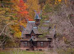
Little Norway |
|
March 16, 1998
(#98000169) |
3576 CTH JG
43°01′32″N 89°47′44″W / 43.025556°N 89.795556°W / 43.025556; -89.795556 (Little Norway) |
Blue Mounds |
|
| 51 |
Lockwood Barn |
|
September 29, 1982
(#82000653) |
Old Stage Rd
42°51′54″N 89°19′22″W / 42.865°N 89.322778°W / 42.865; -89.322778 (Lockwood Barn) |
Rutland |
|
| 52 |
Lower Mud Lake Archeological Complex |
|
March 31, 2004
(#04000253) |
Address Restricted
|
Dunn |
|
| 53 |
John Mann House |
|
July 8, 1982
(#82000655) |
6261 Nesbitt Rd.
43°00′34″N 89°28′44″W / 43.009444°N 89.478889°W / 43.009444; -89.478889 (John Mann House) |
Fitchburg |
|
| 54 |
Maple Bluff Boy Scout Cabin |
|
November 6, 2017
(#100001783) |
296 Woodland Cir.
43°06′39″N 89°21′54″W / 43.110864°N 89.364927°W / 43.110864; -89.364927 (Maple Bluff Boy Scout Cabin) |
Maple Bluff |
|
| 55 |
Mazomanie Downtown Historic District |
|
August 19, 1992
(#92000406) |
1-118 Brodhead, 2-46 Hudson, 37-105 Crescent and 113 E. Exchange Sts.
43°10′32″N 89°47′36″W / 43.175556°N 89.793333°W / 43.175556; -89.793333 (Mazomanie Downtown Historic District) |
Mazomanie |
|
| 56 |
Mazomanie Town Hall |
|
October 22, 1980
(#80000126) |
51 Crescent St.
43°10′34″N 89°47′33″W / 43.176111°N 89.7925°W / 43.176111; -89.7925 (Mazomanie Town Hall) |
Mazomanie |
|
| 57 |
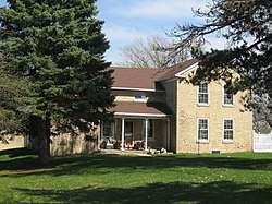
McCoy Farmhouse |
|
May 29, 1980
(#80000124) |
South of Madison at 2925 Syene Rd.
43°00′51″N 89°23′49″W / 43.014167°N 89.396944°W / 43.014167; -89.396944 (McCoy Farmhouse) |
Fitchburg |
|
| 58 |
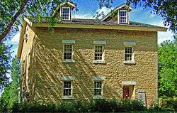
McFarland House |
|
November 3, 1988
(#88002228) |
5923 Exchange St.
43°00′48″N 89°17′19″W / 43.013333°N 89.288611°W / 43.013333; -89.288611 (McFarland House) |
McFarland |
1857, Greek Revival |
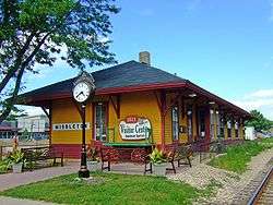
| 59 |
Middleton Depot, Chicago, Milwaukee, and St. Paul Railroad |
|
April 29, 1999
(#99000520) |
1811 Parmenter St.
43°05′42″N 89°30′40″W / 43.095°N 89.511111°W / 43.095; -89.511111 (Middleton Depot, Chicago, Milwaukee, and St. Paul Railroad) |
Middleton |
1895, J. U. Nettenstrom, Late Victorian style |
| 60 |
Monona Mound (47DA275) |
|
December 1, 1989
(#89002064) |
Address Restricted
|
Monona |
water spirit effigy mound, 800-1100 |
| 61 |
Moore Mound Group |
|
August 5, 1993
(#93000809) |
Address Restricted
|
Dunn |
|
| 62 |
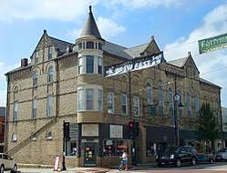
Mt. Horeb Opera Block |
|
February 23, 1989
(#89000068) |
109-117 E. Main St.
43°00′30″N 89°44′19″W / 43.008333°N 89.738611°W / 43.008333; -89.738611 (Mt. Horeb Opera Block) |
Mount Horeb |
|
| 63 |
Mount Horeb Public School |
|
May 28, 2010
(#10000298) |
207 Academy St.
43°00′13″N 89°44′13″W / 43.003494°N 89.73705°W / 43.003494; -89.73705 (Mount Horeb Public School) |
Mount Horeb |
|
| 64 |
Jens Naeset House |
|
March 14, 1985
(#85000577) |
126 E. Washington
42°55′04″N 89°13′09″W / 42.917778°N 89.219167°W / 42.917778; -89.219167 (Jens Naeset House) |
Stoughton |
1878, Italianate style with Second Empire cupola |
| 65 |
Northwest Side Historic District |
|
March 5, 1998
(#98000221) |
Roughly bounded by Van Buren, Clyde, Grant, and Main Sts.
42°55′09″N 89°13′36″W / 42.919167°N 89.226667°W / 42.919167; -89.226667 (Northwest Side Historic District) |
Stoughton |
|
| 66 |
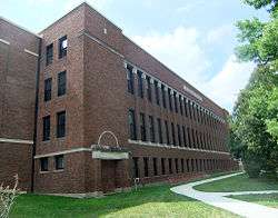
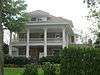
Oregon High School |
|
April 23, 1998
(#98000406) |
220 N. Main St.
42°55′41″N 89°22′58″W / 42.928056°N 89.382778°W / 42.928056; -89.382778 (Oregon High School) |
Oregon |
|
| 67 |
Oregon Masonic Lodge |
|
June 18, 1992
(#92000803) |
117-119 S. Main St.
42°55′33″N 89°23′06″W / 42.925833°N 89.385°W / 42.925833; -89.385 (Oregon Masonic Lodge) |
Oregon |
|
| 68 |
Oregon Water Tower and Pump House |
|
October 16, 2007
(#07001097) |
134 Janesville St.
42°55′31″N 89°23′01″W / 42.925278°N 89.383611°W / 42.925278; -89.383611 (Oregon Water Tower and Pump House) |
Oregon |
|
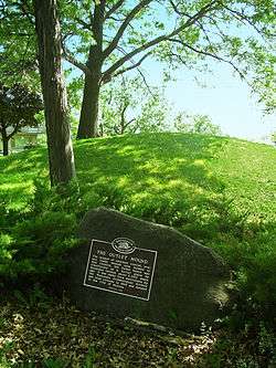
| 69 |
Outlet Mound |
|
October 9, 2003
(#03001022) |
Junction of Ridgewood and Midwood Aves.
43°03′06″N 89°20′05″W / 43.051667°N 89.334722°W / 43.051667; -89.334722 (Outlet Mound) |
Monona |
Oval mound |
| 70 |
Paoli Mills |
|
March 30, 1979
(#79000337) |
6890 Sun Valley Pkwy.
42°55′47″N 89°31′31″W / 42.929722°N 89.525278°W / 42.929722; -89.525278 (Paoli Mills) |
Paoli |
4 buildings on a 5-acre (20,000 m2) site |
| 71 |
Daniel Pond Farmhouse |
|
June 30, 1980
(#80000128) |
East of Brooklyn on U.S. 14
42°50′58″N 89°20′02″W / 42.849444°N 89.333889°W / 42.849444; -89.333889 (Daniel Pond Farmhouse) |
Brooklyn |
|
| 72 |
Ole K. Roe House |
|
September 7, 1984
(#84003652) |
404 S. 5th St.
42°54′56″N 89°13′01″W / 42.915620°N 89.216926°W / 42.915620; -89.216926 (Ole K. Roe House) |
Stoughton |
|
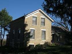
| 73 |
Dr. Newman C. Rowley House |
|
April 29, 1999
(#99000518) |
7410 Hubbard Ave.
43°05′43″N 89°30′32″W / 43.095278°N 89.508889°W / 43.095278; -89.508889 (Dr. Newman C. Rowley House) |
Middleton |
1867 |
| 74 |
Rutland United Brethren in Christ Meeting House and Cemetery |
|
September 15, 2004
(#04001002) |
687 US 14
42°52′59″N 89°21′05″W / 42.883056°N 89.351389°W / 42.883056; -89.351389 (Rutland United Brethren in Christ Meeting House and Cemetery) |
Rutland |
|
| 75 |
St. Peter's Roman Catholic Church |
|
September 23, 1980
(#80000130) |
W I K
43°08′23″N 89°32′27″W / 43.139722°N 89.540833°W / 43.139722; -89.540833 (St. Peter's Roman Catholic Church) |
Ashton |
|
| 76 |
Frederick Schumann Farmstead |
|
December 10, 1993
(#93001426) |
8313 WI 19
43°11′40″N 89°37′49″W / 43.194444°N 89.630278°W / 43.194444; -89.630278 (Frederick Schumann Farmstead) |
Berry |
|
| 77 |
Shorewood Historic District |
|
November 29, 2002
(#02001432) |
Roughly bounded by Lake Mendota Dr., Tallyho Ln., Shorewood Blvd., and the Blackhawk Country Club
43°04′50″N 89°26′48″W / 43.080556°N 89.446667°W / 43.080556; -89.446667 (Shorewood Historic District) |
Shorewood Hills |
|
| 78 |
Siggelkow Park Mound Group (47-Da-504) |
|
March 14, 1985
(#85000576) |
Address Restricted
|
McFarland |
1 linear mound and remnants of 2 others |
| 79 |
Eric and Jerome Skindrud Farm |
|
September 26, 1994
(#94001156) |
3070 Town Hall Rd.
43°01′19″N 89°41′18″W / 43.021944°N 89.688333°W / 43.021944; -89.688333 (Eric and Jerome Skindrud Farm) |
Springdale |
|
| 80 |
Adam and Mary Smith House |
|
April 30, 1998
(#98000434) |
south corner of Smith's Crossing and Leopold Way
43°09′47″N 89°15′53″W / 43.163056°N 89.264722°W / 43.163056; -89.264722 (Adam and Mary Smith House) |
Sun Prairie |
ca. 1856-60, Samuel Donnel and August Kutzbock, Italianate style |
| 81 |
South Main Street Historic District |
|
June 15, 2000
(#00000699) |
S. Main St., junction with Jefferson and Janesville Sts.
42°55′33″N 89°23′05″W / 42.925833°N 89.384722°W / 42.925833; -89.384722 (South Main Street Historic District) |
Oregon |
|
| 82 |
South School |
|
September 12, 1985
(#85002319) |
1009 Summit Ave.
42°54′37″N 89°13′08″W / 42.910278°N 89.218889°W / 42.910278; -89.218889 (South School) |
Stoughton |
|
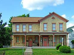
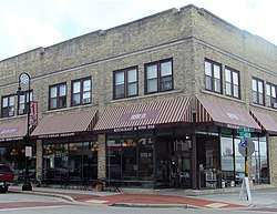
| 83 |
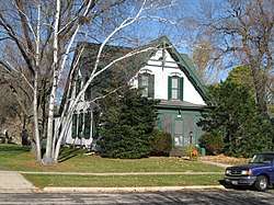
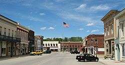
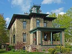
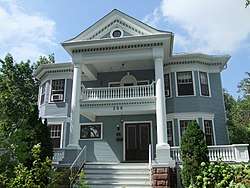
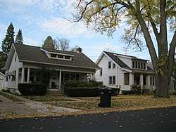
Southwest Side Historic District |
|
December 22, 1997
(#97001554) |
Roughly bounded by Lowell, S. Monroe, W. Main and S. Page Sts.
42°54′52″N 89°13′31″W / 42.914444°N 89.225278°W / 42.914444; -89.225278 (Southwest Side Historic District) |
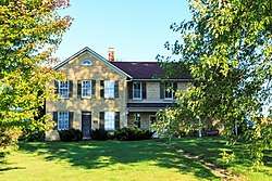
Stoughton |
Shown here is the landmarked Ovren House (1884). |
| 84 |
Stoughton High School |
|
January 17, 2002
(#01001476) |
211 N. Forrest St.
42°55′09″N 89°13′07″W / 42.919167°N 89.218611°W / 42.919167; -89.218611 (Stoughton High School) |
Stoughton |
1892, neo-Renaissance style |
| 85 |
Stoughton Main Street Commercial Historic District |
|
October 21, 1982
(#82001842) |
Main St. from the Yahara River to Forest St.
42°55′01″N 89°13′14″W / 42.916944°N 89.220556°W / 42.916944; -89.220556 (Stoughton Main Street Commercial Historic District) |
Stoughton |
Boundary increase (listed May 12, 1994): Main St. from Forest St. to Fifth St. |
| 86 |
Stoughton Universalist Church |
|
September 30, 1982
(#82000659) |
324 S. Page St.
42°54′58″N 89°13′25″W / 42.916111°N 89.223611°W / 42.916111; -89.223611 (Stoughton Universalist Church) |
Stoughton |
1858, neo-Classicist style |
| 87 |
Stricker Pond I Site (47 DA 424) |
|
July 16, 1979
(#79000069) |
Address Restricted
|
Middleton |
|
| 88 |
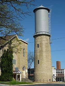
Sun Prairie Water Tower |
|
April 6, 2000
(#00000360) |
Junction of Columbus, Church and Cliff Sts.
43°11′14″N 89°12′39″W / 43.187222°N 89.210833°W / 43.187222; -89.210833 (Sun Prairie Water Tower) |
Sun Prairie |
Frank Stegerwald, 1899 and 1912 |
| 89 |
Sure Johnson Mound Group |
|
May 26, 1994
(#94000537) |
Address Restricted
|
McFarland |
|
| 90 |
Tompkins-Brindler Mound Group |
|
October 9, 2003
(#03001023) |
Monona Dr.
43°03′18″N 89°19′28″W / 43.055°N 89.324444°W / 43.055; -89.324444 (Tompkins-Brindler Mound Group) |
Monona |
2 linear mounds |
| 91 |
Waubesa School |
|
July 17, 1997
(#97000806) |
3579 Sigglekow Rd.
43°01′34″N 89°16′38″W / 43.026111°N 89.277222°W / 43.026111; -89.277222 (Waubesa School) |
Blooming Grove |
1920, Louis A. Harrison, Bungalow/Craftsman style |
| 92 |
Waunakee Railroad Depot |
|
February 14, 1978
(#78000092) |
South and Main Sts.
43°11′30″N 89°27′15″W / 43.191667°N 89.454167°W / 43.191667; -89.454167 (Waunakee Railroad Depot) |
Waunakee |
|
| 93 |
West School |
|
January 22, 1992
(#91001992) |
404 Garfield St.
42°54′52″N 89°13′30″W / 42.914335°N 89.225038°W / 42.914335; -89.225038 (West School) |
Stoughton |
1886 |
| 94 |
Wisconsin Heights Battlefield |
|
January 31, 2002
(#01001553) |
0.4 mi (0.64 km) southeast of the junction of County Rd. Y and WI 78
43°14′41″N 89°43′05″W / 43.244722°N 89.718056°W / 43.244722; -89.718056 (Wisconsin Heights Battlefield) |
Roxbury |
|
| 95 |
Wisconsin Industrial School for Girls |
|
September 13, 1991
(#91001391) |
5212 WI M
42°57′42″N 89°22′39″W / 42.961667°N 89.3775°W / 42.961667; -89.3775 (Wisconsin Industrial School for Girls) |
Fitchburg |
|


.JPG)


.jpg)