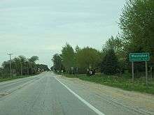
Waunakee, Wisconsin
| Waunakee, Wisconsin | |
|---|---|
| Village | |
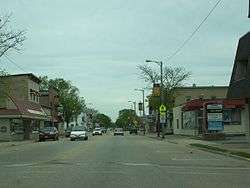 Downtown Waunakee on Wisconsin Highway 19 | |
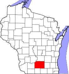
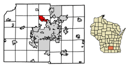 Location of Waunakee in Dane County, Wisconsin. | |
| Coordinates: 43°11′14″N 89°27′8″W / 43.18722°N 89.45222°WCoordinates: 43°11′14″N 89°27′8″W / 43.18722°N 89.45222°W | |
| Country | United States |
| State | Wisconsin |
| County | Dane |
| Government | |
| • Village Administrator | Todd Schmidt |
| • Village Board President | Chris Zellner |
| Area[1] | |
| • Total | 6.39 sq mi (16.55 km2) |
| • Land | 6.38 sq mi (16.52 km2) |
| • Water | 0.01 sq mi (0.03 km2) |
| Elevation[2] | 928 ft (283 m) |
| Population (2010)[3] | |
| • Total | 12,097 |
| • Estimate (2016)[4] | 13,607 |
| • Density | 1,896.1/sq mi (732.1/km2) |
| Time zone | UTC-6 (Central (CST)) |
| • Summer (DST) | UTC-5 (CDT) |
| Area code(s) | 608 |
| FIPS code | 55-84350[5] |
| GNIS feature ID | 1576318[2] |
Waunakee (/ˌwɔːnəˈkiː/)[6] is a village in Dane County, Wisconsin, United States (est. 1870). The population was 12,097 at the 2010 census. It is part of the Madison Metropolitan Statistical Area. Waunakee bills itself as "The Only Waunakee in the World." The village was named as #78 in CNN Money's "Top 100 Best Places to Live" for small towns in 2009.[7]
Geography
Waunakee is located at 43°11′14″N 89°27′8″W / 43.18722°N 89.45222°W (43.187253, -89.452244).[8]
According to the United States Census Bureau, the village has a total area of 6.39 square miles (16.55 km2), of which, 6.38 square miles (16.52 km2) of it is land and 0.01 square miles (0.03 km2) is water.[1]
Demographics
| Historical population | |||
|---|---|---|---|
| Census | Pop. | %± | |
| 1880 | 279 | — | |
| 1890 | 312 | 11.8% | |
| 1900 | 443 | 42.0% | |
| 1910 | 550 | 24.2% | |
| 1920 | 560 | 1.8% | |
| 1930 | 640 | 14.3% | |
| 1940 | 773 | 20.8% | |
| 1950 | 1,042 | 34.8% | |
| 1960 | 1,611 | 54.6% | |
| 1970 | 2,181 | 35.4% | |
| 1980 | 3,866 | 77.3% | |
| 1990 | 5,897 | 52.5% | |
| 2000 | 8,995 | 52.5% | |
| 2010 | 12,097 | 34.5% | |
| Est. 2016 | 13,607 | [4] | 12.5% |
| U.S. Decennial Census[9] | |||
2010 census
As of the census[3] of 2010, there were 12,097 people, 4,344 households, and 3,316 families residing in the village. The population density was 1,896.1 inhabitants per square mile (732.1/km2). There were 4,483 housing units at an average density of 702.7 per square mile (271.3/km2). The racial makeup of the village was 95.8% White, 1.0% African American, 0.2% Native American, 1.2% Asian, 0.5% from other races, and 1.3% from two or more races. Hispanic or Latino of any race were 2.2% of the population.
There were 4,344 households of which 45.3% had children under the age of 18 living with them, 64.3% were married couples living together, 8.8% had a female householder with no husband present, 3.3% had a male householder with no wife present, and 23.7% were non-families. 19.5% of all households were made up of individuals and 8.4% had someone living alone who was 65 years of age or older. The average household size was 2.76 and the average family size was 3.20.
The median age in the village was 37.9 years. 31.6% of residents were under the age of 18; 5.3% were between the ages of 18 and 24; 25.8% were from 25 to 44; 27.5% were from 45 to 64; and 9.9% were 65 years of age or older. The gender makeup of the village was 48.8% male and 51.2% female.
2000 census
As of the census[5] of 2000, there were 8,995 people, 3,203 households, and 2,379 families residing in the village. The population density was 1,509.9 people per square mile (582.7/km²). There were 3,295 housing units at an average density of 553.1 per square mile (213.5/km²). The racial makeup of the village was 98.07% White, 0.36% African American, 0.08% Native American, 0.51% Asian, 0.01% Pacific Islander, 0.24% from other races, and 0.73% from two or more races. Hispanic or Latino of any race were 0.96% of the population.
There are 3,203 households out of which 46.3% have children under the age of 18 living with them, 63.3% were married couples living together, 8.5% had a female householder with no husband present, and 25.7% were non-families. 20.2% of all households were made up of individuals and 8.9% had someone living alone who was 65 years of age or older. The average household size was 2.76 and the average family size was 3.23.
In the village, the population was spread out with 32.1% under the age of 18, 6.3% from 18 to 24, 33.4% from 25 to 44, 18.6% from 45 to 64, and 9.5% who were 65 years of age or older. The median age was 35 years. For every 100 females, there were 94.8 males. For every 100 females age 18 and over, there were 90.2 males.
The median income for a household in the village was $59,225, and the median income for a family was $67,894. Males had a median income of $45,053 versus $30,163 for females. The per capita income for the village was $25,952. About 0.4% of families and 1.7% of the population were below the poverty line, including 0.4% of those under age 18 and 2.0% of those age 65 or over.
Government
Waunakee is governed by a board consisting of a president and six trustees. The president and trustees are elected to two-year terms.[10] The Village President of Waunakee since April, 2015 is Chris Zellner[11].
Economy
Waunakee added a local Village Center in 2006 that acts as a central nucleus for the community by offering a fitness center, senior center, meeting rooms, and a gymnasium. Waunakee Business Park is a 160-acre (0.65 km2) business park development that hosts large and small business operations. Recent years (2016-Current) have seen redevelopments of downtown along Main Street, including a new streetscape, redone building fronts, a mural, new buildings and apartments, and yearly public art displays.
Transportation
Major highways
Airport
The Waunakee Airport (FAA ID 6P3) is a privately owned general aviation airport 1-mile (1.6 km) south of the village center.
Railroad
Wisconsin and Southern runs through town en route to Reedsburg, WI.[12]
Education
Waunakee is served by the Waunakee Community School District, whose schools include:
- Arboretum Elementary School
- Heritage Elementary School
- Prairie Elementary School
- Waunakee Intermediate School
- Waunakee Middle School
- Waunakee High School
The three public elementary schools serve students from kindergarten through 4th grade, the intermediate school 5th and 6th grades, the middle school 7th and 8th grades, and the high school grades 9 through 12.
Private schools include St. John the Baptist Catholic School and Madison Country Day School.
Warrior Stadium is the home of the high school football and track teams.
Notable people
- Martha Bablitch, Judge of the Wisconsin Court of Appeals
- Ernest J. Briskey, Vice President, Technical and Administration of Campbell Soup Company; Dean of Agricultural Science of Oregon State University
- Ron Dayne, Heisman Trophy winner (1999), College Football Hall of Famer
- Edward E. Fitzgibbon, Wisconsin State Assemblyman
- Kenneth A. Koon, Army National Guard general
- J.B. Van Hollen, former Attorney General of Wisconsin
- David D. O'Malley, Wisconsin State Assemblyman
- Cy Pieh, Major League Baseball player
- Robert Campbell Reeve, founder of Reeve Aleutian Airways
- Georgia Thompson, civil servant
References
- 1 2 "US Gazetteer files 2010". United States Census Bureau. Retrieved 2012-11-18.
- 1 2 "US Board on Geographic Names". United States Geological Survey. 2007-10-25. Retrieved 2008-01-31.
- 1 2 "American FactFinder". United States Census Bureau. Retrieved 2012-11-18.
- 1 2 "Population and Housing Unit Estimates". Retrieved June 9, 2017.
- 1 2 "American FactFinder". United States Census Bureau. Retrieved 2008-01-31.
- ↑ 'Miss Pronouncer: Wisconsin's Pronunciation Guide: Waunakee, Wisconsin
- ↑ CNN Money 2009
- ↑ "US Gazetteer files: 2010, 2000, and 1990". United States Census Bureau. 2011-02-12. Retrieved 2011-04-23.
- ↑ "Census of Population and Housing". Census.gov. Retrieved June 4, 2015.
- ↑ Waunakee Board of Trustees Overview
- ↑ Village Presidents by date
- ↑ https://watcocompanies.com/wp-content/uploads/2016/05/WSOR1.pdf
External links
- Village of Waunakee
- Waunakee Tribune newspaper
- Sanborn fire insurance map: 1894
| Surrounding communities |
|  | ||||
|---|---|---|---|---|---|---|
| Counties | ||||||