Narvacan
| Narvacan | ||
|---|---|---|
| Municipality | ||
| Municipality of Narvacan | ||
 | ||
| ||
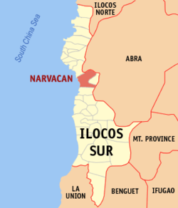 Map of Ilocos Sur with Narvacan highlighted | ||
.svg.png) Narvacan Location within the Philippines | ||
| Coordinates: 17°25′N 120°29′E / 17.42°N 120.48°ECoordinates: 17°25′N 120°29′E / 17.42°N 120.48°E | ||
| Country |
| |
| Region | Ilocos Region (Region I) | |
| Province | Ilocos Sur | |
| District | 2nd District | |
| Barangays | 34 (see Barangays) | |
| Government [1] | ||
| • Type | Sangguniang Bayan | |
| • Mayor | Zuriel S. Zaragoza | |
| • Electorate | 25,933 voters (2016) | |
| Area [2] | ||
| • Total | 122.21 km2 (47.19 sq mi) | |
| Population (2015 census)[3] | ||
| • Total | 44,006 | |
| • Density | 360/km2 (930/sq mi) | |
| Time zone | UTC+8 (PST) | |
| ZIP code | 2704 | |
| PSGC | 012914000 | |
| IDD : area code | +63 (0)77 | |
| Climate type | Tropical monsoon climate | |
| Income class | 2nd municipal income class | |
| Revenue (₱) | 427,749,398.10 (2016) | |
| Native languages |
Ilocano Tagalog | |
| Website |
www | |

Narvacan, officially the Municipality of Narvacan, is a 2nd class municipality in the province of Ilocos Sur, Philippines. According to the 2015 census, it has a population of 44,006 people.[3]
Narvacan is 375 kilometres (233 mi) from Metro Manila and 32 kilometres (20 mi) from Vigan City, the provincial capital.
Barangays
Narvacan is politically subdivided into 34 barangays. [2]
- Abuor
- Ambulogan
- Aquib
- Banglayan
- Bantay Abot
- Bulanos
- Cadacad
- Cagayungan
- Camarao
- Casilagan
- Codoog
- Dasay
- Dinalaoan
- Estancia
- Lanipao
- Lungog
- Margaay
- Marozo
- Nanguneg
- Orence
- Pantoc
- Paratong
- Parparia
- Quinarayan
- Rivadavia
- San Antonio
- San Jose
- San Pablo
- San Pedro
- Santa Lucia
- Sarmingan
- Sucoc
- Sulvec
- Turod
History
Narvacan was discovered by a Spanish expeditionary force sent from Vigan by the military officer and navigator, Captain Juan de Salcedo in 1576. The Spanish expeditionary force was shipwrecked along the town's coast. When they were being rescued by the natives, the Spaniards asked the natives what was the name of their place. The resident's leader replied in an Ilocano dialect by asking the Spaniards "Nalbakan?" (Are you shipwrecked?). The Spaniards thought this to be the answer to their question, and from then on the place was referred to as Narvacan.
Salcedo befriended the small tribe of indigenous valley peoples that resided in the area while Spanish families established a township in 1576. As part of the modern township, a Roman Catholic parish was established by the Augustinian religious order on 25 April 1587. The Narvacan parish would become one of the first Roman Catholic parishes in present-day Ilocos Sur.
Narvacan was organized under the traditions of the royal government of Spain. The Habsburg royal family served as the heads of state which in turn appointed Santiago de Vera as President of the Royal Audiencia – governor over the region in which Narvacan was situated. In 1589, Governor Vera appointed Nicolas de Figueroa as the first Encomendero de Narvacan – principal administrator of the town and its neighbors in the encomienda system. His role eventually evolved into the office of alcalde —
Demographics
| Population census of Narvacan | ||
|---|---|---|
| Year | Pop. | ±% p.a. |
| 1903 | 19,575 | — |
| 1918 | 23,071 | +1.10% |
| 1939 | 22,769 | −0.06% |
| 1948 | 22,237 | −0.26% |
| 1960 | 26,872 | +1.59% |
| 1970 | 26,962 | +0.03% |
| 1975 | 28,516 | +1.13% |
| 1980 | 30,682 | +1.47% |
| 1990 | 35,153 | +1.37% |
| 1995 | 35,489 | +0.18% |
| 2000 | 38,435 | +1.72% |
| 2007 | 41,578 | +1.09% |
| 2010 | 42,803 | +1.06% |
| 2015 | 44,006 | +0.53% |
| Source: Philippine Statistics Authority[3][4][5][6] | ||
In the 2015 census, the population of Narvacan was 44,006 people,[3] with a density of 360 inhabitants per square kilometre or 930 inhabitants per square mile.
Its residents are largely Roman Catholic. A sizeable minority of Iglesia ni Cristo, Methodist Christians, and Jehovah's Witnesses are present. The local language is Ilocano.
Economy
Situated near the western coastline of the island of Luzon, Narvacan is located in a valley surrounded by mountains. A fertile region with a cool tropical climate, the principal crops of Narvacan are corn, cotton, indigo, rice, sugarcane and tobacco.
Education
The Narvacan School of Fisheries, a branch of the Ilocos Sur Polytechnic State College (ISPSC), has been located in Sulvec since 1964.[7] It is also the base of operations of the Philippine Army’s 503rd Infantry Brigade which oversees the Citizen Armed Forces Geographical Units.[8]
References
- ↑ "Municipality". Quezon City, Philippines: Department of the Interior and Local Government. Retrieved 31 May 2013.
- 1 2 "Province: Ilocos Sur". PSGC Interactive. Quezon City, Philippines: Philippine Statistics Authority. Retrieved 12 November 2016.
- 1 2 3 4 Census of Population (2015). "Region I (Ilocos Region)". Total Population by Province, City, Municipality and Barangay. PSA. Retrieved 20 June 2016.
- ↑ Census of Population and Housing (2010). "Region I (Ilocos Region)". Total Population by Province, City, Municipality and Barangay. NSO. Retrieved 29 June 2016.
- ↑ Censuses of Population (1903–2007). "Region I (Ilocos Region)". Table 1. Population Enumerated in Various Censuses by Province/Highly Urbanized City: 1903 to 2007. NSO.
- ↑ "Province of Ilocos Sur". Municipality Population Data. Local Water Utilities Administration Research Division. Retrieved 17 December 2016.
- ↑ "Ilocos Sur Polytechnic State College, Brief History". Archived from the original on 13 April 2009. Retrieved 9 December 2008.
- ↑ "Rebel 'abuses' driving people to join Cafgu". Manila Bulletin. 27 December 2007. Archived from the original on 5 April 2008. Retrieved 9 December 2008.
External links
- Municipality of Narvacan Homepage
- Pasyalang Ilocos Sur
- Philippine Standard Geographic Code
- Philippine Census Information
- Local Governance Performance Management System
Places adjacent to Narvacan | |
|---|---|
ø[1]
- ↑ Harold Fallorin Cambaliza