Santa Cruz, Ilocos Sur
| Santa Cruz | |||
|---|---|---|---|
| Municipality | |||
| Municipality of Santa Cruz | |||
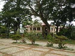 Santa Cruz Municipal Hall | |||
| |||
 Map of Ilocos Sur with Santa Cruz highlighted | |||
.svg.png) Santa Cruz Location within the Philippines | |||
| Coordinates: 17°05′N 120°27′E / 17.08°N 120.45°ECoordinates: 17°05′N 120°27′E / 17.08°N 120.45°E | |||
| Country |
| ||
| Region | Ilocos Region (Region I) | ||
| Province | Ilocos Sur | ||
| District | 2nd District | ||
| Barangays | 49 (see Barangays) | ||
| Government [1] | |||
| • Type | Sangguniang Bayan | ||
| • Mayor | Teresita Corpus Valle | ||
| • Electorate | 22,597 voters (2016) | ||
| Area [2] | |||
| • Total | 88.78 km2 (34.28 sq mi) | ||
| Population (2015 census)[3] | |||
| • Total | 39,868 | ||
| • Density | 450/km2 (1,200/sq mi) | ||
| Time zone | UTC+8 (PST) | ||
| ZIP code | 2713 | ||
| PSGC | 012924000 | ||
| IDD : area code | +63 (0)77 | ||
| Climate type | Tropical monsoon climate | ||
| Income class | 1st municipal income class | ||
| Revenue (₱) | 372,718,831.15 (2016) | ||
| Native languages |
Ilocano Tagalog | ||
| Website |
stacruz-is | ||


Santa Cruz (/ˈsæntə
Santa Cruz is 333 kilometres (207 mi) from Metro Manila and 74 kilometres (46 mi) from Vigan City, the provincial capital.
Barangays
Santa Cruz is politically subdivided into 49 barangays. [2]
- Amarao
- Babayoan
- Bacsayan
- Banay
- Bayugao Este
- Bayugao Oeste
- Besalan
- Bugbuga
- Calaoan
- Camanggaan
- Candalican
- Capariaan
- Casilagan
- Coscosnong
- Daligan
- Dili
- Gabor Norte
- Gabor Sur
- Lalong
- Lantag
- Las-ud
- Mambog
- Mantanas
- Nagtengnga
- Padaoil
- Paratong
- Pattiqui
- Pidpid
- Pilar
- Pinipin
- Poblacion Este
- Poblacion Norte
- Poblacion Weste
- Poblacion Sur
- Quinfermin
- Quinsoriano
- Sagat
- San Antonio
- San Jose
- San Pedro
- Saoat
- Sevilla
- Sidaoen
- Suyo
- Tampugo
- Turod
- Villa Garcia
- Villa Hermosa
- Villa Laurencia
Etymology
The place now known as Santa Cruz was the site where Captain Juan de Salcedo landed to get provisions, especially water, on his way to pacify the North. As soon as they came ashore, his men went immediately to the top of the highest sand dune and planted a big wooden cross to signify the place has been conquered by the white men (like what they did later in Santa Catalina). This cross is visible to mariners passing by, often describing the place as "Santa Cruz." The cross may have vanished, but the name Santa Cruz stuck, especially with natives who became Christians.
Demographics
| Population census of Santa Cruz | ||
|---|---|---|
| Year | Pop. | ±% p.a. |
| 1903 | 8,533 | — |
| 1918 | 12,672 | +2.67% |
| 1939 | 12,948 | +0.10% |
| 1948 | 13,799 | +0.71% |
| 1960 | 16,954 | +1.73% |
| 1970 | 20,459 | +1.89% |
| 1975 | 22,688 | +2.10% |
| 1980 | 23,027 | +0.30% |
| 1990 | 28,764 | +2.25% |
| 1995 | 30,145 | +0.88% |
| 2000 | 34,433 | +2.89% |
| 2007 | 35,906 | +0.58% |
| 2010 | 37,911 | +2.00% |
| 2015 | 39,868 | +0.96% |
| Source: Philippine Statistics Authority[3][4][5][6] | ||
In the 2015 census, the population of Santa Cruz, Ilocos Sur, was 39,868 people,[3] with a density of 450 inhabitants per square kilometre or 1,200 inhabitants per square mile.
References
- ↑ "Municipality". Quezon City, Philippines: Department of the Interior and Local Government. Retrieved 31 May 2013.
- 1 2 "Province: Ilocos Sur". PSGC Interactive. Quezon City, Philippines: Philippine Statistics Authority. Retrieved 12 November 2016.
- 1 2 3 4 Census of Population (2015). "Region I (Ilocos Region)". Total Population by Province, City, Municipality and Barangay. PSA. Retrieved 20 June 2016.
- ↑ Census of Population and Housing (2010). "Region I (Ilocos Region)". Total Population by Province, City, Municipality and Barangay. NSO. Retrieved 29 June 2016.
- ↑ Censuses of Population (1903–2007). "Region I (Ilocos Region)". Table 1. Population Enumerated in Various Censuses by Province/Highly Urbanized City: 1903 to 2007. NSO.
- ↑ "Province of Ilocos Sur". Municipality Population Data. Local Water Utilities Administration Research Division. Retrieved 17 December 2016.
External links
| Wikimedia Commons has media related to Santa Cruz, Ilocos Sur. |
- Pasyalang Ilocos Sur
- Philippine Standard Geographic Code
- Philippine Census Information
- Local Governance Performance Management System
Places adjacent to Santa Cruz, Ilocos Sur | ||||||||||
|---|---|---|---|---|---|---|---|---|---|---|
| ||||||||||