Alilem
| Alilem | ||
|---|---|---|
| Municipality | ||
| Municipality of Alilem | ||
| ||
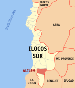 Map of Ilocos Sur with Alilem highlighted | ||
.svg.png) Alilem Location within the Philippines | ||
| Coordinates: 16°53′N 120°32′E / 16.88°N 120.53°ECoordinates: 16°53′N 120°32′E / 16.88°N 120.53°E | ||
| Country |
| |
| Region | Ilocos Region (Region I) | |
| Province | Ilocos Sur | |
| District | 2nd District | |
| Barangays | 9 (see Barangays) | |
| Government [1] | ||
| • Type | Sangguniang Bayan | |
| • Mayor | Mar Ruel P. Sumabat | |
| • Electorate | 4,113 voters (2016) | |
| Area [2] | ||
| • Total | 119.33 km2 (46.07 sq mi) | |
| Population (2015 census)[3] | ||
| • Total | 6,695 | |
| • Density | 56/km2 (150/sq mi) | |
| Time zone | UTC+8 (PST) | |
| ZIP code | 2716 | |
| PSGC | 012901000 | |
| IDD : area code | +63 (0)77 | |
| Climate type | Tropical monsoon climate | |
| Income class | 4th municipal income class | |
| Revenue (₱) | 105,286,601.65 (2016) | |
| Native languages |
Kankanaey language Ilocano Tagalog | |
| Website |
www | |

Alilem, officially the Municipality of Alilem, is a 4th class municipality in the province of Ilocos Sur, Philippines. According to the 2015 census, it has a population of 6,695 people.[3]
History
Long before the Spanish colonizers landed on the Philippine shores, there were already natives living in this place. These people live in huts built on the hillsides located at the northern and eastern parts of the valley. This was so because the present valley was then the course of the Bakun River. For many years, the natives lived simply but peacefully. Such peaceful life did not last forever for it was soon disturbed by an unusual and fearful occurrence in the people’s environment. It all started with the continuous heavy downpour or “LEMLEM” in the native dialect. This “lemlem” caused the Bakun River to swell to an extraordinary size and overflow its banks. In the middle part of the river, there was a big “ALICONO” or whirlpool which the people feared so much. Even after the rains ceased, the ‘alicono’ remained; so the people believed it to Kabunian’s (GOD) punishment for their sins. As it was their custom, the people held native feast called “kaniaw”, the “alicono” vanished and the Bakun River changed its course to the foot of the mountains in the southern part leaving a dry level land suited for residential lots and farms. The people moved their homes to the valley and named the place ALILEM after the “ALICONO” and “LEMLEM”.
Accurate and reliable information on the exact date of the founding of the town cannot be secured because there are no complete historical records available. However, basing from its information gathered from the old folks, it could be deduced that the town of Alilem was founded sometime after 1820. What is certainly known only is that the lay-out of the town was done by the Spaniards. During the Spanish occupation, Alilem was noted for being the center of the district government of “commandancia politico-militar” of Amburayan. This commandancia was composed of Alilem, Sigay, Suyo, Tagudin, Sudipen, San Gabriel and Bakun. In 1908, the commandancia of amburayan became a sub-province of the newly created special capital of the sub-province until the Americans transferred the seat to Tagudin.
Barangays
Alilem is politically subdivided into 9 barangays. [2]
- Alilem Daya (Poblacion)
- Amilongan
- Anaao
- Apang
- Apaya
- Batbato
- Daddaay
- Dalawa
- Kiat
Demographics
| Population census of Alilem | ||
|---|---|---|
| Year | Pop. | ±% p.a. |
| 1903 | 175 | — |
| 1918 | 1,621 | +16.00% |
| 1939 | 3,285 | +3.42% |
| 1948 | 3,049 | −0.82% |
| 1960 | 3,594 | +1.38% |
| 1970 | 4,145 | +1.43% |
| 1975 | 4,409 | +1.25% |
| 1980 | 4,599 | +0.85% |
| 1990 | 5,314 | +1.46% |
| 1995 | 5,533 | +0.76% |
| 2000 | 6,353 | +3.01% |
| 2007 | 6,217 | −0.30% |
| 2010 | 6,640 | +2.42% |
| 2015 | 6,695 | +0.16% |
| Source: Philippine Statistics Authority[3] [4] [5] [6] | ||
In the 2015 census, the population of Alilem was 6,695 people,[3] with a density of 56 inhabitants per square kilometre or 150 inhabitants per square mile.
References
- ↑ "Municipality". Quezon City, Philippines: Department of the Interior and Local Government. Retrieved 31 May 2013.
- 1 2 "Province: Ilocos Sur". PSGC Interactive. Quezon City, Philippines: Philippine Statistics Authority. Retrieved 12 November 2016.
- 1 2 3 4 Census of Population (2015). "Region I (Ilocos Region)". Total Population by Province, City, Municipality and Barangay. PSA. Retrieved 20 June 2016.
- ↑ Census of Population and Housing (2010). "Region I (Ilocos Region)". Total Population by Province, City, Municipality and Barangay. NSO. Retrieved 29 June 2016.
- ↑ Censuses of Population (1903–2007). "Region I (Ilocos Region)". Table 1. Population Enumerated in Various Censuses by Province/Highly Urbanized City: 1903 to 2007. NSO.
- ↑ "Province of Ilocos Sur". Municipality Population Data. Local Water Utilities Administration Research Division. Retrieved 17 December 2016.
External links
- Municipal Government of Alilem, Ilocos Sur
- Municipal Government of Tagudin, Ilocos Sur
- Municipal Government of Santa Lucia, Ilocos Sur
- Pasyalang Ilocos Sur
- Philippine Standard Geographic Code
- Philippine Census Information
- Local Governance Performance Management System
Places adjacent to Alilem | |
|---|---|