Salcedo, Ilocos Sur
| Salcedo | |
|---|---|
| Municipality | |
| Municipality of Salcedo | |
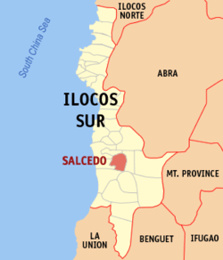 Map of Ilocos Sur with Salcedo highlighted | |
.svg.png) Salcedo Location within the Philippines | |
| Coordinates: 17°09′N 120°32′E / 17.15°N 120.53°ECoordinates: 17°09′N 120°32′E / 17.15°N 120.53°E | |
| Country |
|
| Region | Ilocos Region (Region I) |
| Province | Ilocos Sur |
| District | 2nd District |
| Barangays | 21 (see Barangays) |
| Government [1] | |
| • Type | Sangguniang Bayan |
| • Mayor | Leopoldo G. Gironella Jr. |
| • Electorate | 7,221 voters (2016) |
| Area [2] | |
| • Total | 103.44 km2 (39.94 sq mi) |
| Population (2015 census)[3] | |
| • Total | 11,288 |
| • Density | 110/km2 (280/sq mi) |
| Time zone | UTC+8 (PST) |
| ZIP code | 2711 |
| PSGC | 012916000 |
| IDD : area code | +63 (0)77 |
| Climate type | Tropical monsoon climate |
| Income class | 4th municipal income class |
| Revenue (₱) | 210,026,563.01 (2016) |
| Native languages |
Ilocano Tagalog |
| Website |
www |
Salcedo, officially the Municipality of Salcedo, is a 4th class municipality in the province of Ilocos Sur, Philippines. According to the 2015 census, it has a population of 11,288 people.[3]
Formerly known as Baugen, it was renamed to Salcedo by virtue of Republic Act No. 1627 after the Spanish Conquistador Juan de Salcedo on June 20, 1957.[4]
Barangays
Salcedo is politically subdivided into 21 barangays. [2]
- Atabay
- Calangcuasan
- Balidbid
- Baluarte
- Baybayading
- Boguibog
- Bulala-Leguey
- Kaliwakiw
- Culiong
- Dinaratan
- Kinmarin
- Lucbuban
- Madarang
- Maligcong
- Pias
- Poblacion Norte
- Poblacion Sur
- San Gaspar
- San Tiburcio
- Sorioan
- Ubbog
Demographics
| Population census of Salcedo | ||
|---|---|---|
| Year | Pop. | ±% p.a. |
| 1903 | 1,504 | — |
| 1918 | 2,200 | +2.57% |
| 1939 | 5,065 | +4.05% |
| 1948 | 4,771 | −0.66% |
| 1960 | 6,005 | +1.94% |
| 1970 | 6,992 | +1.53% |
| 1975 | 7,978 | +2.68% |
| 1980 | 8,302 | +0.80% |
| 1990 | 9,397 | +1.25% |
| 1995 | 10,116 | +1.39% |
| 2000 | 10,409 | +0.61% |
| 2007 | 10,704 | +0.39% |
| 2010 | 10,935 | +0.78% |
| 2015 | 11,288 | +0.61% |
| Source: Philippine Statistics Authority[3][5][6][7] | ||
In the 2015 census, the population of Salcedo was 11,288 people,[3] with a density of 110 inhabitants per square kilometre or 280 inhabitants per square mile.
Economy
The people are engaged in farming, producing food crops, mostly rice and tobacco.
See also
References
- ↑ "Municipality". Quezon City, Philippines: Department of the Interior and Local Government. Retrieved 31 May 2013.
- 1 2 "Province: Ilocos Sur". PSGC Interactive. Quezon City, Philippines: Philippine Statistics Authority. Retrieved 12 November 2016.
- 1 2 3 4 Census of Population (2015). "Region I (Ilocos Region)". Total Population by Province, City, Municipality and Barangay. PSA. Retrieved 20 June 2016.
- ↑ "REPUBLIC ACT NO. 1627 AN ACT CHANGING THE NAME OF THE MUNICIPALITY OF BAUGUEN, PROVINCE OF ILOCOS SUR, TO SALCEDO". Philippine legal materials database. PhilippineLaw.info. June 20, 1957. Retrieved 20 September 2013.
- ↑ Census of Population and Housing (2010). "Region I (Ilocos Region)". Total Population by Province, City, Municipality and Barangay. NSO. Retrieved 29 June 2016.
- ↑ Censuses of Population (1903–2007). "Region I (Ilocos Region)". Table 1. Population Enumerated in Various Censuses by Province/Highly Urbanized City: 1903 to 2007. NSO.
- ↑ "Province of Ilocos Sur". Municipality Population Data. Local Water Utilities Administration Research Division. Retrieved 17 December 2016.
External links
- Act renaming the municipality of Baugen to Salcedo
- Pasyalang Ilocos Sur
- Philippine Standard Geographic Code
- Philippine Census Information
- Local Governance Performance Management System
Places adjacent to Salcedo, Ilocos Sur | |
|---|---|
This article is issued from
Wikipedia.
The text is licensed under Creative Commons - Attribution - Sharealike.
Additional terms may apply for the media files.