Division No. 19, Alberta
| Division No. 19 | |
|---|---|
| Census division in Alberta | |
| Country | Canada |
| Province | Alberta |
| Area[1] | |
| • Total | 20,520 km2 (7,920 sq mi) |
| Population (2011)[1] | |
| • Total | 109,712 |
| • Density | 5.3/km2 (14/sq mi) |
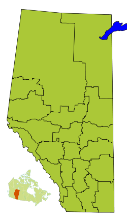
Division No. 19 is a census division in Alberta, Canada. It is located in the west-central portion of northern Alberta and surrounds the City of Grande Prairie.
Census subdivisions
The following census subdivisions (municipalities or municipal equivalents) are located within Alberta's Division No. 19.[2][3]
- Cities
- Towns
- Villages
- Municipal districts
- Indian reserves
- Duncan's 151A
- Horse Lakes 152B
Demographics
In the 2011 Census, Division No. 19 had a population of 109,712 living in 41,399 of its 44,851 total dwellings, an 11.1% change from its 2006 population of 98,712. With a land area of 20,520 km2 (7,920 sq mi), it had a population density of 5.3 people per square kilometre in 2011.[1]
In 2006, Division No. 19 had a population of 98,712 living in 37,685 dwellings, a 14.4% increase from 2001. The census division has a land area of 20,518.15 km2 (7,922.10 sq mi) and a population density of 4.8 inhabitants per square kilometre.[4]
See also
References
- 1 2 3 "Population and dwelling counts, for Canada, provinces and territories, and census divisions, 2011 and 2006 censuses (Alberta)". Statistics Canada. 2012-02-08. Retrieved 2012-02-16.
- ↑ "2006 Community Profiles, Geographic hierarchy – Division No. 19 (Census division)". Statistics Canada. 2010-12-07. Retrieved 2011-08-30.
- ↑ "2011 Municipal Codes" (PDF). Alberta Municipal Affairs. 2011-01-05. Retrieved 2011-08-30.
- ↑ Statistics Canada. "Canada 2006 Census: Division No. 19 - Community Profile". Retrieved 2007-06-06.
Places adjacent to Division No. 19, Alberta | |
|---|---|
| Subdivisions | |
|---|---|
| Communities | |
| Cities and urban service areas | |
| Census divisions | |
| |
Coordinates: 55°10′41″N 118°47′00″W / 55.17806°N 118.78333°W