Moroto Airport
| Moroto Airport | |||||||||||
|---|---|---|---|---|---|---|---|---|---|---|---|
| Summary | |||||||||||
| Airport type | Public | ||||||||||
| Serves | Moroto | ||||||||||
| Elevation AMSL | 4,200 ft / 1,280 m | ||||||||||
| Coordinates | 2°30′15″N 34°35′45″E / 2.50417°N 34.59583°ECoordinates: 2°30′15″N 34°35′45″E / 2.50417°N 34.59583°E | ||||||||||
| Map | |||||||||||
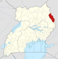
 HUMO Location of the airport in Uganda | |||||||||||
| Runways | |||||||||||
| |||||||||||
Moroto Airport (ICAO: HUMO) is an airport serving Moroto in the Northern Region of Uganda. It is one of twelve upcountry airports managed by the Civil Aviation Authority of Uganda.[1]
The well-marked runway is just south of the Pader Palwo - Moroto road, 8 kilometres (5.0 mi) west of Moroto.[3]
See also
- Transport in Uganda


- List of airports in Uganda
References
- 1 2 Uganda CAA - Moroto
- ↑ Google Maps - Moroto
- ↑ "OpenStreetMap". OpenStreetMap. Retrieved 2018-08-29.
- Airport information for HUMO at Great Circle Mapper.
External links
Capital: Moroto | ||
| Counties and sub-counties |
|  |
| Towns and villages | ||
| Economy | ||
| Notable landmarks | ||
| Health | ||
| Transport | ||
This article is issued from
Wikipedia.
The text is licensed under Creative Commons - Attribution - Sharealike.
Additional terms may apply for the media files.