Soroti–Katakwi–Moroto–Lokitanyala Road
| Soroti–Katakwi–Moroto–Lokitanyala Road | |
|---|---|
| Route information | |
| Length | 129 mi (208 km) |
| History |
Expected designation in 2017 Expected completion in 2021 |
| Major junctions | |
| South end | Soroti |
|
Katakwi Napak Moroto | |
| North end | Lokitanyala |
| Highway system | |
| Roads in Uganda | |
Soroti–Katakwi–Moroto–Lokitanyala Road is a road in the Eastern and Northern regions of Uganda. The road connects the towns of Soroti, the largest town in Teso sub-region, to Katakwi, the district headquarters of Katakwi District and to Moroto, the largest town in the Karamoja sub-region. It ends at Lokitanyala, at the international border with Kenya.
Location
The road starts at Soroti and continues northeastwards through Katakwi, and on to Moroto. The distance between Soroti and Moroto is approximately 171 kilometres (106 mi).[1] At Moroto, the road takes a southeasterly direction for approximately 37 kilometres (23 mi), to end at Lokitanyala, for a total road distance of 208 kilometres (129 mi).[2]
Upgrading to bitumen
The existing road is gravel surfaced, pot-holed, and in poor general state.[3] As far back as 2009, this road appears on the list of roads earmarked for upgrade from gravel surface to class II bitumen surface, with shoulders, drainage channels, and culverts.[4] As at January 2016, this road remains on the list of roads yet to be upgraded.[2]
See also
References
- ↑ GFC (19 January 2016). "Distance between Soroti, Eastern Region, Uganda and Moroto, Northern Region, Uganda". Globefeed.com (GF). Retrieved 19 January 2016.
- 1 2 UNRA (19 January 2016). "Upcoming Projects: New Roads for Upgrade to Tarmac". Kampala: Uganda National Roads Authority (UNRA). Retrieved 19 January 2016.
- ↑ "Uganda: Rains Cut Off Access to Karamoja". The Observer (Uganda) via AllAfrica.com. Kampala. 9 December 2015. Retrieved 19 January 2016.
- ↑ UNRA (27 October 2009). "Supplement: The 5th Annual Joint Transport Sector Review - Uganda National Roads Authority". The Independent (Uganda). Kampala. Retrieved 19 January 2016.
External links
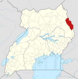
Capital: Moroto | ||
| Counties and sub-counties |
|  |
| Towns and villages | ||
| Economy | ||
| Notable landmarks | ||
| Health | ||
| Transport | ||
Capital: Katakwi | ||
| Towns and villages | 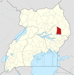 | |
| Economy | ||
| Health | ||
| Transport | ||
| Notable people | ||
Capital: Soroti | ||
| Towns and villages | 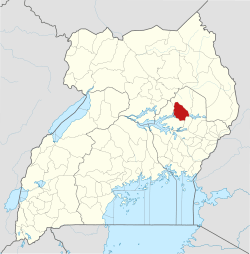 | |
| Economy | ||
| Transport | ||
| Energy | ||
| Health |
| |
| Media |
| |
| Notable landmarks |
| |
| Education | ||
| Hospitality |
| |
| Notable people | ||