Pakuba Airfield
| Pakuba Airfield | |||||||||||
|---|---|---|---|---|---|---|---|---|---|---|---|
| Summary | |||||||||||
| Airport type | Public | ||||||||||
| Owner | Civil Aviation Authority of Uganda | ||||||||||
| Serves | Pakuba, Uganda | ||||||||||
| Elevation AMSL | 2,365 ft / 721 m | ||||||||||
| Coordinates | 02°20′00″N 031°30′00″E / 2.33333°N 31.50000°E | ||||||||||
| Map | |||||||||||
 PAF Location of Pakuba Airport in Uganda | |||||||||||
| Runways | |||||||||||
| |||||||||||
Pakuba Airfield (IATA: PAF, ICAO: HUPA) is an airfield serving Pakuba and Murchison Falls National Park in the Nwoya District of northern Uganda.
The airport is operated by the Civil Aviation Authority of Uganda. It is one of the five upcountry airports that are authorized to handle cross-border air traffic from member countries of the East African Community, as part of efforts to promote tourism within eastern Africa.[3]
Location
Pakuba Airfield is approximately 275 kilometres (171 mi) by air north-west of Entebbe International Airport, the country’s largest civilian and military airport.[4]
It is 15 kilometres (9 mi) north-west of Bugungu Airstrip and 72 kilometres (45 mi) west of Chobe Safari Lodge Airport, which are also within Murchison Falls National Park.[5]
Cartographic misdesignation

On a considerable number of cartographic materials (including Wikimapia, Google Maps, and others) Pakuba Airfield is incorrectly denoted as "Kabalega Falls Airport". "Kabalega Falls" is a now-disused designation for "Murchison Falls."[6]
See also


- List of airports in Uganda
- Transport in Uganda
References
- ↑ Pakuba Airfield, Civil Aviation Authority of Uganda, 24 February 2014, accessed 15 November 2015
- ↑ "Pakuba, Uganda (IATA: PAF, ICAO: HUPA)". Great Circle Mapper. Retrieved 8 March 2010.
- ↑ "Aerodromes". Civil Aviation Authority of Uganda. Retrieved 8 March 2010.
- ↑ Uganda CAA - Pakuba
- ↑ Uganda Wildlife travel
- ↑ "Google Maps". Google Maps. Retrieved 2018-08-29.
External links
- Uganda Civil Aviation Authority
- Accident history for Pakuba Airport (IATA: PAF, ICAO: HUPA) at Aviation Safety Network
- Pakuba Airfield on OpenStreetMap
Capital: Nwoya | ||
| Towns and villages | 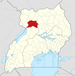 | |
| Geography |
| |
| Economy | ||
| Energy | ||
| Transport | ||
| Health | ||
| Notable landmarks | ||
| Notable people | ||