Mweya Airport
| Mweya Airport | |||||||||||
|---|---|---|---|---|---|---|---|---|---|---|---|
| Summary | |||||||||||
| Airport type | Civilian | ||||||||||
| Owner | Queen Elizabeth National Park | ||||||||||
| Serves | Mweya, Uganda | ||||||||||
| Location | Mweya, Uganda | ||||||||||
| Elevation AMSL | 3,200 ft / 980 m | ||||||||||
| Coordinates | 00°11′39″S 029°53′38″E / 0.19417°S 29.89389°ECoordinates: 00°11′39″S 029°53′38″E / 0.19417°S 29.89389°E | ||||||||||
| Runways | |||||||||||
| |||||||||||
|
Source: Google Maps[1] | |||||||||||
Mweya Airport (ICAO: HUMW) is a small civilian airport in Uganda. It is one of the 46 airports in the country.[2]
Location
Mweya Airport is located in Mweya, Kasese District, in western Uganda, approximately 283 kilometres (176 mi), by air, west of Entebbe International Airport, the country's largest civilian and military airport.[3]
Overview
Mweya Airport serves the area of Mweya and the neighboring areas of Queen Elizabeth National Park and the Lake Katwe Explosion Crater.[4][5] As of January 2010, the airport was not under the administration of the Uganda Civil Aviation Authority.[6]
External links
See also
References
- ↑ Google Maps - Mweya
- ↑ "Uganda". CIA World Factbook.
Airports: 46 (2010)
- ↑ Nautical Distance Between Entebbe and Mweya with Map
- ↑ "Lake Kwatwe Uganda Safaris". Queen Elizabeth National Park Uganda. 2012-09-28. Retrieved 2018-08-29.
- ↑ "Google Maps". Google Maps. Retrieved 2018-08-29.
- ↑ Mweya Airport Not Under Uganda CAA Administration Archived 2010-02-16 at Archive.is
Capital: Kasese | ||
| Towns and villages | 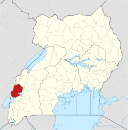 | |
| Economy |
| |
| Transport | ||
| Energy |
| |
| Notable landmarks | ||
| Health | ||
| Notable people | ||
This article is issued from
Wikipedia.
The text is licensed under Creative Commons - Attribution - Sharealike.
Additional terms may apply for the media files.