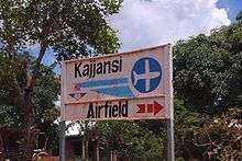
Kajjansi Airfield
| Kajjansi Airfield | |||||||||||
|---|---|---|---|---|---|---|---|---|---|---|---|
 | |||||||||||
| Summary | |||||||||||
| Airport type | Private & civilian | ||||||||||
| Owner/Operator | Mission Aviation Fellowship | ||||||||||
| Location | Kajjansi, Uganda | ||||||||||
| Elevation AMSL | 3,748 ft / 1,142 m | ||||||||||
| Coordinates | 0°12′N 32°33′E / 0.200°N 32.550°ECoordinates: 0°12′N 32°33′E / 0.200°N 32.550°E | ||||||||||
| Map | |||||||||||
 HUKJ Location of Kajjansi Airfield in Uganda | |||||||||||
| Runways | |||||||||||
| |||||||||||
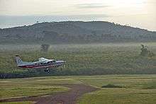
Kajjansi Airfield (ICAO: HUKJ) is an airfield serving Kajjansi, a town in the Central Region of Uganda. The airfield is approximately 20 kilometres (12 mi) north-east of Entebbe International Airport, Uganda's largest airport, and 16 kilometres (9.9 mi) south of central Kampala, Uganda's capital and largest city.
Kajjansi is in the southern portion of the Kampala conurbation. The runway is east of the Kampala-Entebbe road, bordering marshland near the shore of Lake Victoria.
Operations
The airfield is owned and operated by Mission Aviation Fellowship (MAF), an international Christian humanitarian relief and development organisation. In the mid-2010s, the Christian engineering charity Engineering Ministries International (EMI) redeveloped the office building of the airfield.[3] The new office building became the headquarters of both MAF Uganda and EMI East Africa.[4]
See also


- List of airports in Uganda
- Transport in Uganda
References
- ↑ SkyVector - Kajjansi
- ↑ Google Maps - Kajjansi
- ↑ Dallmann, John (2014). "Growing globally" (PDF). eMi newsletter: 2.
- ↑ Sauder, John (2016). "EMI Summer Newsletter 2016: Into Deeper Waters". Engineering Ministries International. Retrieved 2016-11-30.
External links
- Mission Aviation Fellowship (Uganda)
- Kampala Aeroclub and Flight Training Centre
- OurAirports - Kajjansi Airfield
