Kisoro Airport
| Kisoro Airport | |||||||||||
|---|---|---|---|---|---|---|---|---|---|---|---|
| Summary | |||||||||||
| Airport type | Public | ||||||||||
| Owner | Civil Aviation Authority of Uganda | ||||||||||
| Serves | Kisoro, Uganda | ||||||||||
| Elevation AMSL | 6,200 ft / 1,890 m | ||||||||||
| Coordinates | 1°17′00″S 29°43′10″E / 1.28333°S 29.71944°ECoordinates: 1°17′00″S 29°43′10″E / 1.28333°S 29.71944°E | ||||||||||
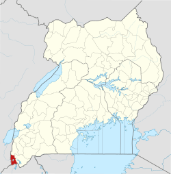
| Map | |||||||||||
 HUKI Location of the airport in Uganda | |||||||||||
| Runways | |||||||||||
| |||||||||||
Kisoro Airport (ICAO: HUKI) is an airport serving the town of Kisoro in Uganda and nearby Bwindi Impenetrable National Park and Mgahinga Gorilla National Park. It is in extreme southwestern Uganda, approximately 343 kilometres (213 mi) by air southwest of Entebbe International Airport, the country's largest civilian and military airport.[4] It is one of twelve upcountry airports administered by the Civil Aviation Authority of Uganda.
The airport is mainly used by small planes taking tourists visiting Bwindi Impenetrable National Park. As of 2017, the airport does not accommodate international flights. The Civil Aviation Authority of Uganda has hinted on plans of upgrading the Kisoro Airport [5].
The Kisoro non-directional beacon (Ident: KS) is located on the field.[6]
See also
References
- ↑ Kisoro Airfield, Uganda Civil Aviation Authority, 25 February 2014, accessed 15 November 2015
- ↑ Google Maps - Kisoro
- ↑ SkyVector - Kisoro National
- ↑ "Distance between Entebbe Airport () and Kisoro (Kisoro) (Uganda)". distancecalculator.globefeed.com. Retrieved 2018-08-29.
- ↑ CAA unveils master plan to create four new international airports
- ↑ "SkyVector: Flight Planning / Aeronautical Charts". skyvector.com. Retrieved 2018-08-29.
External links
Capital: Kisoro | ||
| Parishes |
|  |
| Towns and villages | ||
| Economy | ||
| Transport | ||
| Notable landmarks | ||
| Health | ||
| Education |
| |
| Notable people | ||