Moroto Town
| Moroto | |
|---|---|
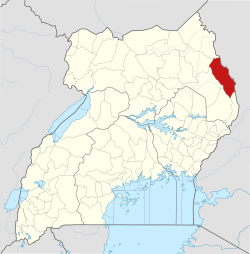
 Moroto Location in Uganda | |
| Coordinates: 02°31′48″N 34°40′12″E / 2.53000°N 34.67000°E | |
| Country |
|
| Region | Northern Region |
| Sub-region | Karamoja sub-region |
| District | Moroto District |
| Elevation | 4,530 ft (1,380 m) |
| Population (2014 Census) | |
| • Total | 14,818[1] |
Moroto is a town in Moroto District in the Northern Region of Uganda. It is the location of the district headquarters.[2]
Location
Moroto is approximately 210 kilometres (130 mi), by road, northeast of Mbale, the nearest large city.[3] This is approximately 420 kilometres (260 mi), by road, northeast of Kampala, the capital and largest city of Uganda.[4] The coordinates of the town are 2°31'48.0"N, 34°40'12.0"E (Latitude:2.5300; Longitude:34.6700).[5]
Population
The 2002 national census estimated the population of Moroto at 7,380. In 2010, the Uganda Bureau of Statistics (UBOS) estimated the population at 11,600. In 2011, UBOS estimated the mid-year population at 12,300.[6] In 2014, the national population census put the population at 14,818.[7]
Points of interest
The additional points of interest lie within the town limits or near the edges of town: (1) the offices of Moroto Town Council (2) Mount Moroto, rising to an elevation of 3,083 metres (10,115 ft) about 3 kilometres (1.9 mi) east of town (3) Moroto central market (4) Moroto Airport, a public airport located about 8 kilometres (5.0 mi) west of town (4) a branch of the National Social Security Fund (5) Moroto Regional Referral Hospital, a 200-bed regional referral hospital administered by the Uganda Ministry of Health (6) Moroto–Nakapiripirit Road,[8] passing through the middle of town (7) a branch of Centenary Bank and (8) a branch of Stanbic Bank Uganda Limited. (9) the headquarters of the Roman Catholic Diocese of Moroto, headed by Bishop Damiano Giulio Guzzetti.[9]
See also
References
- ↑ UBOS (27 August 2014). "The Population of The Regions of the Republic of Uganda And All Cities And Towns of More Than 15,000 Inhabitants". Citypopulation.de Quoting Uganda Bureau of Statistics (UBOS). Retrieved 23 February 2015.
- ↑ Ssemutooke, Joseph (7 October 2017). "It's not all gloom in Karamoja". Daily Monitor. Kampala. Retrieved 9 August 2017.
- ↑ "Map Showing Mbale And Moroto With Distance Marker". Globefeed.com. Retrieved 3 June 2014.
- ↑ GFC. "Road Distance Between Kampala And Moroto With Map". Globefeed.com (GFC). Retrieved 3 June 2014.
- ↑ Google (19 July 2015). "Location of Moroto Town at Google Maps" (Map). Google Maps. Google. Retrieved 19 July 2015.
- ↑ UBOS. "Estimated Population of Moroto Town In 2002, 2010 And 2011" (PDF). Uganda Bureau of Statistics (UBOS). Retrieved 3 June 2014.
- ↑ UBOS (27 August 2014). "The Population of The Regions of the Republic of Uganda And All Cities And Towns of More Than 15,000 Inhabitants". Citypopulation.de Quoting Uganda Bureau of Statistics (UBOS). Retrieved 23 February 2015.
- ↑ Wanyama, Olandason (12 November 2013). "Moroto - Nakapiripirit Road Construction Commissioned". Uganda Radio Network. Retrieved 21 July 2015.
- ↑ Steven Ariong, and Esther Oluka (27 May 2014). "Moroto Diocese gets new bishop". Daily Monitor. Kampala. Retrieved 21 July 2015.
External links
Capital: Moroto | ||
| Counties and sub-counties |
|  |
| Towns and villages | ||
| Economy | ||
| Notable landmarks | ||
| Health | ||
| Transport | ||