Montclair, California
| City of Montclair | |
|---|---|
| City | |
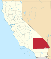
 Location of Montclair in California | |
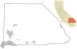
 City of Montclair Location in the United States | |
| Coordinates: 34°04′39″N 117°41′23″W / 34.07750°N 117.68972°WCoordinates: 34°04′39″N 117°41′23″W / 34.07750°N 117.68972°W[1] | |
| Country |
|
| State |
|
| County | San Bernardino |
| Incorporated | April 25, 1956[2] |
| Government | |
| • Mayor | Paul M. Eaton[3] |
| • City Manager | Edward C. Starr[4] |
| Area[5] | |
| • Total | 5.52 sq mi (14.29 km2) |
| • Land | 5.52 sq mi (14.29 km2) |
| • Water | 0.00 sq mi (0.00 km2) 0% |
| Elevation[1] | 1,066 ft (325 m) |
| Population (2010)[6] | |
| • Total | 36,664 |
| • Estimate (2016)[7] | 38,944 |
| • Density | 7,058.91/sq mi (2,725.37/km2) |
| Time zone | UTC-8 (PST) |
| • Summer (DST) | UTC-7 (PDT) |
| ZIP Code | 91763[8] |
| Area code(s) | 909[9] |
| FIPS code | 06-48788 |
| GNIS feature IDs | 252320, 2411141 |
| Website |
www |
Montclair is a city in the Pomona Valley, in southwestern San Bernardino County, California. The population was 36,664 in the 2010 United States Census.
Description
Montclair is bordered by Pomona to the west, Claremont and Upland to the north, Ontario to the east, and Chino to the south. Montclair is in the Pomona Valley and part of the Inland Empire region.
The San Bernardino Freeway (I-10) runs through the northern part of the city.
Demographics
| Historical population | |||
|---|---|---|---|
| Census | Pop. | %± | |
| 1960 | 13,546 | — | |
| 1970 | 22,546 | 66.4% | |
| 1980 | 22,628 | 0.4% | |
| 1990 | 28,434 | 25.7% | |
| 2000 | 33,049 | 16.2% | |
| 2010 | 36,664 | 10.9% | |
| Est. 2016 | 38,944 | [7] | 6.2% |
| U.S. Decennial Census[10] | |||
2010
The 2010 United States Census[11] reported that Montclair had a population of 36,664. The population density was 6,645.4 people per square mile (2,565.8/km²). The racial makeup of Montclair was 19,337 (52.7%) White (14.4% Non-Hispanic White),[12] 1,908 (5.2%) African American, 434 (1.2%) Native American, 3,425 (9.3%) Asian, 74 (0.2%) Pacific Islander, 9,882 (27.0%) from other races, and 1,604 (4.4%) from two or more races. Hispanic or Latino of any race were 25,744 persons (70.2%).
The Census reported that 36,268 people (98.9% of the population) lived in households, 215 (0.6%) lived in non-institutionalized group quarters, and 181 (0.5%) were institutionalized.
There were 9,523 households, out of which 4,954 (52.0%) had children under the age of 18 living in them, 5,094 (53.5%) were opposite-sex married couples living together, 1,781 (18.7%) had a female householder with no husband present, 901 (9.5%) had a male householder with no wife present. There were 690 (7.2%) unmarried opposite-sex partnerships, and 77 (0.8%) same-sex married couples or partnerships. 1,240 households (13.0%) were made up of individuals and 524 (5.5%) had someone living alone who was 65 years of age or older. The average household size was 3.81. There were 7,776 families (81.7% of all households); the average family size was 4.09.
The population was spread out with 10,756 people (29.3%) under the age of 18, 4,300 people (11.7%) aged 18 to 24, 10,694 people (29.2%) aged 25 to 44, 7,831 people (21.4%) aged 45 to 64, and 3,083 people (8.4%) who were 65 years of age or older. The median age was 30.7 years. For every 100 females, there were 99.1 males. For every 100 females age 18 and over, there were 96.8 males.
There were 9,911 housing units at an average density of 1,796.4 per square mile (693.6/km²), of which 5,683 (59.7%) were owner-occupied, and 3,840 (40.3%) were occupied by renters. The homeowner vacancy rate was 2.0%; the rental vacancy rate was 4.6%. 21,076 people (57.5% of the population) lived in owner-occupied housing units and 15,192 people (41.4%) lived in rental housing units.
2000

According to the census[13] of 2000, there were 33,049 people, 8,800 households, and 7,048 families residing in the city. The population density was 6,482.4 inhabitants per square mile (2,502.0/km²). There were 9,066 housing units at an average density of 1,778.3 per square mile (686.4/km²). The racial makeup of the city was 33.8% White, 6.4% African American, 1.0% Native American, 5.1% Asian, 0.3% Pacific Islander, 34.6% from other races, and 4.8% from two or more races. Hispanic or Latino of any race were 73.0% of the population.
There were 8,800 households out of which 47.5% had children under the age of 18 living with them, 46.3% were married couples living together, 26.3% had a female householder with no husband present, and 19.9% were non-families. 15.0% of all households were made up of individuals and 6.3% had someone living alone who was 65 years of age or older. The average household size was 3.7 and the average family size was 4.0.
In the city, the population was spread out with 33.1% under the age of 18, 10.7% from 18 to 24, 30.4% from 25 to 44, 17.4% from 45 to 64, and 8.3% who were 65 years of age or older. The median age was 29 years. For every 100 females, there were 99.6 males. For every 100 females age 18 and over, there were 96.2 males.
The median income for a household in the city was $30,797, and the median income for a family was $32,815. Males had a median income of $30,902 versus $27,014 for females. The per capita income for the city was $13,556. About 34.2% of families and 27.4% of individuals were below the poverty line.
Government
The current mayor is Paul M. Eaton, and the other members of the city council are Carolyn Raft, J. John Dutrey, Bill Ruh, and Trisha Martinez.[3]
In the California State Legislature, Montclair is in the 20th Senate District, represented by Democrat Connie Leyva, and in the 52nd Assembly District, represented by Democrat Freddie Rodriguez.[14]
In the United States House of Representatives, Montclair is in California's 35th congressional district, represented by Democrat Norma Torres.[15]
History
The earliest known inhabitants of the area were from the Serrano tribe of Native Americans. The Serrano established their village along a creek named Arroyo de los Alisos, now named San Antonio Creek, which flowed along a route that is now Mills Avenue, the western border of the city.
In 1897, a "Township of Marquette" was founded within the borders of the modern city of Montclair. In 1900, a 1,000 acres (4.0 km2) tract of land was surveyed and named "Monte Vista". A small settlement to the south of Monte Vista was established in 1907 and named "Narod". Throughout the first half of the 20th century, the settlement was largely devoted to citrus orchards. The Monte Vista tract experienced growth in residential development after the Second World War, and the tract was incorporated as the city of Monte Vista on April 25, 1956. Due to conflict with the Post Office, which refused to open an office in Monte Vista due to a name conflict with a community in Northern California, the city was renamed Montclair on April 8, 1958.
References
- 1 2 "Montclair". Geographic Names Information System. United States Geological Survey. Retrieved October 12, 2014.
- ↑ "California Cities by Incorporation Date". California Association of Local Agency Formation Commissions. Archived from the original (Word) on October 17, 2013. Retrieved August 25, 2014.
- 1 2 "City of Montclair, CA - City Elected Officials". Retrieved May 8, 2015.
- ↑ "City of Montclair, CA - City Manager". Retrieved 2007-01-18.
- ↑ "2016 U.S. Gazetteer Files". United States Census Bureau. Retrieved Jun 28, 2017.
- ↑ "Montclair city, California - Fact Sheet - American FactFinder". Retrieved 2007-01-18.
- 1 2 "Population and Housing Unit Estimates". Retrieved June 9, 2017.
- ↑ "USPS - ZIP Code Lookup - Find a ZIP+ 4 Code By City Results". Retrieved 2007-01-18.
- ↑ "Number Administration System - NPA and City/Town Search Results". Archived from the original on September 29, 2007. Retrieved January 18, 2007.
- ↑ "Census of Population and Housing". Census.gov. Retrieved June 4, 2015.
- ↑ "2010 Census Interactive Population Search: CA - Montclair city". U.S. Census Bureau. Retrieved July 12, 2014.
- ↑ http://quickfacts.census.gov/qfd/states/06/0648788.html. Missing or empty
|title=(help) - ↑ "American FactFinder". United States Census Bureau. Retrieved 2008-01-31.
- ↑ "Statewide Database". Regents of the University of California. Retrieved February 26, 2015.
- ↑ "California's 35th Congressional District - Representatives & District Map". Civic Impulse, LLC.
External links
| Wikimedia Commons has media related to Montclair, California. |