Menifee, California
| Menifee, California | |
|---|---|
| City | |
| City of Menifee | |
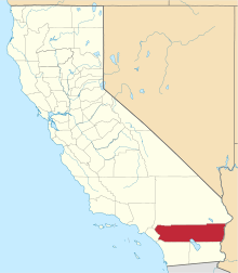
 Location in Riverside County and the state of California | |
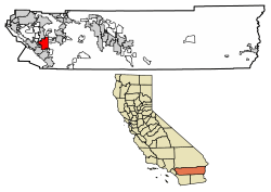
 Menifee Location in the United States | |
| Coordinates: 33°41′27″N 117°11′06″W / 33.69083°N 117.18500°WCoordinates: 33°41′27″N 117°11′06″W / 33.69083°N 117.18500°W[1] | |
| Country |
|
| State |
|
| County | Riverside County |
| Incorporated | October 4, 2008[2] |
| Government | |
| • Type | Council-Manager |
| • Mayor pro tempore | Lesa Sobek |
| Area[3] | |
| • Total | 46.62 sq mi (120.75 km2) |
| • Land | 46.47 sq mi (120.36 km2) |
| • Water | 0.15 sq mi (0.39 km2) 0.30% |
| Elevation[1] | 1,424 ft (434 m) |
| Population (2010)[4] | |
| • Total | 77,519 |
| • Estimate (2017)[5] | 90,595 |
| • Density | 1,905.04/sq mi (735.53/km2) |
| Time zone | UTC−8 (Pacific) |
| • Summer (DST) | UTC−7 (PDT) |
| ZIP codes | 92584–92587, 92596 |
| Area code | 951 |
| FIPS code | 06-46842 |
| GNIS feature IDs | 252936, 2497157 |
| Website |
www |
Menifee, California is a city in Southwestern Riverside County, California, United States and part of the Los Angeles Combined Statistical Area. The city is also centrally located in the heart of Southern California between San Diego County and Los Angeles County. Almost 15 miles (24 km) north of Temecula and bordering the city of Murrieta, Menifee is roughly 46 square miles (100 km2) in size and has an elevation of 1,424 feet (434 m). The incorporated City of Menifee includes the communities of Sun City, Quail Valley, Paloma Valley and Romoland.
History
The area was originally inhabited by the Luiseño people, specifically the Pechanga band. In the 18th century, the area fell under Spanish rule and was ceded by Mexico to the United States in 1850 as a result of the Mexican-American War.
Farming, which began in the mid-19th century, was concentrated in the Menifee area. Mining began in the early 1880s with the discovery of a significant quartz lode by miner Luther Menifee Wilson, from which Menifee derived its name.
Early development of the Menifee area began with Sun City in the early 1960s, conceptualized as an active retirement community by Del Webb, a building contractor from Phoenix, Arizona. Webb also developed Sun City, Arizona under the same concept. Sun City is a centrally located neighborhood within Menifee with a mix of residential and commercial activity.
The Menifee area later grew during the late 1980s and into the early 1990s as a master-planned community. However, lack of resources such as industry-oriented occupations and high-density retail and commercial businesses caused many residents to drive longer distances to nearby cities such as Temecula or Murrieta, to shop, dine, or work. In recent years however, there has been substantial growth in Menifee with new home construction in close proximity to large parks, lakes, and fine amenities, attracting many new residents from all areas of Southern California such as the Inland Empire, San Diego, Orange County and Los Angeles.
On June 3, 2008, the residents of the communities encompassing the Menifee area voted to incorporate together to form Riverside County's 26th city. The new City of Menifee was officially established on October 1, 2008.[6]
Geography
The city of Menifee is bordered on the north, west, south and east by the cities of Perris, Wildomar, Canyon Lake, Lake Elsinore, Murrieta and Winchester. The city center of Menifee lies at the intersection of Newport Road and the Escondido Freeway (Interstate 215).
According to the United States Census Bureau, the city covers an area of 46.6 square miles (120.7 km²), 99.70% of it land, and 0.30% of it water.
Climate
| Menifee | ||||||||||||||||||||||||||||||||||||||||||||||||||||||||||||
|---|---|---|---|---|---|---|---|---|---|---|---|---|---|---|---|---|---|---|---|---|---|---|---|---|---|---|---|---|---|---|---|---|---|---|---|---|---|---|---|---|---|---|---|---|---|---|---|---|---|---|---|---|---|---|---|---|---|---|---|---|
| Climate chart (explanation) | ||||||||||||||||||||||||||||||||||||||||||||||||||||||||||||
| ||||||||||||||||||||||||||||||||||||||||||||||||||||||||||||
| ||||||||||||||||||||||||||||||||||||||||||||||||||||||||||||
Menifee has mild winters and hot dry Summers.
- On average, the warmest month is August.
- The highest recorded temperature was 117 °F (47 °C) on June 20, 2016.
- On average, the coldest month is December.
- The lowest recorded temperature was 18 °F (−8 °C) on Jan 1st,1976.[7]
- The maximum average precipitation occurs in February.[8]
Menifee has a Mediterranean climate or Dry-Summer Subtropical (Köppen climate classification Csa). Menifee enjoys plenty of sunshine throughout the year, with an average of 263 sunshine days and only 35 days with measurable precipitation annually of 12.51" inches of rainfall.[9]
The period of April through October is hot and dry with average high temperatures of 83 to 101 °F (28 to 38 °C) and lows of 42 to 66 °F (6 to 19 °C), though in the summer, temperatures can easily reach above 105. The period of November through March is somewhat rainy, as shown in the adjacent table. At times, during the Winter, large dust storms start to form due to the large mass of humidity, and low, and flat land that is there.[10]
Demographics
| Historical population | |||
|---|---|---|---|
| Census | Pop. | %± | |
| 2010 | 77,519 | — | |
| Est. 2017 | 90,595 | [11] | 16.9% |
| U.S. Decennial Census[12] | |||
The 2010 United States Census[13] reported that Menifee had a population of 77,519. The population density was 1,663.3 people per square mile (642.2/km²). The racial makeup of Menifee was 55,444 (71.5%) White (54.2% Non-Hispanic White),[14] 3,858 (5.0%) African American, 655 (0.8%) Native American, 3,788 (4.9%) Asian, 295 (0.4%) Pacific Islander, 9,642 (12.4%) from other races, and 3,837 (4.9%) from two or more races. Hispanic or Latino of any race were 25,551 persons (33.0%).
The 2010 Census reported that 77,331 people (99.8% of the population) lived in households, 81 (0.1%) lived in non-institutionalized group quarters, and 107 (0.1%) were institutionalized.
There were 27,461 households, out of which 9,729 (35.4%) had children under the age of 18 living in them, 15,405 (56.1%) were opposite-sex married couples living together, 2,743 (10.0%) had a female householder with no husband present, 1,324 (4.8%) had a male householder with no wife present. There were 1,348 (4.9%) unmarried opposite-sex partnerships, and 184 (0.7%) same-sex married couples or partnerships. 6,591 households (24.0%) were made up of individuals and 4,153 (15.1%) had someone living alone who was 65 years of age or older. The average household size was 2.82. There were 19,472 families (70.9% of all households); the average family size was 3.35.
The population was spread out with 20,067 people (25.9%) under the age of 18, 6,460 people (8.3%) aged 18 to 24, 18,771 people (24.2%) aged 25 to 44, 17,571 people (22.7%) aged 45 to 64, and 14,650 people (18.9%) who were 65 years of age or older. The median age was 38.1 years. For every 100 females, there were 92.8 males. For every 100 females age 18 and over, there were 88.9 males.
There were 30,269 housing units at an average density of 649.5 per square mile (250.8/km²), of which 21,104 (76.9%) were owner-occupied, and 6,357 (23.1%) were occupied by renters. The homeowner vacancy rate was 4.1%; the rental vacancy rate was 6.8%. 58,330 people (75.2% of the population) lived in owner-occupied housing units and 19,001 people (24.5%) lived in rental housing units.
On May 1, 2013 the Department of Finance reported the population of Menifee to be 82,292.
During 2009–2013, Menifee had a median household income of $54,903, with 10.3% of the population living below the federal poverty line.[14]
Government
On June 3, 2008, voters elected to incorporate Menifee as a general law city. The new City of Menifee was officially established on October 1, 2008 and is the 26th city located within Riverside County. It was first governed by a five-member city council consisting of Wallace Edgerton as the Mayor; Darcy Kuenzi as the Mayor Pro-Tem; and Fred Twyman, John Vaughn Denver, and Scott Mann as Councilmembers. In 2010, Fred Twyman was appointed Vice Mayor (a new terminology). Wallace Edgerton was re-appointed Mayor. In 2010, Scott Mann lost his re-election to Tom Fuhrman. John Denver renewed his place on the council by winning re-election over two challengers. Term limits for councilmembers consisting of two four-year terms were placed on the ballot and the initiative won. An "At large" voting measure and a "four districts plus a mayor" initiative for how councilmembers would represent the people of Menifee were voted on in 2010. The four district plus a mayor narrowly won approval. The third city manager, William A. (Bill) Rawlings was hired in February 2011. The first city manager was George Wentz, followed by Steve Harding (former Murrieta City Manager) as interim for several months. William Rawlins was chosen City Manager in 2011. As of December 2011, the City Council has consisted of: John Denver (Mayor); Tom Fuhrman (Mayor Pro Tem); and Councilmembers Wallace Edgerton, Sue Krisjansson and Darcy Kuenzi. In the November 2012 election, Scott Mann was named Mayor. Greg August was also elected to council. Darcy Kuenzi and Sue Kristjansson lost their council seats. City manager Bill Rawlings resigned. Rob Johnson was appointed Interim City Manager. Wally Edgerton was named Deputy Mayor. As of the election on Tuesday, November 4, 2014, Matt Liesemeyer was elected and John Denver was re-elected as Councilmen and Scott Mann was re-elected as Mayor. Tom Fuhrman lost his council seat. In 2015 Greg August was named Mayor Pro-Tem. Scott Mann withdrew his re-election nomination in 2016 due to an FPPC violation of using campaign funding for personal funding. Following Mann, soon after Rob Johnson resigned, and Menifee City Council appointed Ronald Bradley, retired Temecula City Manager, as Interim City Manager. One year later, City Council appointed permanent City Manager Armando G. Villa, known for team-building and pro-business leadership style.
Mayor Neil Winter passed away on May 19, 2018, due to an apparent heart attack.[15] Councilwoman Lesa Sobek was appointed mayor pro tempore following his death. Bill Zimmerman was appointed mayor of Menifee on Wednesday, July 18, 2018. Zimmerman will serve until December 2020.[16]
Education
Elementary and middle school level education in Menifee is provided by the Menifee Union School District and Romoland School District, which serves most of Menifee as well as parts of the City of Lake Elsinore and the other newly incorporated city of Wildomar, and French Valley (northeast of the cities Temecula & Murrieta). Students in the high school level attend school in the Perris Union High School District, which includes Paloma Valley High School in Menifee. In 2007, Heritage High School was added to serve the Romoland/Menifee area. Menifee is also home to Mt. San Jacinto College, Menifee Valley Campus which serves the Temecula, Murrieta and Menifee areas and is known as the fastest growing community college in California. Students are able to take the classes necessary in order to transfer to four-year college institutions. The community college also has an award-winning nursing program for those wanting to become Registered Nurses. MSJC Nursing Dept has pathways from MSJC directly to Loma Linda Medical Center, Menifee Valley Medical Center, Temecula Hospital, and Inland Valley Medical Center. Brandman University, which is part of the Chapman University System, has opened on the MSJC campus to offer Menifee its first four-year college, and soon accompanied by Grand Canyon University, and Bellevue University.
Public safety
The City of Menifee contracts for police service with the Riverside County Sheriff's Department through the Perris Valley Station and also houses a Police Substation in the City of Menifee, at the Cherry Hills Plaza.
The City of Menifee contracts for fire and paramedic services with the Riverside County Fire Department through a cooperative agreement with CAL FIRE.[17] There are four fire stations in Menifee and each station has a paramedic engine company, and there is one medic patrol unit out of Fire Station #7 to assist with call volumes, as Station #7 is the 10th busiest station in the nation. The Menifee Lakes station also has a truck company located there with specialized equipment for large structural fires.
Transportation
The primary routes in Menifee are the Escondido Freeway (Interstate 215) and Newport Road/Dominegoni Parkway. Scott Road and McCall Boulevard are also primary east-west travel streets with Murrieta, Bradley, Haun, Antelope, and Menifee Roads being the main north-south thoroughfares. Construction along I-215 to add another travel lane through Menifee was completed in 2015. The expansion of Newport Road from the City's western border with Canyon Lake was to I-215 was completed in early 2011. The Goetz Road bridge, under construction since 2010, has since opened to traffic. Menifee has bus routes and Dial-A-Ride stops throughout the City to enhance mobility. Menifee is located approximately one hour east of Orange County, 90 minutes southeast of Los Angeles and about 70 minutes north of San Diego.
RTA provides bus service to local residents.
Notable residents
- Tony Burton, actor
- Warren G, Rapper, Actor, Producer
- Fernando Gonzalez, MMA fighter
- Mike Metzger, motocross rider[18]
- Audie Murphy, World War II veteran, actor[19]
- Nia Sanchez, model and Miss USA 2014
References
- 1 2 "City of Menifee". Geographic Names Information System. United States Geological Survey. Retrieved May 22, 2015.
- ↑ "California Cities by Incorporation Date". California Association of Local Agency Formation Commissions. Archived from the original (Word) on October 17, 2013. Retrieved August 25, 2014.
- ↑ "2016 U.S. Gazetteer Files". United States Census Bureau. Retrieved Jun 28, 2017.
- ↑ "American FactFinder - Results". United States Census Bureau. Retrieved May 22, 2015.
- ↑ "Population and Housing Unit Estimates". Retrieved July 29, 2018.
- ↑ "History - Menifee, CA - Official Website". www.cityofmenifee.us. Retrieved 31 August 2017.
- ↑ WeatherCurrents. "Archive Overview - Menifee, California Weather Summary". weathercurrents.com. Retrieved 31 August 2017.
- ↑ Menifee, CA: Weather Facts Retrieved 2009-04-20
- ↑ "Weatherbase: Historical Weather for Los Angeles, California, United States of America". Weatherbase.com. Retrieved 2009-01-08.
- ↑ "National and Local Weather Radar, Daily Forecast, Hurricane and information from The Weather Channel and weather.com". Retrieved 31 August 2017.
- ↑ "Population and Housing Unit Estimates". Retrieved July 4, 2018.
- ↑ "Census of Population and Housing". Census.gov. Retrieved June 4, 2015.
- ↑ "2010 Census Interactive Population Search: CA - Menifee city". U.S. Census Bureau. Retrieved July 12, 2014.
- 1 2 "Menifee (city) QuickFacts".
- ↑ "Menifee Mayor Neil Winter dies at age 65, city says". ABC7.com. Retrieved 20 May 2018.
- ↑ "Bill Zimmerman picked as Menifee's new mayor". Press Enterprise. 2018-07-19. Retrieved 2018-09-15.
- ↑ "Service Area". rvcfire.org. Retrieved 31 August 2017.
- ↑ "Archived copy" (PDF). Archived from the original (PDF) on 2012-04-25. Retrieved 2012-10-29.
- ↑ http://www.nctimes.com/news/local/community/article_4faa89ad-3717-5f8f-837f-85101ebd1a33.html