Ménilles
| Ménilles | ||
|---|---|---|
| Commune | ||
 | ||
| ||
 Ménilles Location within Normandy region  Ménilles | ||
| Coordinates: 49°02′03″N 1°21′58″E / 49.0342°N 1.3661°ECoordinates: 49°02′03″N 1°21′58″E / 49.0342°N 1.3661°E | ||
| Country | France | |
| Region | Normandy | |
| Department | Eure | |
| Arrondissement | Les Andelys | |
| Canton | Pacy-sur-Eure | |
| Government | ||
| • Mayor (2008–2014) | Yves Rochette | |
| Area1 | 5.81 km2 (2.24 sq mi) | |
| Population (2008)2 | 1,516 | |
| • Density | 260/km2 (680/sq mi) | |
| Time zone | UTC+1 (CET) | |
| • Summer (DST) | UTC+2 (CEST) | |
| INSEE/Postal code | 27397 /27120 | |
| Elevation |
35–138 m (115–453 ft) (avg. 102 m or 335 ft) | |
|
1 French Land Register data, which excludes lakes, ponds, glaciers > 1 km2 (0.386 sq mi or 247 acres) and river estuaries. 2 Population without double counting: residents of multiple communes (e.g., students and military personnel) only counted once. | ||
.svg.png)
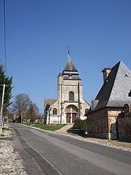
Ménilles is a commune in the Eure department in the Normandy region in northern France.
Population
| Historical population | ||
|---|---|---|
| Year | Pop. | ±% |
| 1962 | 862 | — |
| 1968 | 909 | +5.5% |
| 1975 | 1,183 | +30.1% |
| 1982 | 1,248 | +5.5% |
| 1990 | 1,449 | +16.1% |
| 1999 | 1,382 | −4.6% |
| 2008 | 1,516 | +9.7% |
See also
References
| Wikimedia Commons has media related to Ménilles. |
This article is issued from
Wikipedia.
The text is licensed under Creative Commons - Attribution - Sharealike.
Additional terms may apply for the media files.