McConnells, South Carolina
| McConnells, South Carolina | |
|---|---|
| Town | |
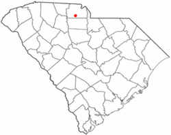 Location of McConnells, South Carolina | |
| Coordinates: 34°52′1″N 81°13′24″W / 34.86694°N 81.22333°WCoordinates: 34°52′1″N 81°13′24″W / 34.86694°N 81.22333°W | |
| Country | United States |
| State | South Carolina |
| County | York |
| Area | |
| • Total | 3.4 sq mi (8.9 km2) |
| • Land | 3.4 sq mi (8.9 km2) |
| • Water | 0.0 sq mi (0.0 km2) |
| Elevation | 682 ft (208 m) |
| Population (2000) | |
| • Total | 287 |
| • Density | 83.4/sq mi (32.2/km2) |
| Time zone | UTC-5 (Eastern (EST)) |
| • Summer (DST) | UTC-4 (EDT) |
| ZIP code | 29726 |
| Area code(s) | 803 |
| FIPS code | 45-43675[1] |
| GNIS feature ID | 1246582[2] |
McConnells is a town in York County, South Carolina, United States and a suburb of York. The population was 287 at the 2000 census.
History
The Bethesda Presbyterian Church, Brattonsville Historic District, and Hightower Hall are listed on the National Register of Historic Places.[3]
Geography
McConnells is located at 34°52′1″N 81°13′24″W / 34.86694°N 81.22333°W (34.866827, -81.223465).[4]
According to the United States Census Bureau, the town has a total area of 3.4 square miles (8.9 km²), all land.
Demographics
| Historical population | |||
|---|---|---|---|
| Census | Pop. | %± | |
| 1910 | 279 | — | |
| 1920 | 247 | −11.5% | |
| 1930 | 279 | 13.0% | |
| 1940 | 263 | −5.7% | |
| 1950 | 255 | −3.0% | |
| 1960 | 266 | 4.3% | |
| 1970 | 213 | −19.9% | |
| 1980 | 171 | −19.7% | |
| 1990 | 157 | −8.2% | |
| 2000 | 287 | 82.8% | |
| 2010 | 255 | −11.1% | |
| Est. 2016 | 295 | [5] | 15.7% |
| U.S. Decennial Census[6] | |||
As of the census[1] of 2000, there were 287 people, 101 households, and 76 families residing in the town. The population density was 83.4 people per square mile (32.2/km²). There were 107 housing units at an average density of 31.1 per square mile (12.0/km²). The racial makeup of the town was 71.43% White, 28.22% African American, and 0.35% from two or more races. Hispanic or Latino of any race were 0.70% of the population.
There were 101 households out of which 37.6% had children under the age of 18 living with them, 63.4% were married couples living together, 7.9% had a female householder with no husband present, and 23.8% were non-families. 23.8% of all households were made up of individuals and 10.9% had someone living alone who was 65 years of age or older. The average household size was 2.84 and the average family size was 3.38.
In the town, the population was spread out with 27.5% under the age of 18, 7.7% from 18 to 24, 33.1% from 25 to 44, 23.0% from 45 to 64, and 8.7% who were 65 years of age or older. The median age was 36 years. For every 100 females, there were 102.1 males. For every 100 females age 18 and over, there were 94.4 males.
The median income for a household in the town was $41,875, and the median income for a family was $61,094. Males had a median income of $26,750 versus $22,100 for females. The per capita income for the town was $15,831. About 5.3% of families and 5.7% of the population were below the poverty line, including 14.1% of those under the age of eighteen and 8.1% of those sixty five or over.
Notable person
- Ivory Latta, guard for the Washington Mystics of the WNBA
References
- 1 2 "American FactFinder". United States Census Bureau. Archived from the original on September 11, 2013. Retrieved 2008-01-31.
- ↑ "US Board on Geographic Names". United States Geological Survey. 2007-10-25. Retrieved 2008-01-31.
- ↑ National Park Service (2010-07-09). "National Register Information System". National Register of Historic Places. National Park Service.
- ↑ "US Gazetteer files: 2010, 2000, and 1990". United States Census Bureau. 2011-02-12. Retrieved 2011-04-23.
- ↑ "Population and Housing Unit Estimates". Retrieved June 9, 2017.
- ↑ "Census of Population and Housing". Census.gov. Archived from the original on May 12, 2015. Retrieved June 4, 2015.
Municipalities and communities of York County, South Carolina, United States | ||
|---|---|---|
| Cities | 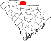 | |
| Towns | ||
| CDPs | ||
| Other unincorporated communities | ||
| Indian reservation | ||
| Footnotes | ‡This populated place also has portions in an adjacent county or counties | |
|  | ||||||||||||
|
| |||||||||||||