Malakal Airport
| Malakal Airport | |||||||||||
|---|---|---|---|---|---|---|---|---|---|---|---|
 The runway in 2009 | |||||||||||
| Summary | |||||||||||
| Airport type | Public, Civilian | ||||||||||
| Owner | Civil Aviation Authority of South Sudan | ||||||||||
| Serves | Malakal, South Sudan | ||||||||||
| Elevation AMSL | 1,291 ft / 393 m | ||||||||||
| Coordinates | 09°33′32″N 031°39′08″E / 9.55889°N 31.65222°ECoordinates: 09°33′32″N 031°39′08″E / 9.55889°N 31.65222°E | ||||||||||
| Map | |||||||||||
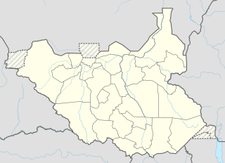 HSSM Location of airport in South Sudan | |||||||||||
| Runways | |||||||||||
| |||||||||||
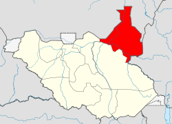
Malakal Airport (IATA: MAK, ICAO: HSSM) is an airport serving Malakal,[1] a city in Malakal County in the Eastern Nile[3] state of South Sudan. The airport is located just north of the city's central business district, adjacent to the main campus of Upper Nile University. Malakal is near the international border with the Republic of Sudan and the border with Ethiopia.
Malakal is the smaller of two international airports in South Sudan. The largest, Juba International Airport, lies approximately 521 kilometres (281 NM) to the south in the capital city of Juba.
As part of the United Nation's Mission to Sudan (UNMIS), the airport was a major staging point for United Nation operations to South Sudan and will continue to do so under the new United Nation's Mission to South Sudan (UNMISS) mandate.[4]
Facilities
The airport resides at an elevation of 1,291 feet (393 m) above mean sea level.[1][5] It has one runway designated 05/23 with an asphalt surface measuring 2,000 by 38 metres (6,562 ft × 125 ft).[1][6]
Scheduled airlines and destinations
The following airlines maintain scheduled service at Malakal Airport to the following destinations:
| Airlines | Destinations |
|---|---|
| Sudan Airways | Khartoum, Juba[7] |
See also
References
- 1 2 3 4 Airport information for HSSM from DAFIF (effective October 2006)
- ↑ Airport information for MAK at Great Circle Mapper. Source: DAFIF (effective October 2006).
- ↑ UNMISS chief pays courtesy call to Eastern Nile governor following Malakal killings
- ↑ "United Nations Radio -". 7 June 2015. Retrieved 7 June 2015.
- ↑ "Malakal Airport elevation - Wolfram-Alpha". Retrieved 7 June 2015.
- ↑ "Pilot information for Malakal Airport". Retrieved 7 June 2015.
- ↑ Flight Stats, Arrivals for May 26, 2014, http://www.flightstats.com/go/FlightStatus/flightStatusByAirport.do?airportCode=MAK&airportQueryType=1
External links
- Photo of Malakal Airport In 2011
- Photo of Malakal Airport In 2007
- Accident history for MAK at Aviation Safety Network
- Location of Malakal Airport At Google Maps