Malakal
| Malakal | |
|---|---|
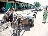
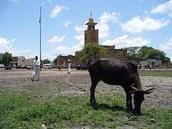 Malakal Marketplace Aug 2005 | |
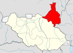
 Malakal Location in South Sudan | |
| Coordinates: 09°33′00″N 31°39′00″E / 9.55000°N 31.65000°E | |
| Country |
|
| State | Eastern Nile State |
| County | Malakal County |
| Elevation | 385 m (1,263 ft) |
| Population (2014 est) | |
| • Total | 147,450 |
Malakal is a city and Latin Catholic bishopric in South Sudan and second largest city after the national capital Juba.
Malakal is the capital of Upper Nile State, South Sudan. It also serves as the headquarters of Malakal County.
Location
The city of Malakal is located in Malakal County, Eastern Nile State,[1] in the northeast of South Sudan, close to the International borders with the Republic of Sudan and with Ethiopia. The town is located on the banks of the White Nile, just north of its confluence with the Sobat River.
This location lies approximately 650 kilometres (400 mi), by road, directly north of Juba, the capital of South Sudan and the largest city in that county.[2]
History
During the Second Sudanese Civil War, the town was a garrison town of the Khartoum-based Sudanese Armed Forces (SAF). Following South Sudan's independence on 9 July 2011, the troops from the Republic of Sudan have retreated from Malakal. Malakal was the site of the November 2006 Battle of Malakal.
Beginning in 2013, Malakal has been the site of numerous battles between government SPLA forces and the Nuer White Army, loosely commanded by the SPLM-IO which is headed by Riek Machar. The city has been overrun on various occasions by both sides.[3] As of October 2015, Malakal had exchanged hands twelve times during the civil war, and was utterly destroyed in the process.[4]
Religion
Its cathedral [5] is the episcopal see of the Roman Catholic Diocese of Malakal (promoted 1974; established in 1933 as Mission sui juris of Kodok).
Climate
| Climate data for Malakal | |||||||||||||
|---|---|---|---|---|---|---|---|---|---|---|---|---|---|
| Month | Jan | Feb | Mar | Apr | May | Jun | Jul | Aug | Sep | Oct | Nov | Dec | Year |
| Record high °C (°F) | 41.7 (107.1) |
43.0 (109.4) |
44.4 (111.9) |
43.7 (110.7) |
42.5 (108.5) |
39.5 (103.1) |
38.0 (100.4) |
36.7 (98.1) |
37.8 (100) |
39.5 (103.1) |
40.0 (104) |
40.5 (104.9) |
44.4 (111.9) |
| Average high °C (°F) | 34.9 (94.8) |
36.8 (98.2) |
38.7 (101.7) |
38.8 (101.8) |
35.9 (96.6) |
33.1 (91.6) |
31.1 (88) |
30.9 (87.6) |
31.9 (89.4) |
33.6 (92.5) |
35.1 (95.2) |
35.0 (95) |
34.7 (94.5) |
| Daily mean °C (°F) | 26.7 (80.1) |
28.5 (83.3) |
30.9 (87.6) |
31.5 (88.7) |
29.8 (85.6) |
27.7 (81.9) |
26.5 (79.7) |
26.3 (79.3) |
26.9 (80.4) |
27.7 (81.9) |
27.5 (81.5) |
26.8 (80.2) |
28.1 (82.6) |
| Average low °C (°F) | 18.5 (65.3) |
20.1 (68.2) |
23.0 (73.4) |
24.2 (75.6) |
23.7 (74.7) |
22.4 (72.3) |
21.8 (71.2) |
21.7 (71.1) |
21.9 (71.4) |
21.9 (71.4) |
19.9 (67.8) |
18.6 (65.5) |
21.5 (70.7) |
| Record low °C (°F) | 11.4 (52.5) |
10.0 (50) |
16.4 (61.5) |
16.5 (61.7) |
17.5 (63.5) |
17.6 (63.7) |
17.0 (62.6) |
17.0 (62.6) |
18.0 (64.4) |
15.0 (59) |
14.0 (57.2) |
12.2 (54) |
10.0 (50) |
| Average precipitation mm (inches) | 0.0 (0) |
0.2 (0.008) |
6.9 (0.272) |
19.9 (0.783) |
86.1 (3.39) |
103.4 (4.071) |
146.8 (5.78) |
163.4 (6.433) |
124.4 (4.898) |
75.6 (2.976) |
4.9 (0.193) |
0.0 (0) |
731.6 (28.803) |
| Average precipitation days (≥ 0.1 mm) | 0.0 | 0.1 | 1.0 | 2.1 | 7.0 | 10.0 | 13.9 | 14.9 | 10.9 | 7.3 | 0.8 | 0.0 | 68.0 |
| Average relative humidity (%) | 30 | 25 | 29 | 40 | 59 | 70 | 78 | 80 | 78 | 72 | 49 | 35 | 54 |
| Mean monthly sunshine hours | 294.5 | 263.2 | 260.4 | 261.0 | 229.4 | 168.0 | 151.9 | 170.5 | 177.0 | 223.2 | 282.0 | 297.6 | 2,778.7 |
| Mean daily sunshine hours | 9.5 | 9.4 | 8.4 | 8.7 | 7.4 | 5.6 | 4.9 | 5.5 | 5.9 | 7.2 | 9.4 | 9.6 | 7.6 |
| Percent possible sunshine | 82 | 80 | 70 | 70 | 58 | 43 | 39 | 43 | 48 | 61 | 81 | 85 | 63 |
| Source: NOAA[6] | |||||||||||||
Transportation
A major road linking Malakal with the town of Kurmuk at the border with Ethiopia is under repairs and renovations to asphalt surface. The road is expected to be ready for commissioning by May 2013.[7] The city of Malakal is also served by Malakal International Airport, one of the two International airports in South Sudan, the other being Juba International Airport. Water traffic on the White Nile River can travel as far north as Khartoum in the Republic of Sudan, and as far south as Adok in Lakes State.
Newspapers
Malakal has very limited newspapers circulated in hardcopy form. However, the Juba-based 'Citizen' is widely read around the town. In the eve of Independence day on July 9, 2011, The Upper Nile Times online newspaper was launched. The website for this online digital newspaper is no longer active, with the domain name being available for purchase.
Population
As of 2005 the population of Malakal was estimated at about 129,620.[8] The 2008 Sudanese census, which was boycotted by the South Sudanese government, recorded a population of about 126,500.[9] However, those results are disputed by the authorities in Juba. In 2010, it was estimated that the population of Malakal had grown to about 139,450.[10] Below is a table depicting the estimated population of the city from 1983 until 2010 from all sources:
| Year | Population[10] |
|---|---|
| 1983 | 33,750 |
| 1993 | 72,000 |
| 2005 | 129,620 |
| 2008 | 126,500 |
| 2010 | 139,450 |
Points of interest
The following points of interest are found in or near the town of Malakal:
- The offices of Malakal City Council
- The headquarters of Malakal County Administration
- The headquarters of Upper Nile State Government
- Malakal International Airport - A civilian and military airport
- The White Nile River - Malakal lies on the eastern bank and the town of Kwogo lies on the western bank, across from Malakal
- Malakal Stadium - A public outdoor sports complex
- Upper Nile University - A public university, founded in 2007
- Malakal Port - Located on the White Nile
- Upper Nile Primary School
- A branch of Nile Commercial Bank[11]
- A branch of Ivory Bank
- A branch of Equity Bank (South Sudan)[12]
- Malakal Vocational Training Center - A vocational school
Photogallery
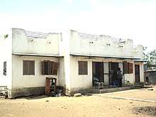
 Malakal center
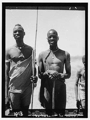 Malakal locals, 1936
 Trucks of the Force Publique (Belgian-Congolese colonial army) parked at Malakal during World War II
See also
References
- ↑ "SHILLUK FIGHT FOR DINKA TAKE-OVER OF MALAKAL: S. SUDAN LEGISLATORS WARN OF WAR OVER LAND DISPUTES IN UPPER NILE STATE". Africans Press. 10 February 2016. Retrieved 14 August 2016.
- ↑ "Distance between Juba () (Airport) and Malakal () (Airport) (Sudan)". Distancecalculator.globefeed.com. Retrieved 2014-02-15.
- ↑ "South Sudan Troops Recapture Malakal From Rebels - News". The Wall Street Journal. 2014-03-20. Retrieved 2014-05-24.
- ↑ Franks, Tim (24 October 2015). "Malakal: The city that vanished in South Sudan". BBC News. Retrieved 24 November 2015.
- ↑ http://www.gcatholic.org/churches/africa/5267.htm Gcatjolic, with Google satellite HQ photo
- ↑ "Malakal Climate Normals 1961–1990". National Oceanic and Atmospheric Administration. Retrieved January 24, 2015.
- ↑ "Contractors rush for South Sudan contracts - News". Theeastafrican.co.ke. 2013-09-21. Retrieved 2014-02-15.
- ↑ "Google Drive Viewer". Docs.google.com. Retrieved 2014-02-15.
- ↑ "Malakal's water woes | The Window". Imeechan.com. Retrieved 2014-02-15.
- 1 2 Archived May 23, 2012, at the Wayback Machine.
- ↑ Archived January 11, 2012, at the Wayback Machine.
- ↑ Archived January 26, 2011, at the Wayback Machine.
External links
| Wikivoyage has a travel guide for Malakal. |
| Wikimedia Commons has media related to Malakal. |
- Location of Malkal At Google Maps
- Malakal Vocational Training Centre.
- The Gateway to the Shilluk People of Malakal.