Pibor Airport
| Pibor Airport | |||||||||||
|---|---|---|---|---|---|---|---|---|---|---|---|
| Summary | |||||||||||
| Airport type | Public, Civilian | ||||||||||
| Owner | Civil Aviation Authority of South Sudan | ||||||||||
| Serves | Pibor, South Sudan | ||||||||||
| Location |
Pibor, | ||||||||||
| Elevation AMSL | 1,352 ft / 412 m | ||||||||||
| Coordinates | 06°47′37″N 33°07′49″E / 6.79361°N 33.13028°ECoordinates: 06°47′37″N 33°07′49″E / 6.79361°N 33.13028°E | ||||||||||
| Map | |||||||||||
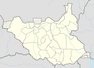 Pibor Location of Pibor Airport in South Sudan | |||||||||||
| Runways | |||||||||||
| |||||||||||
Pibor Airport is an airport serving the town of Pibor, in South Sudan.
Location
Pibor Airport (IATA: n/a, ICAO: HSPI) is located in Pibor County in Boma State,[1] in the town of Pibor. The airport is located approximately 3 kilometres (1.9 mi) west of the Pibor market.
This location lies approximately 274 kilometres (170 mi), by air, northeast of Juba International Airport, the largest airport in South Sudan.[2] The geographic coordinates of Pibor Airport are: 6° 47' 24.00"N, 33° 8' 6.00"E (Latitude: 6.7900; Longitude: 33.1350). The airport is situated 412 metres (1,352 ft) above sea level. The airport has a single unpaved runway, measuring 1,097 metres (3,599 ft).[3]
Overview
Pibor Airport is a small civilian airport that serves the town of Pibor and surrounding communities. There are no known scheduled airlines serving Pibor Airport at this time.
See also
References
- ↑ "South Sudan's Boma state violence displaces hundreds". Sudan Tribune. 24 February 2016.
- ↑ "Distance between Juba () (Airport) and Pibor Post () (Sudan)". distancecalculator.globefeed.com. Retrieved 2018-08-24.
- ↑ "HSPI - Pibor Post [Pibor Airport], JG, SS - Airport - Great Circle Mapper". www.gcmap.com. Retrieved 2018-08-24.
State capital: Bor | ||
| Populated places | 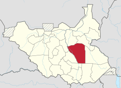 | |
| Universities | ||
| Airports | ||
| Other | ||