Greater Upper Nile
| Greater Upper Nile | |
|---|---|
| Region | |
 South Sudan Lucy digger. | |
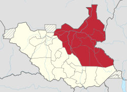 Location in South Sudan. | |
| Coordinates: 10°30′N 32°30′E / 10.500°N 32.500°ECoordinates: 10°30′N 32°30′E / 10.500°N 32.500°E | |
| Country |
|
| Region | Greater Upper Nile |
| Capital | Malakal |
| Area | |
| • Total | 236,208 km2 (91,200 sq mi) |
| Population (2014 Estimate) | |
| • Total | 4,119,700 |
| • Density | 17/km2 (45/sq mi) |
| Time zone | UTC+3 (EAT) |
The Greater Upper Nile is a region of northeastern South Sudan.[1] It is named for the White Nile, a tributary of the Nile River in North and East Africa.
Geography
The region consisted of the erstwhile states of Jonglei, Unity, and Upper Nile.[1] It borders Ethiopia to the east and the Republic of the Sudan to the north. The South Sudanese region of Bahr el Ghazal lies to the west and the region of Equatoria lies to the South of Greater Upper Nile.
History
The Greater Upper Nile region seceded from the Republic of Sudan on 9 July 2011 along with its fellow Southern Sudanese regions of Bahr el Ghazal and Equatoria. The three regions now constitute the Republic of South Sudan.[1]
See also
References
- 1 2 3 "SUDAN: land conflicts threaten peace in Upper Nile State". Afronline. 23 June 2011. Retrieved 8 July 2011.
External links
![]()
This article is issued from
Wikipedia.
The text is licensed under Creative Commons - Attribution - Sharealike.
Additional terms may apply for the media files.