Torit Airport
| Torit Airport | |||||||||||
|---|---|---|---|---|---|---|---|---|---|---|---|
| Summary | |||||||||||
| Airport type | Public, Civilian | ||||||||||
| Owner | Civil Aviation Authority of South Sudan | ||||||||||
| Serves | Torit, South Sudan | ||||||||||
| Location |
Torit, | ||||||||||
| Elevation AMSL | 2,018 ft / 615 m | ||||||||||
| Coordinates | 04°24′40″N 32°34′44″E / 4.41111°N 32.57889°E | ||||||||||
| Map | |||||||||||
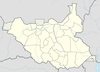 Torit Location of Torit Airport in South Sudan | |||||||||||
| Runways | |||||||||||
| |||||||||||
Torit Airport is an airport serving the town of Torit, in South Sudan.
Location
Torit Airport (IATA: n/a, ICAO: HSTR) is located in Torit County, Imatong State, in the town of Torit, near the International border with the Republic of Uganda. The airport is located to the northeast of the central business district of the town.
This location lies approximately 120 kilometres (75 mi), by air, east of Juba International Airport, the largest airport in South Sudan.[1] The geographic coordinates of Torit Airport are: 4° 24' 40.00"N, 32° 34' 44.00"E (Latitude: 4.411110; Longitude: 32.578890). This airport sits at an elevation of 615 metres (2,018 ft) above sea level.[2] The airport has a single unpaved runway, the dimensions of which are not publicly known at this time.
Overview
Torit Airport is a small civilian airport that serves the town of Torit and surrounding communities. There are no known scheduled airlines serving this airport at this time.
See also
References
- ↑ "Distance between Juba () (Airport) and Torit (Al Wilayah al Istiwa'iyah) (Sudan)". distancecalculator.globefeed.com. Retrieved 2018-08-26.
- ↑ Torit Elevation Is 2,018 Feet Above Sea Level
External links
Coordinates: 4°24′40″N 32°34′44″E / 4.411110°N 32.578890°E
| Counties | 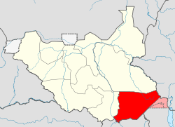 | |
|---|---|---|
| Principal towns | ||
| Airports | ||
| Rivers | ||
| Mountains | ||
| Communities | ||