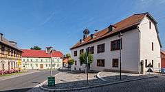
Magdala, Germany
| Magdala | ||
|---|---|---|
| ||
 Magdala Location of Magdala within Weimarer Land district 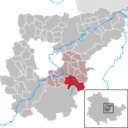 | ||
| Coordinates: 50°54′24″N 11°26′46″E / 50.90667°N 11.44611°ECoordinates: 50°54′24″N 11°26′46″E / 50.90667°N 11.44611°E | ||
| Country | Germany | |
| State | Thuringia | |
| District | Weimarer Land | |
| Municipal assoc. | Mellingen | |
| Government | ||
| • Mayor | Mario Haßkarl | |
| Area | ||
| • Total | 20.53 km2 (7.93 sq mi) | |
| Elevation | 271 m (889 ft) | |
| Population (2017-12-31)[1] | ||
| • Total | 2,014 | |
| • Density | 98/km2 (250/sq mi) | |
| Time zone | CET/CEST (UTC+1/+2) | |
| Postal codes | 99441 | |
| Dialling codes | 036454 | |
| Vehicle registration | AP | |
| Website | www.stadt-magdala.de | |

Magdala is a town in the Weimarer Land district, in Thuringia, Germany. It is situated 10 kilometres (6 miles) west of Jena, and 12 kilometres (7 miles) southeast of Weimar.
History
Within the German Empire (1871-1918), Magdala was part of the Grand Duchy of Saxe-Weimar-Eisenach.
Magdala
Personalities
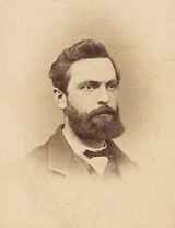
Heinrich Friedrich Weber
- August Wilhelm Dennstedt (1776-1826), natural scientist, doctor and author. In addition, he was mayor in Magdala and, since 1818, scientific director of the botanical garden Belvedere in Weimar.
- Anton Sommer (1816-1888), poet from Rudolstadt, worked temporarily as a house teacher in Magdala
- Heinrich Friedrich Weber (1843-1912), physicist from Magdala, professor at the ETH Zürich
References
| Wikimedia Commons has media related to Magdala, Germany. |
| Authority control |
|---|
This article is issued from
Wikipedia.
The text is licensed under Creative Commons - Attribution - Sharealike.
Additional terms may apply for the media files.