Leutenthal
| Leutenthal | |
|---|---|
 Leutenthal Location of Leutenthal within Weimarer Land district 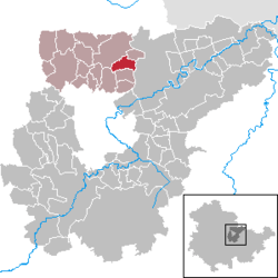 | |
| Coordinates: 51°3′22″N 11°22′26″E / 51.05611°N 11.37389°ECoordinates: 51°3′22″N 11°22′26″E / 51.05611°N 11.37389°E | |
| Country | Germany |
| State | Thuringia |
| District | Weimarer Land |
| Municipal assoc. | Nordkreis Weimar |
| Government | |
| • Mayor | Herbert Steinhäuser |
| Area | |
| • Total | 5.50 km2 (2.12 sq mi) |
| Elevation | 230 m (750 ft) |
| Population (2017-12-31)[1] | |
| • Total | 256 |
| • Density | 47/km2 (120/sq mi) |
| Time zone | CET/CEST (UTC+1/+2) |
| Postal codes | 99439 |
| Dialling codes | 036451 |
| Vehicle registration | AP |
| Website | www.vg-buttelstedt.de |
Leutenthal is a municipality in the Weimarer Land district of Thuringia, Germany.
References
| Authority control |
|---|
This article is issued from
Wikipedia.
The text is licensed under Creative Commons - Attribution - Sharealike.
Additional terms may apply for the media files.