Kromsdorf
| Kromsdorf | |
|---|---|
 Kromsdorf Location of Kromsdorf within Weimarer Land district 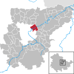 | |
| Coordinates: 50°59′56″N 11°22′25″E / 50.99889°N 11.37361°ECoordinates: 50°59′56″N 11°22′25″E / 50.99889°N 11.37361°E | |
| Country | Germany |
| State | Thuringia |
| District | Weimarer Land |
| Government | |
| • Mayor | Gunter Braniek |
| Area | |
| • Total | 10.72 km2 (4.14 sq mi) |
| Elevation | 200 m (700 ft) |
| Population (2017-12-31)[1] | |
| • Total | 1,449 |
| • Density | 140/km2 (350/sq mi) |
| Time zone | CET/CEST (UTC+1/+2) |
| Postal codes | 99441 |
| Dialling codes | 03643 |
| Vehicle registration | AP |
| Website | http://www.kromsdorf-denstedt.de |
Kromsdorf is a municipality in the district of Weimarer Land in Thuringia, Germany. It was part of the Verwaltungsgemeinschaft Ilmtal-Weinstraße until 31 December 2013. It borders on Weimar (quarters Süßenborn and Tiefurt), and is situated northeast of the city, not far from Schloss Tiefurt, on both banks of the river Ilm.
Structure
Kromsdorf consists of the settlements Kromsdorf-Nord (formerly Großkromsdorf) on the left bank of the Ilm, Kromsdorf-Süd (formerly Kleinkromsdorf) on the right bank, and Denstedt.
Places of interest
- The park wall of the Renaissance castle Kromsdorf is decorated with 64 portrait busts. Today the castle serves as a culture center.
- Denstedt Castle, in the village Denstedt, has a remarkable tower.
Sports
- TSV 1928 Kromsdorf e. V. (football, table tennis, ninepins, volleyball)
References
External links
| Wikimedia Commons has media related to Kromsdorf. |
This article is issued from
Wikipedia.
The text is licensed under Creative Commons - Attribution - Sharealike.
Additional terms may apply for the media files.