| Name / description |
Country 1 |
Country 2 |
Country 3 |
Coordinates |
Region |
Image |
|---|
|  Algeria Algeria |  Libya Libya |  Niger Niger | 23°31′N 12°00′E / 23.517°N 12.000°E / 23.517; 12.000 | Africa - North | |
| Algeria | Libya |  Tunisia Tunisia | 30°14′N 9°32′E / 30.233°N 9.533°E / 30.233; 9.533 | Africa - North | |
| Algeria |  Mali Mali |  Mauritania Mauritania | 25°00′N 4°50′W / 25.000°N 4.833°W / 25.000; -4.833 | Africa - North | |
| Algeria | Mali | Niger | 19°9′N 4°16′E / 19.150°N 4.267°E / 19.150; 4.267 | Africa - North | |
| Algeria | Mauritania |  Western Sahara Western Sahara | 27°18′N 8°40′W / 27.300°N 8.667°W / 27.300; -8.667 | Africa - North | |
| Algeria |  Morocco Morocco | Western Sahara | 27°40′N 8°40′W / 27.667°N 8.667°W / 27.667; -8.667 | Africa - North | |
|  Angola Angola |  Democratic Republic of the Congo Democratic Republic of the Congo |  Republic of the Congo Republic of the Congo | 4°41′S 13°6′E / 4.683°S 13.100°E / -4.683; 13.100 | Africa - West/Central | |
| Angola | Democratic Republic of the Congo |  Zambia Zambia | 10°53′S 23°59′E / 10.883°S 23.983°E / -10.883; 23.983 | Africa - South/East | |
| Angola |  Namibia Namibia | Zambia | 17°38′S 23°28′E / 17.633°S 23.467°E / -17.633; 23.467 | Africa - South/East | |
|  Benin Benin |  Burkina Faso Burkina Faso | Niger | 11°54′N 2°24′E / 11.900°N 2.400°E / 11.900; 2.400 | Africa - West/Central | |
| Benin | Burkina Faso |  Togo Togo | 11°0′N 0°55′E / 11.000°N 0.917°E / 11.000; 0.917 | Africa - West/Central | |
| Benin | Niger |  Nigeria Nigeria | 11°42′N 3°36′E / 11.700°N 3.600°E / 11.700; 3.600 | Africa - West/Central | |
| Union's End (Nossob River/20°E) |  Botswana Botswana | Namibia |  South Africa South Africa | 24°46′S 20°0′E / 24.767°S 20.000°E / -24.767; 20.000 | Africa - South/East | |
| near Kasane (four corners) | Botswana | Namibia | Zambia | 17°47′16″S 25°15′24″E / 17.78778°S 25.25667°E / -17.78778; 25.25667 | Africa - South/East | |
| Limpopo–Shashe confluence | Botswana | South Africa |  Zimbabwe Zimbabwe | 22°12′S 29°22′E / 22.200°S 29.367°E / -22.200; 29.367 | Africa - South/East | |
| Kasane (Four corners) | Botswana | Zambia | Zimbabwe | 17°47′56″S 25°16′13″E / 17.79889°S 25.27028°E / -17.79889; 25.27028 | Africa - South/East | |
| Burkina Faso |  Ivory Coast Ivory Coast |  Ghana Ghana | 9°29′N 2°41′W / 9.483°N 2.683°W / 9.483; -2.683 | Africa - West/Central | |
| Burkina Faso | Ivory Coast | Mali | 10°26′N 5°31′W / 10.433°N 5.517°W / 10.433; -5.517 | Africa - West/Central | |
| west of Senkase | Burkina Faso | Ghana | Togo | 11°7′N 0°0′W / 11.117°N -0.000°E / 11.117; -0.000 | Africa - West/Central | |
| Burkina Faso | Mali | Niger | 15°0′N 0°14′E / 15.000°N 0.233°E / 15.000; 0.233 | Africa - West/Central | |
| Ruzizi River |  Burundi Burundi | Democratic Republic of the Congo |  Rwanda Rwanda | 2°45′S 29°2′E / 2.750°S 29.033°E / -2.750; 29.033 | Africa - South/East | |
| Lake Tanganyika | Burundi | Democratic Republic of the Congo |  Tanzania Tanzania | 4°27′S 29°25′E / 4.450°S 29.417°E / -4.450; 29.417 | Africa - South/East | |
| Burundi | Rwanda | Tanzania | 2°24′S 30°34′E / 2.400°S 30.567°E / -2.400; 30.567 | Africa - South/East | |
|  Cameroon Cameroon |  Central African Republic Central African Republic |  Chad Chad | 7°32′N 15°30′E / 7.533°N 15.500°E / 7.533; 15.500 | Africa - West/Central | |
| Cameroon | Central African Republic | Republic of the Congo | 2°13′N 16°12′E / 2.217°N 16.200°E / 2.217; 16.200 | Africa - West/Central | |
| Lake Tchad | Cameroon | Chad | Nigeria | 13°5′N 14°5′E / 13.083°N 14.083°E / 13.083; 14.083 | Africa - West/Central | |
| Cameroon |  Gabon Gabon | Republic of the Congo | 2°10′N 13°18′E / 2.167°N 13.300°E / 2.167; 13.300 | Africa - West/Central | |
| Cameroon |  Equatorial Guinea Equatorial Guinea | Gabon | 2°10′N 11°20′E / 2.167°N 11.333°E / 2.167; 11.333 | Africa - West/Central | |
| Central African Republic | Chad |  Sudan Sudan | 10°56′N 22°52′E / 10.933°N 22.867°E / 10.933; 22.867 | Africa - West/Central | |
| near Betoukoumba | Central African Republic | Democratic Republic of the Congo | Republic of the Congo | 3°28′N 18°37′E / 3.467°N 18.617°E / 3.467; 18.617 | Africa - West/Central | |
| near Nabiapai | Central African Republic | Democratic Republic of the Congo |  South Sudan South Sudan | 5°1′N 27°27′E / 5.017°N 27.450°E / 5.017; 27.450 | Africa - West/Central | |
| Central African Republic | South Sudan | Sudan | 8°38.75′N 24°14.15′E / 8.64583°N 24.23583°E / 8.64583; 24.23583 | Africa - West/Central | |
| Chad | Libya | Niger | 23°N 15°E / 23°N 15°E / 23; 15 | Africa - North | |
| Chad | Libya | Sudan | 19°30′N 24°00′E / 19.5°N 24°E / 19.5; 24 | Africa - North | |
| Lake Tchad | Chad | Niger | Nigeria | 13°42′N 13°38′E / 13.700°N 13.633°E / 13.700; 13.633 | Africa - West/Central | |
| Ivory Coast |  Guinea Guinea |  Liberia Liberia | 7°34′N 8°28′W / 7.567°N 8.467°W / 7.567; -8.467 | Africa - West/Central | |
| Ivory Coast | Guinea | Mali | 10°10′N 7°58′W / 10.167°N 7.967°W / 10.167; -7.967 | Africa - West/Central | |
|  Djibouti Djibouti |  Eritrea Eritrea |  Ethiopia Ethiopia | 12°28′N 42°24′E / 12.467°N 42.400°E / 12.467; 42.400 | Africa - North | |
| Djibouti | Ethiopia |  Somalia Somalia | 10°59′N 42°58′E / 10.983°N 42.967°E / 10.983; 42.967 | Africa - North | |
| Mount Sabyinyo | Democratic Republic of the Congo | Rwanda |  Uganda Uganda | 1°23′S 29°36′E / 1.383°S 29.600°E / -1.383; 29.600 | Africa - South/East | 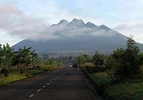 |
| Salia Musala, near Oraba | Democratic Republic of the Congo | South Sudan | Uganda | 3°30′N 30°52′E / 3.500°N 30.867°E / 3.500; 30.867 | Africa - South/East | |
| Lake Tanganyika | Democratic Republic of the Congo | Tanzania | Zambia | 8°12′S 30°46′E / 8.200°S 30.767°E / -8.200; 30.767 | Africa - South/East | |
|  Egypt Egypt | Libya | Sudan | 22°N 25°E / 22°N 25°E / 22; 25 | Africa - North | |
| Eritrea | Ethiopia | Sudan | 14°15′N 36°34′E / 14.250°N 36.567°E / 14.250; 36.567 | Africa - North | |
| Ethiopia |  Kenya Kenya | Somalia | 3°59′N 41°54′E / 3.983°N 41.900°E / 3.983; 41.900 | Africa - South/East | |
| Ilemi Triangle | Ethiopia | Kenya | South Sudan | 5°24′N 35°18′E / 5.4°N 35.3°E / 5.4; 35.3 (disputed) | Africa - South/East | |
| Ethiopia | South Sudan | Sudan | 9°30′N 34°6.4′E / 9.500°N 34.1067°E / 9.500; 34.1067 | Africa - North | |
| Guinea |  Guinea-Bissau Guinea-Bissau |  Senegal Senegal | 12°41′N 13°43′W / 12.683°N 13.717°W / 12.683; -13.717 | Africa - West/Central | |
| Guinea | Liberia |  Sierra Leone Sierra Leone | 8°29′N 10°16′W / 8.483°N 10.267°W / 8.483; -10.267 | Africa - West/Central | |
| Guinea | Mali | Senegal | 12°25′N 11°22′W / 12.417°N 11.367°W / 12.417; -11.367 | Africa - West/Central | |
| Kenya | South Sudan | Uganda | 4°13′N 34°0′E / 4.217°N 34.000°E / 4.217; 34.000 | Africa - South/East | |
| Lake Victoria | Kenya | Tanzania | Uganda | 1°0′S 33°55′E / 1.000°S 33.917°E / -1.000; 33.917 | Africa - South/East | |
| Lake Malawi |  Malawi Malawi |  Mozambique Mozambique | Tanzania | 11°34′S 34°58′E / 11.567°S 34.967°E / -11.567; 34.967 (disputed) | Africa - South/East | |
| Malawi | Mozambique | Zambia | 14°1′S 33°13′E / 14.017°S 33.217°E / -14.017; 33.217 | Africa - South/East | |
| Malawi | Tanzania | Zambia | 9°24′S 32°58′E / 9.400°S 32.967°E / -9.400; 32.967 | Africa - South/East | |
| Mali | Mauritania | Senegal | 14°46′N 12°15′W / 14.767°N 12.250°W / 14.767; -12.250 | Africa - West/Central | |
| Mpundweni Beacon | Mozambique | South Africa |  Swaziland Swaziland | north: 25°57′S 31°58′E / 25.950°S 31.967°E / -25.950; 31.967 | Africa - South/East | |
| Abercorn Drift, Maputo River | Mozambique | South Africa | Swaziland | south: 26°50′S 32°8′E / 26.833°S 32.133°E / -26.833; 32.133 | Africa - South/East | |
| Crook's Corner, Pafuri Triangle (Limpopo–Luvuvhu confluence) | Mozambique | South Africa | Zimbabwe | 22°25′17″S 31°18′32″E / 22.42139°S 31.30889°E / -22.42139; 31.30889 | Africa - South/East | |
| Mozambique | Zambia | Zimbabwe | 15°37′S 30°25′E / 15.617°S 30.417°E / -15.617; 30.417 | Africa - South/East | |
| Rwanda | Tanzania | Uganda | 1°4′S 30°29′E / 1.067°S 30.483°E / -1.067; 30.483 | Africa - South/East | |


.jpg)