Hawaii Route 130
| ||||
|---|---|---|---|---|
| Route information | ||||
| Maintained by HDOT | ||||
| Major junctions | ||||
| South end | near Kaimū | |||
| North end |
| |||
| Highway system | ||||
| ||||

Route 130 is a state highway in Hawaii County, Hawaii. It runs from Route 11 at Ke'aau through the Puna District to Kaimū.
Route description
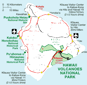
Route 130 starts from the intersection of Ke'aau on Route 11, in the south of Hilo. It heads south on the east side of Kīlauea to Pahoa, where Route 132 branches out via Kapoho to Cape Kumukahi with further connection to Route 137, and curves toward west, ending at Kaimū.[1]
History
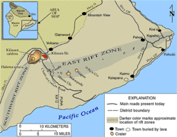
Route 130 used to travel further to the west and was connected via Kaimū and Kalapana to Chain of Craters Road in Hawaii Volcanoes National Park. However, the lava flows from Puʻu ʻŌʻō Crater that started in 1983 buried Kaimū and Kalapana, and cut that connection.
In the more recent years, in 2014 and 2018, the Puʻu ʻŌʻō lava appeared in the subdivisions in the suburbs of Pahoa, and forced the people there to evacuate.
See also


References
- ↑ Bier, James A. Map of Hawai'i, the Big Island (Map). University of Hawai'i Press.