| Name |
Image |
Location |
Coordinates |
Year first lit |
Automated |
Year deactivated |
Current Lens |
Focal Height |
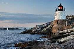
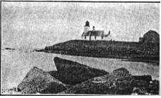
| Beavertail Lighthouse |
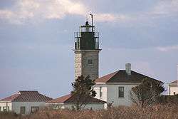 |
Jamestown
(Conanicut Island) |
41°26′57″N 71°23′57″W / 41.4493°N 71.3993°W / 41.4493; -71.3993 (Beavertail Lighthouse) |
1749 (Former)
1856 (Current) |
1989 |
Active |
Third-order Fresnel |
068 68 ft (21 m) |
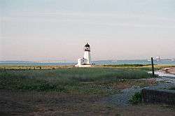
| Block Island North Light |
 |
New Shoreham
(Block Island) |
41°13′39″N 71°34′34″W / 41.2275°N 71.5761°W / 41.2275; -71.5761 (Block Island North Light) |
1829 (Former)
1867 (Current) |
1955 |
Active
(Inactive: 1973–1989,
2008–2010) |
Unknown |
061 61 ft (19 m) |
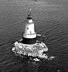
| Block Island Southeast Light |
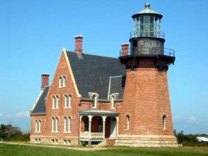 |
New Shoreham
(Block Island) |
41°09′35″N 71°32′50″W / 41.1597°N 71.5472°W / 41.1597; -71.5472 (Block Island Southeast Light) |
1875 |
1990 |
Active
(Inactive: 1990–1994) |
First-order Fresnel |
258 258 ft (79 m) |
| Brenton Reef Light |
|
Narragansett |
41°25′35″N 71°23′22″W / 41.4264°N 71.3894°W / 41.4264; -71.3894 (Brenton Reef Light)[4] |
1962 |
Unknown |
1989
(Now a lighted buoy) |
None |
087 87 ft (27 m)[4] |
| Bristol Ferry Light |
 |
Bristol |
41°38′35″N 71°15′37″W / 41.6431°N 71.2603°W / 41.6431; -71.2603 (Bristol Ferry Light)[5] |
1855 |
Never |
1927
(Now a private house) |
None |
035 35 ft (11 m)[5] |
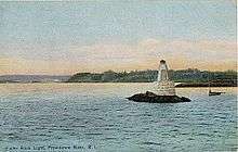
| Bullock's Point Light |
|
Providence River |
41°44′16″N 71°21′51″W / 41.7377°N 71.3642°W / 41.7377; -71.3642 (Bullock's Point Light) |
1876
(Former)
1939
(Current) |
1939
(skeleton tower) |
Active
(Original tower
destroyed) |
Unknown |
050 50 ft (15 m) |
| Castle Hill Light |
 |
Newport |
41°27′43″N 71°21′48″W / 41.4619°N 71.3633°W / 41.4619; -71.3633 (Castle Hill Light) |
1890 |
1957 |
Active |
300mm |
040 40 ft (12 m) |
| Conanicut Island Light |
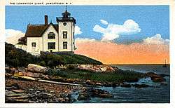 |
Jamestown
(Conanicut Island) |
41°34′24″N 71°22′21″W / 41.5733°N 71.3725°W / 41.5733; -71.3725 (Conanicut Island Light) |
1886 |
Never |
1933 |
None |
047 47 ft (14 m)[6] |
| Conimicut Shoal Light |
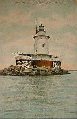 |
Warwick |
41°43′01″N 71°20′45″W / 41.7169°N 71.3458°W / 41.7169; -71.3458 (Conimicut Shoal Light) |
1868 (Former)
1883 (Current) |
1966 |
Active |
Unknown |
029 29 ft (8.8 m) |
| Dutch Island Light |
 |
Jamestown |
41°29′44″N 71°24′16″W / 41.4956°N 71.4044°W / 41.4956; -71.4044 (Dutch Island Light) |
1826 (Former)
1857 (Current) |
1947 |
Active
(Inactive: 1979-2007) |
250mm |
056 56 ft (17 m)[7] |
| Fuller Rock Light |
 |
Providence River |
41°47′23″N 71°22′47″W / 41.7898°N 71.3796°W / 41.7898; -71.3796 (Fuller Rock Light) |
1872[8] |
1918[8] |
1923[8]
(Destroyed) |
None |
028 28 ft (8.5 m)[8] |
| Gould Island Light |
|
Jamestown
(Gould Island [9]) |
41°32′02″N 71°20′35″W / 41.534°N 71.343°W / 41.534; -71.343 (Gould Island Light)[9] |
1889[9] |
Never |
1947[9] |
None |
052 52 ft (16 m)[9] |
| Gull Rocks Light |
|
Newport |
41°30′09″N 71°19′59″W / 41.5024°N 71.3331°W / 41.5024; -71.3331 (Gull Rocks Light) |
1887 (Former)
1928 (Current) |
1960 |
1969
(Demolished) |
None |
033 33 ft (10 m) |
| Hog Island Shoal Light |
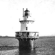 |
Portsmouth
(Hog Island |
41°37′56″N 71°16′25″W / 41.6322°N 71.2736°W / 41.6322; -71.2736 (Hog Island Shoal Light) |
1901 |
1964 |
Active |
250mm |
054 54 ft (16 m) |
| Ida Lewis Rock Light |
 |
Newport
(Lime Rock) |
41°28′40″N 71°19′35″W / 41.4778°N 71.3264°W / 41.4778; -71.3264 (Ida Lewis Light) |
1854 |
1927 |
1963 |
None |
Unknown |
| Musselbed Shoals Light |
 |
Narragansett Bay
(Open water) |
41°38′11″N 71°15′36″W / 41.6363°N 71.2599°W / 41.6363; -71.2599 (Musselbed Shoals Light) |
1873[10] |
Never |
1938[10] |
None |
035 35 ft (11 m)[10] |
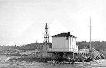
| Nayatt Point Light |
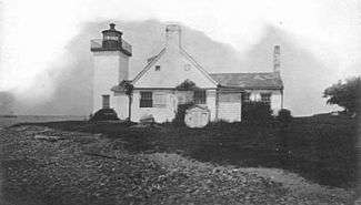 |
Barrington |
41°43′30″N 71°20′23″W / 41.7250°N 71.3397°W / 41.7250; -71.3397 (Nayatt Point Light) |
1828 (Former)
1856 (Current) |
Unknown |
1868 |
None |
Unknown |
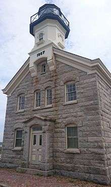
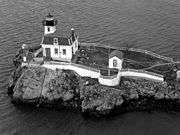
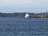
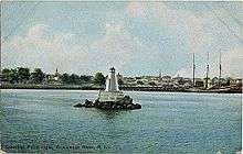
| Newport Harbor Light |
.jpg) |
Newport
(Goat Island |
41°29′36″N 71°19′37″W / 41.4933°N 71.3270°W / 41.4933; -71.3270 (Newport Harbor Light) |
1823 (Former)
1865 (Current) |
1923 |
Active |
250mm |
033 33 ft (10 m) |
| Plum Beach Light |
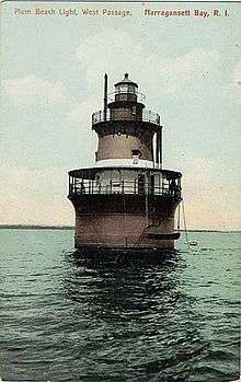 |
North Kingstown |
41°31′48″N 71°24′20″W / 41.5300°N 71.4056°W / 41.5300; -71.4056 (Plum Beach Light) |
1897 |
2003
(Relit) |
Active
(Inactive: 1941–2003) |
Unknown |
Unknown |
| Point Judith Light |
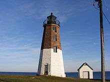 |
Narragansett |
41°21′39″N 71°28′55″W / 41.3608°N 71.4819°W / 41.3608; -71.4819 (Point Judith Light) |
1810 (Former)
1857 (Current) |
1954 |
Active |
Fourth-order Fresnel |
051 51 ft (16 m) |
| Pomham Rocks Light |
 |
East Providence |
41°46′39″N 71°22′11″W / 41.7775°N 71.3696°W / 41.7775; -71.3696 (Pomham Rocks Light) |
1871 |
2006
(Relit) |
Active
(Inactive: 1974–2006) |
250mm |
067 67 ft (20 m) |
| Poplar Point Light |
 |
North Kingstown |
41°34′15″N 71°26′23″W / 41.5708°N 71.4397°W / 41.5708; -71.4397 (Poplar Point Light) |
1831 |
Never |
1882
(Now a private house) |
None |
Unknown |
| Prudence Island Light |
 |
Portsmouth
(Prudence Island) |
41°36′20″N 71°18′11″W / 41.6056°N 71.3031°W / 41.6056; -71.3031 (Prudence Island Light) |
1852 |
1961 |
Active |
250mm |
028 28 ft (8.5 m) |
| Rose Island Light |
 |
Newport
(Rose island |
41°29′44″N 71°20′35″W / 41.4956°N 71.3431°W / 41.4956; -71.3431 (Rose Island Light) |
1870 |
1992
(Relit) |
Active
(Inactive: 1971–1992) |
Unknown |
048 48 ft (15 m) |
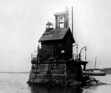
| Sabin Point Light |
|
Providence River |
41°45′43″N 71°22′27″W / 41.7619°N 71.3742°W / 41.7619; -71.3742 (Sabin Point Light) |
1872 |
1956 |
1968
(Razed) |
None |
036 36 ft (11 m) |
| Sakonnet Light |
 |
Little Compton
(Sakonnet River) |
41°27′11″N 71°12′11″W / 41.4531°N 71.2031°W / 41.4531; -71.2031 (Sakonnet Light) |
1884[11] |
1997
(Relit) |
Active
(Inactive: 1955–1997) |
Unknown |
058 58 ft (18 m) |
| Sassafras Point Light |
 |
Providence River |
41°48′00″N 71°23′31″W / 41.800°N 71.392°W / 41.800; -71.392 (Sassafras Point Light)[12] |
1872[13] |
Never |
1912[13]
(Demolished) |
None |
025 25 ft (7.6 m)[13] |
| Warwick Light |
 |
Warwick |
41°40′01″N 71°22′43″W / 41.6669°N 71.3786°W / 41.6669; -71.3786 (Warwick Light) |
1827 (Former)
1932 (Current) |
1985 |
Active |
250mm |
066 66 ft (20 m) |
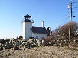
| Watch Hill Light |
 |
Westerly
(Watch Hill) |
41°18′14″N 71°51′30″W / 41.3039°N 71.8584°W / 41.3039; -71.8584 (Watch Hill Light) |
1808 (Former)
1857 (Current) |
1986 |
Active |
VRB-25 |
061 61 ft (19 m) |
| Whale Rock Light |
 |
Narragansett
(Whale Rock) |
41°26′37″N 71°25′25″W / 41.4436°N 71.4236°W / 41.4436; -71.4236 (Whale Rock Light) |
1882 |
Never |
1938
(Destroyed) |
None |
073 73 ft (22 m)[14] |
| Wickford Harbor Light |
 |
North Kingstown
Wickford |
41°34′24″N 71°26′10″W / 41.5734°N 71.4362°W / 41.5734; -71.4362 (Wickford Harbor Light) |
1882 (Former)
1930 (Current) |
1930
(skeleton tower) |
Active
(skeleton tower) |
Unknown |
042 42 ft (13 m) |