List of lighthouses in Georgia (U.S. state)
This is a list of all lighthouses in the U.S. state of Georgia as identified by the United States Coast Guard. There are three active lights in the state including one maintained as a private aid; four are standing but inactive, and one has been replaced by an automated skeleton tower, and one destroyed by a ship collision. One tower, the second Sapelo Island Light, was moved to Michigan; the first tower on the site is still standing and was relit in 1998.
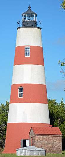
The earliest lighthouse in the state was erected in 1736; the oldest surviving tower is the Sapelo Island Light, though the present Tybee Island Light, erected in 1867, incorporates the base of its 1773 predecessor.[1] The last lighthouse in the state, the Savannah Light, was constructed in 1964.[1]
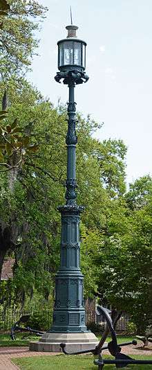
The lighthouses on Cumberland Island, Sapelo Island, and St. Simons Island are on the National Register of Historic Places. The Old Harbor Light in Savannah is a contributing property to a National Historic Landmark district.
If not otherwise noted, focal height and coordinates are taken from the United States Coast Guard Light List,[2] while location and dates of activation, automation, and deactivation are taken from the United States Coast Guard Historical information site for lighthouses.[3]
%2C_GA%2C_US.jpg)
.jpg)


.jpg)
Notes
- A.^ Sapelo Island Light also served as a rear range light from 1856 to 1898.
- B.^ The second Sapelo Island Light was a steel tower built in 1905, it was later re-erected at South Fox Island Light (Michigan) in 1933. The original brick 1820 tower was reactivated in 1998 and still stands today.
- C.^ Sapelo Island Light originally had a Fourth-order Fresnel lens but it has since been replaced by an unknown modern optic.
- D.^ There isn't any evidence that this is still used for navigational purposes. The light remains lit as a decorate piece.
- E.^ Replaced with a skeleton tower at an unknown date.[1]
References
- 1 2 3 "Lighthouses of the United States: Georgia". Russ Rowlett.
- ↑ Light List, Volume III, Atlantic Coast, Little River, South Carolina to Econfina River, Florida (PDF). Light List. United States Coast Guard. 2012.
- ↑ "Historic Light Station Information and Photography: Georgia". United States Coast Guard Historian's Office.
- 1 2 3 4 "Cockspur Island Lighthouse". Lighthouse Friends. Retrieved October 13, 2017.
- ↑ Tybee Island to Doboy Sound (Map). 1:80,000. NOAA. 1980. Chart 11509.