List of North American deserts
This list of North American deserts identifies areas of the continent that receive less than 10 in (250 mm) annual precipitation. The "North American Desert" is also the term for a large U.S. Level 1 ecoregion (EPA)[1] of the North American Cordillera, in the Deserts and xeric shrublands biome (WWF). The continent's deserts are largely between the Rocky Mountains and Sierra Madre Oriental on the east, and the rain shadow-creating Sierra Nevada, Transverse, and Peninsular Ranges on the west. The North American xeric region of over 95,751 sq mi (247,990 km2) includes: three major deserts; numerous smaller deserts; and large non-desert arid regions; in the western United States and in northeast, central, and northwest Mexico.
Overview
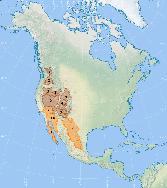
The following are three major hot and dry deserts in North America, all located in the southwestern United States and northern Mexico.[2]
- The Chihuahuan Desert is the largest hot desert in North America, located in the Southwestern United States and Northern Mexico. Its total area is 140,000 sq mi (360,000 km2).
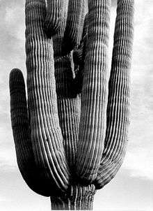
- The Sonoran Desert is a desert located in the Southwestern United States and northwest Mexico. It is the second largest hot desert in North America. Its total area is 120,000 sq mi (310,000 km2).
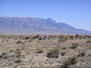
- The Mojave Desert is the hottest desert in North America, located primarily in southeastern California. Its total area is 22,000 sq mi (57,000 km2).
The largest cold desert is the Great Basin Desert, which encompasses much of the northern Basin and Range Province, north of the Mojave Desert.
Other smaller cold deserts lie within the Columbia Plateau/Columbia Basin, the Snake River Plain, and the Colorado Plateau regions.
Full listing
(Listed from north to south)
- Western Canada
- Ashcroft – Located along the Thompson River. The entire length of the Thompson River from Kamloops to Lytton is mostly semi-arid, but at the midpoint near Ashcroft, the climate is dry enough to be classified as arid.[3]
- Washington – Idaho – Wyoming – Oregon – Nevada
- Much of the Columbia Basin is desert, such as the
- Channeled Scablands, a desert in the Columbia Basin of eastern Washington
- Most of the Snake River Plain (ecoregion) is sagebrush steppe, but barren lava fields form small deserts, such as
- The Wyoming Basin (ecoregion) is dominated by arid grasslands and shrub steppe, but also contains the
- Owyhee Desert, in southwestern Idaho, northern Nevada, and southeastern Oregon.
- Yp Desert, a portion of the Owyhee Desert in Idaho
- Oregon High Desert, aka "Great Sandy Desert", eastern Oregon
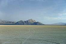
- Alvord Desert, a dry lake bed.
- Northwest Lahontan subregion in Nevada-part of the Northern Basin and Range (ecoregion)
- Black Rock Desert, a dry lake bed.
- Much of the Columbia Basin is desert, such as the
- Great Basin Desert
- Nevada, dominated by sagebrush steppe
- Forty Mile Desert, in northwest Nevada
- Smoke Creek Desert, Nevada (980 sq mi)
- Carson Desert
- Utah
- Great Salt Lake Desert, Utah
- Sevier Desert surrounds the intermittent, salty Sevier Lake
- Escalante Desert (3,270 sq mi)
- Nevada, dominated by sagebrush steppe
- Colorado Plateau
- Utah
- San Rafael Desert, the drier portions of the San Rafael Swell
- Colorado, dominated by pinyon–juniper woodlands, but contains desert areas where unfavorable soil conditions exist:
- Utah
- Mojave Desert
- California (the High Desert); and parts of western Arizona, southern Nevada, and a small portion of Utah.
- Death Valley, California
- Amargosa Desert, Nevada
- California (the High Desert); and parts of western Arizona, southern Nevada, and a small portion of Utah.
- Sonoran Desert
- Colorado Desert, Southern California (the Low Desert)
- Yuha Desert, Imperial Valley, California
- Yuma Desert, southwest Arizona
- Lechuguilla Desert, southwest Arizona
- Tule Desert (Arizona) and Sonora, Mexico
- Gran Desierto de Altar, Sonora, Mexico
- Baja California Desert, State of Baja California, Mexico
- Vizcaíno Desert, central State of Baja California, Mexico
- Colorado Desert, Southern California (the Low Desert)
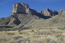
- Chihuahuan Desert
- Trans-Pecos Desert, west Texas
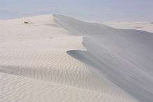
- White Sands, unusual gypsum dune field in New Mexico
Western arid regions of North America
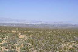
The separately defined western arid regions of North America are continental regions of aridity based on available water in addition to rain shadow-diminished rainfall[4] and which have many non-desert shrub-steppe (EPA) and xeric shrublands (WWF) in addition to desert ecosystems and ecoregions. This large arid region of 190,000 sq mi (490,000 km2) includes: deserts, such as the Great Basin Desert and Sonoran Desert; and the non-desert arid region areas (with greater than 10 inches (250 mm) annual precipitation) in the Great Basin arid region, Colorado Plateau, Mexican Plateau, and others. This arid region extends from the top of the North American Desert in Washington and Idaho southward into Mexico in the Trans-Mexican Volcanic Belt. The 'western arid region' is east of and (except for Mojave sky islands) discontiguous from the Mojave Desert,[5] unlike the southwestern Great Basin deserts adjacent with ecotones to the northern Mojave Desert.
See also
- North American Deserts in List of ecoregions in the United States (EPA)
- North American Deserts in List of ecoregions in North America (CEC)
- List of deserts
- Semi-arid climate
- Deserts of California
- Great American Desert
- Desert of Maine
- Desert ecology
- Deserts and xeric shrublands – biome and ecoregions
References
- ↑ EPA,OA,OEAEE,OWC, US. "About the National Health and Environmental Effects Research Laboratory (NHEERL) – US EPA". US EPA. Retrieved 11 April 2018.
- ↑ "Desert Biome". University of California Museum of Paleontology.
- ↑ "Canada's Only True Desert". Retrieved January 9, 2013.
- ↑ (1953 Meigs criteria)
- ↑ "The World's Largest Desert". Geology and Earth Science. geology.com. Retrieved 2010-04-25.