La Pobla de Lillet
| La Pobla de Lillet | |
|---|---|
| Municipality | |
 | |
 La Pobla de Lillet Location in Catalonia  La Pobla de Lillet La Pobla de Lillet (Spain) | |
| Coordinates: 42°14′38″N 1°58′30″E / 42.244°N 1.975°E | |
| Country |
|
| Community |
|
| Province | Barcelona |
| Comarca | Berguedà |
| Government | |
| • Mayor | Vicenç Linares Clota (2015)[1] (CiU) |
| Area[2] | |
| • Total | 51.4 km2 (19.8 sq mi) |
| Elevation | 843 m (2,766 ft) |
| Population (2014)[1] | |
| • Total | 1,155 |
| • Density | 22/km2 (58/sq mi) |
| Demonym(s) | Poblatà |
| Website |
www |
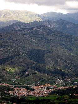
La Pobla de Lillet is a municipality in the comarca of the Berguedà in Catalonia. It is located in the upper valley of the Llobregat river and is linked to Guardiola de Berguedà by Road B-402.
The town is home to the Artigas Gardens, a park designed by Antoni Gaudí in the 1900s. Other sights include the 15th-century bridge, the Sanctuary of Falgars and remains of the late 13th-century fortress.
Transportation

Steam locomotive with 600 mm gauge of Ateliers de Construction de la Meuse in Liege (Belgium), 1901
The Ferrocarril Turístic de l'Alt Llobregat is a 600 mm gauge tourist railway that runs from the narrow gauge railway museum at La Pobla de Lillet to the cement museum at Clot del Moro.[3]
References
- Panareda Clopés, Josep Maria; Rios Calvet, Jaume; Rabella Vives, Josep Maria (1989). Guia de Catalunya, Barcelona:Caixa de Catalunya. ISBN 84-87135-01-3 (in Spanish). ISBN 84-87135-02-1 (in Catalan).
- 1 2 "Ajuntament de la Pobla de Lillet". Generalitat of Catalonia. Retrieved 2015-11-13.
- ↑ "El municipi en xifres: La Pobla de Lillet". Statistical Institute of Catalonia. Retrieved 2015-11-23.
- ↑ "Ferrocarril Turístic de l'Alt Llobregat - Traçat" (in Catalan). trenscat.com. Retrieved 2010-07-29.
External links
- Official website (in Catalan)
- Government data pages (in Catalan)
Places adjacent to La Pobla de Lillet | |
|---|---|
.svg.png)
This article is issued from
Wikipedia.
The text is licensed under Creative Commons - Attribution - Sharealike.
Additional terms may apply for the media files.