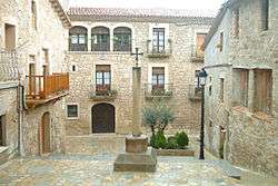
Casserres
| Casserres | ||
|---|---|---|
| Municipality | ||
 | ||
| ||
 Casserres Location in Catalonia  Casserres Casserres (Spain) | ||
| Coordinates: 42°0′54″N 1°50′36″E / 42.01500°N 1.84333°ECoordinates: 42°0′54″N 1°50′36″E / 42.01500°N 1.84333°E | ||
| Country |
| |
| Community |
| |
| Province | Barcelona | |
| Comarca | Berguedà | |
| Government | ||
| • Mayor | Josep Colillas Sabartés (2015)[1] (ERC-AM) | |
| Area[2] | ||
| • Total | 29.5 km2 (11.4 sq mi) | |
| Elevation | 611 m (2,005 ft) | |
| Population (2014)[1] | ||
| • Total | 1,569 | |
| • Density | 53/km2 (140/sq mi) | |
| Demonym(s) | Casserrenc, casserrenca | |
| Website |
casserres | |

Casserres is a town and municipality in the comarca of Berguedà, Catalonia, a part of the Baix Berguedà region. The town is named after the medieval castle, named Castrum Serris.
Geography
The town is situated 12 kilometers from the comarcal capital of Berga, and two streams, the Clarà and Meriola, pass through the municipal limits. The Llobregat river comprises one of its borders.
Dryland farming is prevalent in Casserres, with most agriculture focusing on cereals and potatoes, as well as animal herding.
Sites of interest
- Church of the Mare de Déu dels Àngels, from the 14th century. Includes a Baroque altar from 1704.
- Church of Sant Pau de Casserres, from the 12th century. Its murals are conserved in the Museu Diocesà de Solsona
- Neo-gothic church of l'Ametlla de Casserres
- Hermitage of Sant Miquel de Fonogadell, romanesque.
- Remains of the Iberian settlement of el Serrat dels Tres Hereus.
References
- 1 2 "Ajuntament de Casserres". Generalitat of Catalonia. Retrieved 2015-11-13.
- ↑ "El municipi en xifres: Casserres". Statistical Institute of Catalonia. Retrieved 2015-11-23.
External links
- Government data pages (in Catalan)
Places adjacent to Casserres | ||||||||||
|---|---|---|---|---|---|---|---|---|---|---|
| ||||||||||
.svg.png)
This article is issued from
Wikipedia.
The text is licensed under Creative Commons - Attribution - Sharealike.
Additional terms may apply for the media files.