La Guancha, Tenerife
| La Guancha | |||
|---|---|---|---|
| Municipality | |||
| |||
 Municipal location in Tenerife | |||
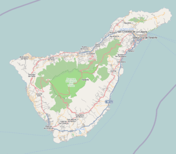 La Guancha Location of the town in Tenerife  La Guancha La Guancha (Canary Islands)  La Guancha La Guancha (Spain, Canary Islands) | |||
| Coordinates: 28°22′30″N 16°39′10″W / 28.37500°N 16.65278°WCoordinates: 28°22′30″N 16°39′10″W / 28.37500°N 16.65278°W | |||
| Country |
| ||
| Autonomous community |
| ||
| Province |
| ||
| Island |
| ||
| Area[1] | |||
| • Total | 23.77 km2 (9.18 sq mi) | ||
| Elevation[1] | 500 m (1,600 ft) | ||
| Population (2013)[2] | |||
| • Total | 5,448 | ||
| • Density | 230/km2 (590/sq mi) | ||
| Climate | Csb | ||


La Guancha is a municipality in the northern part of the island of Tenerife, one of the Canary Islands, and part of the province of Santa Cruz de Tenerife. It is located about 40 km west of the island's capital Santa Cruz de Tenerife, and 6 km east of Icod de los Vinos. The population is 5,448 (2013)[2] and the area is 23.77 km².[1] The elevation is 501 m.
Historical population
| Year | Population |
|---|---|
| 1991 | 5,205 |
| 1996 | 5,232 |
| 2001 | 5,193 |
| 2002 | 5,294 |
| 2003 | 5,318 |
| 2004 | 5,372 |
| 2013 | 5,448 |
See also
References
- 1 2 3 "SUPERFICIE, PERÍMETRO Y ALTITUD DE LOS MUNICIPIOS DE CANARIAS" (in Spanish). Instituto Canario de Estadística (ISTAC). Archived from the original on 2012-12-04.
- 1 2 "Población en Canarias. Tenerife. 1-1-2013" (in Spanish). Instituto Canario de Estadística (ISTAC). Archived from the original on 2014-04-16.
External links
Places adjacent to La Guancha, Tenerife | |
|---|---|
This article is issued from
Wikipedia.
The text is licensed under Creative Commons - Attribution - Sharealike.
Additional terms may apply for the media files.