Guía de Isora
| Guía de Isora | |||
|---|---|---|---|
| Municipality | |||
| |||
 Municipal location in Tenerife | |||
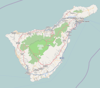 Guía de Isora Location in Tenerife  Guía de Isora Guía de Isora (Canary Islands)  Guía de Isora Guía de Isora (Spain, Canary Islands) | |||
| Coordinates: 28°12′40″N 16°46′50″W / 28.21111°N 16.78056°W | |||
| Country |
| ||
| Autonomous Community |
| ||
| Province | Tenerife | ||
| Island | Tenerife | ||
| Government | |||
| • Mayor | Pedro Martín Domínguez (PSOE) | ||
| Area | |||
| • Total | 143.4 km2 (55.4 sq mi) | ||
| Elevation(AMSL) | 540 m (1,770 ft) | ||
| Population (2013)[1] | |||
| • Total | 20,537 | ||
| • Density | 140/km2 (370/sq mi) | ||
| Time zone | UTC+0 (CET) | ||
| • Summer (DST) | UTC+1 (CEST (GMT +1)) | ||
| Postal code | 38680 | ||
| Area code(s) | +34 (Spain) + 922 (Tenerife) | ||
| Climate | Csb | ||
| Website | www.guiadeisora.es | ||


Guía de Isora is a municipality in the western part of the island of Tenerife, one of the Canary Islands, and part of the Province of Santa Cruz de Tenerife. The population is 20,537 (2013[1]), and the area is 143 km. The town Guía de Isora is 5 km from the coast, 16 km northwest of Arona and 60 km southwest of the island's capital Santa Cruz de Tenerife.
Historical population
| Year | Population |
|---|---|
| 1991 | 11,915 |
| 1996 | 12,560 |
| 2001 | 14,982 |
| 2002 | 16,320 |
| 2003 | 17,163 |
| 2004 | 17,816 |
| 2013 | 20,537 |
References
- 1 2 Instituto Canario de Estadística Archived 2014-04-16 at the Wayback Machine.
Places adjacent to Guía de Isora | ||||||||||
|---|---|---|---|---|---|---|---|---|---|---|
| ||||||||||
This article is issued from
Wikipedia.
The text is licensed under Creative Commons - Attribution - Sharealike.
Additional terms may apply for the media files.