El Rosario, Tenerife
| El Rosario | |
|---|---|
| Municipality | |
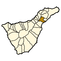 Municipal location in Tenerife | |
 El Rosario Location in Tenerife  El Rosario El Rosario (Canary Islands)  El Rosario El Rosario (Spain, Canary Islands) | |
| Coordinates: 28°27′N 16°22′W / 28.450°N 16.367°WCoordinates: 28°27′N 16°22′W / 28.450°N 16.367°W | |
| Country |
|
| Autonomous Region | Canary Islands |
| Province | Santa Cruz de Tenerife |
| Island | Tenerife |
| Area[1] | |
| • Total | 39.43 km2 (15.22 sq mi) |
| Population (2013)[2] | |
| • Total | 17,465 |
| • Density | 440/km2 (1,100/sq mi) |
| Time zone | UTC+0 (GMT) |
| Climate | Csb |
| Website |
www |
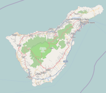
El Rosario is a municipality in the northeastern part of the island of Tenerife in the Santa Cruz de Tenerife province, on the Canary Islands, Spain. The seat of the municipality is the town La Esperanza, in the mountainous interior of the island. The municipality includes the coastal town Radazul. The TF-1 motorway passes through the southern part of the municipality.
The population is 15,542 (2013[2]), its area is 39.43 km².[1]
Historical population
| Year | Population |
|---|---|
| 1991 | 8,103 |
| 1996 | 10,880 |
| 2001 | 13,462 |
| 2002 | 13,718 |
| 2003 | 14,862 |
| 2004 | 15,542 |
| 2005 | 16,024 |
| 2013 | 17,465 |
Education
The Deutsche Schule Santa Cruz de Tenerife, a German international school, is located in the Tabaita Alta section of El Rosario.[3]
See also
References
- 1 2 Instituto Canario de Estadística, area
- 1 2 Instituto Canario de Estadística Archived 2014-04-18 at the Wayback Machine., population
- ↑ "Deutsche Schule Santa Cruz de Tenerife." ZfA. Retrieved on 13 February 2016. "Deutsche Schule - Colegio Alemán Calle Drago , 1 38190 Tabaiba Alta (El Rosario) Spanien"
Places adjacent to El Rosario, Tenerife | |
|---|---|
This article is issued from
Wikipedia.
The text is licensed under Creative Commons - Attribution - Sharealike.
Additional terms may apply for the media files.