Kinder Scout
| Kinder Scout | |
|---|---|
 The Kinder plateau seen from the south | |
| Highest point | |
| Elevation | 636 metres (2,087 ft) [1] |
| Prominence | 496.6 m (1,629 ft) [2] |
| Parent peak | Cross Fell |
| Listing | Marilyn, Hewitt, Hardy, county top, Nuttall |
| Coordinates | 53°23′0″N 1°52′2″W / 53.38333°N 1.86722°WCoordinates: 53°23′0″N 1°52′2″W / 53.38333°N 1.86722°W |
| Naming | |
| Translation | Water over the edge (Old Norse) |
| Pronunciation |
/ˈkɪndər |
| Geography | |
 Kinder Scout Location of Kinder Scout in Derbyshire | |
| Location | Derbyshire, England |
| Parent range | Peak District |
| OS grid | SK084875 |
| Topo map | OS Landranger 110 |
Kinder Scout is a moorland plateau and National Nature Reserve[3] in the Dark Peak of the Derbyshire Peak District in England. Part of the moor, at 636 metres (2,087 ft) above sea level, is the highest point in the Peak District, the highest point in Derbyshire, and the highest point in the East Midlands. In excellent weather conditions the city of Manchester and the Greater Manchester conurbation can be seen, as well as Winter Hill near Bolton, and the mountains of Snowdonia in North Wales.
To the north across the Snake Pass lie the high moors of Bleaklow and Black Hill, which are of similar elevation.
Kinder Scout featured on the BBC television programme Seven Natural Wonders (2005) as one of the wonders of the Midlands, though it is considered by many to be in Northern England, lying between the cities of Manchester and Sheffield.
The history and meaning of the name have been studied by Broderick.[4] In chronostratigraphy, the British sub-stage of the Carboniferous period, the 'Kinderscoutian' derives its name from Kinder Scout.
Public access
Kinder Scout is accessible from the villages of Hayfield and Edale in the High Peak of Derbyshire. It is a popular hiking location and the Pennine Way crosses Kinder Scout and the moors to the north. This has resulted in the erosion of the underlying peat, prompting work by Derbyshire County Council and the Peak District National Park to repair it, in conjunction with the landowner, the National Trust.[5]
The plateau was the target of the mass trespass in 1932. From the National Park's inception, a large area of the high moorland north of Edale was designated as 'Open Country'. In 2003, the "right to roam" on uncultivated land was enshrined into law, and this area of open country has been significantly extended.
Parts of the Kinder Scout plateau (except legal rights of way) are still occasionally closed for conservation, public safety, grouse shooting or fire prevention reasons, but prior notice is generally given on the Peak District National Park Authority's website.[6]
Kinder Downfall and gritstone edges
Kinder Downfall is the tallest waterfall in the Peak District, with a 30-metre fall. It lies on the River Kinder, where it flows west over one of the gritstone cliffs on the plateau edge. The waterfall was formerly known as Kinder Scut, and it is from this that the plateau derives its name. Although usually little more than a trickle in summer, in spate conditions it is impressive. In certain wind conditions (notably when there is a strong westerly wind), the water is blown back on itself, and the resulting cloud of spray can be seen from several miles away. Below the Downfall the River Kinder flows into Kinder Reservoir. In cold winters the waterfall freezes providing local mountaineers with an icy challenge that can be climbed with ice axes, ropes and crampons.
Some of Kinder's many gritstone cliffs were featured in the first rock-climbing guide to the Peak District, Some Gritstone Climbs, published in 1913 and written by John Laycock.
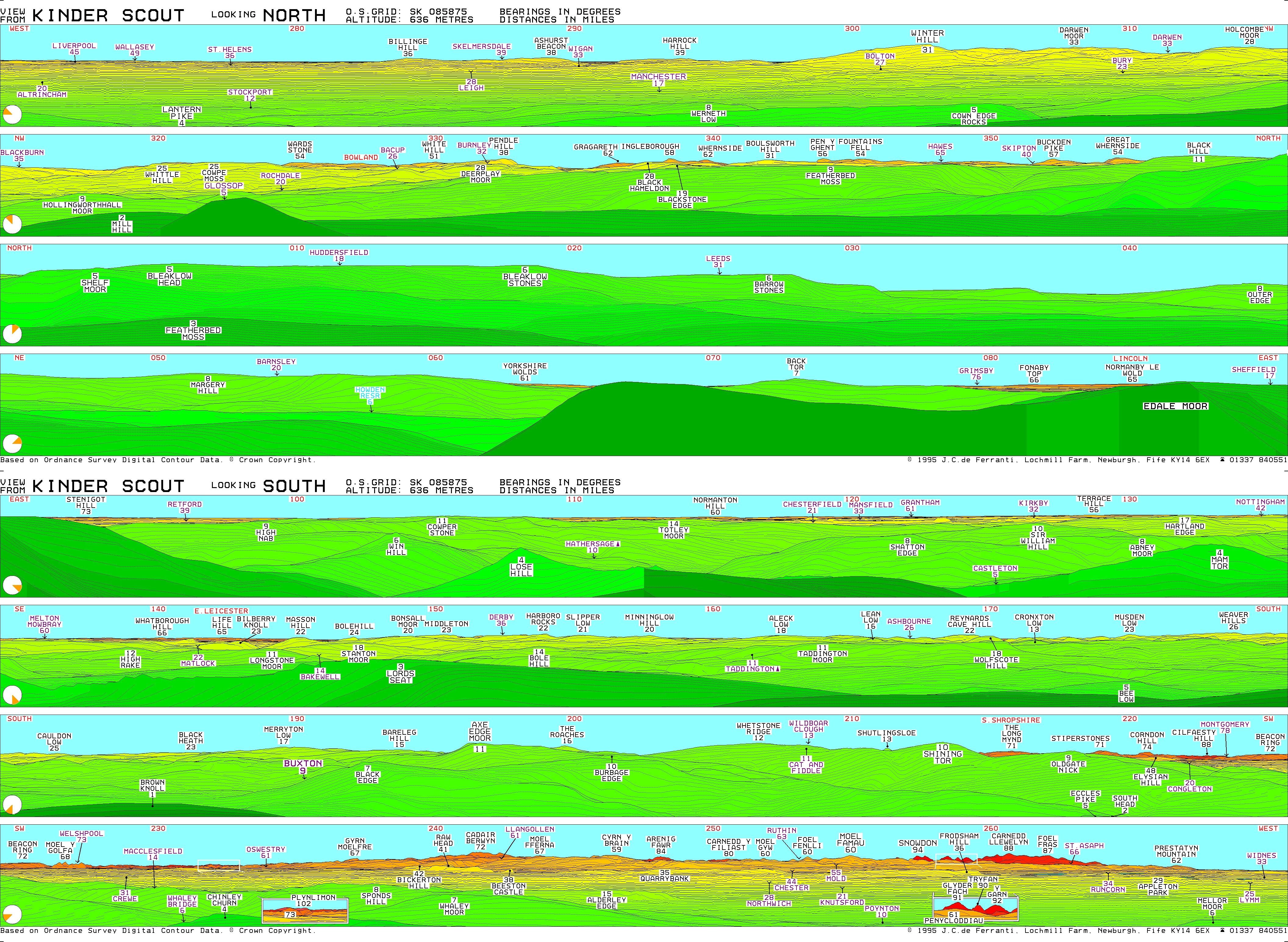
View
Major English and Welsh peaks visible (in ideal conditions) from Kinder Scout include (clockwise from west) Winter Hill (50 km, 31 mi), Pendle Hill (61 km, 38 mi), Ingleborough (93 km, 58 mi), Whernside (100 km, 62 mi), Pen-y-ghent (90 km, 56 mi), Fountains Fell (87 km, 54 mi), Buckden Pike (92 km, 57 mi), Great Whernside (87 km, 54 mi), Bleaklow (8 km, 5 mi), Margery Hill (13 km, 8 mi), the Weaver Hills (42 km, 26 mi), Axe Edge (18 km, 11 mi), The Roaches (26 km, 16 mi), Shutlingsloe (21 km, 13 mi), Shining Tor (16 km, 10 mi), the Long Mynd (114 km, 71 mi), Stiperstones (114 km, 71 mi), Corndon Hill (119 km, 74 mi), Cilfaesty Hill (142 km, 88 mi), Moel y Golfa (109 km, 68 mi), Plynlimon (164 km, 102 mi), Cadair Berwyn (116 km, 72 mi), Beeston Castle (61 km, 38 mi), Alderley Edge (24 km, 15 mi), Arenig Fawr (135 km, 84 mi), Moel Famau (97 km, 60 mi), Snowdon (151 km, 94 mi), Glyder Fach (146 km, 91 mi), Tryfan (145 km, 90 mi), Y Garn (148 km, 92 mi), Carnedd Llewelyn (142 km, 88 mi) and Foel-fras (140 km, 87 mi).[7]
Edale Cross

The Edale Cross lies immediately south of Kinder Scout, under Kinder Low and on the former Hayfield to Edale road. It marks the former junction of the three wards of the Forest of Peak: Glossop and Longdendale, Hopedale and Campagna. The first cross on the site may have been set up by the Abbots of Basingwerk Abbey to mark the southern boundary of their land, granted in 1157. The date of the current cross is unknown, although a plaque beside it claims it to be mediaeval. At some point it fell down, and was re-erected in 1810, when the date and initials JG, WD, GH, JH and JS were carved into it. These stand for John Gee, William Drinkwater, George and Joseph Hadfield and John Shirt, local farmers of the day who raised the cross.[8] The cross is a Scheduled Ancient Monument.[9]
Mermaid legend
Mermaid's Pool, a small pool below Kinder Downfall, is said to be inhabited by a mermaid who will grant immortality upon whoever sees her on Easter Eve.[10]
See also
References
- ↑ Nuttall, J.; Nuttall, A. (1990). The Mountains of England & Wales - Volume 2: England. Milnthorpe: Cicerone. ISBN 1-85284-037-4. Retrieved 2009-08-23.
- ↑ Kinder Scout at www.hill-bagging.co.uk. Retrieved 11 March 2016.
- ↑ Anon. "Kinder Scout NNR". Natural England:Our work. Natural England. Retrieved 1 August 2014.
- ↑ Broderick, George (2010). "Kinder Scout". Journal of the English Place-name Society. 42: 63–74.
- ↑ Peak District National Park Authority, Landscape Strategy and Action Plan, September 2009 (section on Dark Peak)
- ↑ "Access land restrictions". www.peakdistrict.gov.uk. Peak District National Park Authority. Retrieved 31 January 2017.
- ↑ de Ferranti, J. C. (1995). "View from Kinder Scout". viewfinderpanoramas.org. Retrieved 10 August 2016.
- ↑ Sharpe, Neville T. (2002). Crosses of the Peak District. Landmark Collectors Library. ISBN 978-1843060444.
- ↑ Historic England. "Wayside and boundary cross known as Edale Cross (1008615)". National Heritage List for England. Retrieved 15 February 2014.
- ↑ Hope, Robert Charles (1893). The Legendary Lore of the Holy Wells of England. London: Elliot Stock.
External links
| Wikimedia Commons has media related to Kinder Scout. |
- Kinder Scout Computer-generated summit panoramas. Note: the panorama shown is not all visible from the summit. There is a large summit plateau; to see the entire panorama shown, it is necessary to walk around the summit but nearer the perimeter of the plateau.
Bibliography
Picture gallery
 Poor visibility near the summit
 Kinder Downfall
 Kinder Downfall in strong westerly wind
 Head of Grindsbrook
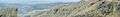 Panoramic view over Kinder Reservoir from Kinder
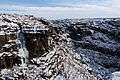 Ice climbers on Kinder Downfall
 Ascending Jacob's Ladder towards Kinder Low trigpoint
 Hags and groughs on the Kinder plateau
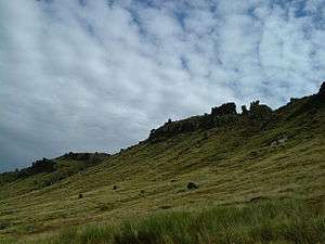 North flank of Kinder Scout taken from grid reference SK075900
Peaks of the Peak District of England | ||
|---|---|---|
| Marilyns | 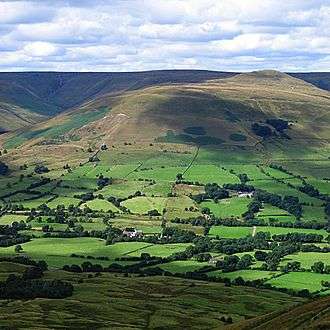 | |
| Other peaks |
| |